
The following notes describe what you’ll encounter along the trail. They’re written in the direction of travel from south to north, but the stage can be hiked in either direction.
Two Options
This stage offers two endpoints:
Option A — Nedzvi Reserve to Zanavi (17.44 km). The main TCT route. From Zanavi, the trail continues into Borjomi-Kharagauli National Park via National Park Trail #4.
Option B — Nedzvi Reserve to Borjomi via Kvibisi (22.85 km). The recommended option for section hikers starting or finishing at Borjomi.
The two routes share the same trail for most of the stage. They diverge at a trail split partway down the descent — Option A continues north toward Zanavi, Option B takes the western branch down to Kvibisi and then follows roads into Borjomi.
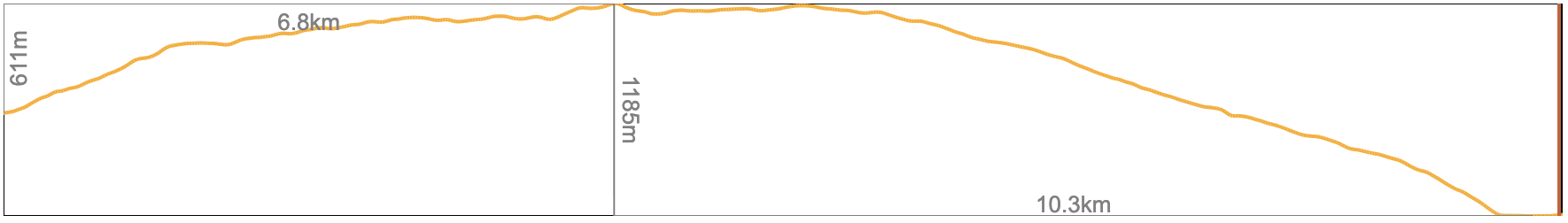
Quick Facts — Option A (Nedzvi to Zanavi)
- Distance
- 17.44 km
- Elevation range
- 763m to 1,948m
- Elevation gain (south to north)
- +778m / −1,345m
Option A — Northbound Elevation Profile
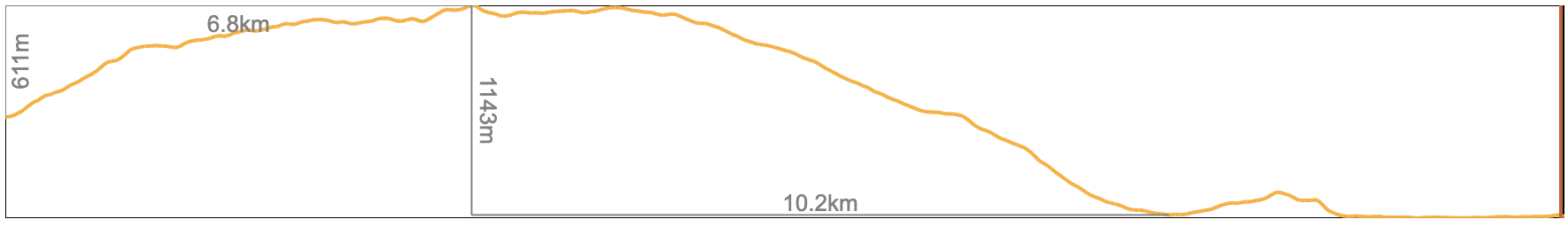
Quick Facts — Option B (Nedzvi to Borjomi via Kvibisi)
- Distance
- 22.85 km
- Elevation range
- 787m to 1,948m
- Elevation gain (south to north)
- +935m / −1,475m
Option B — Northbound Elevation Profile
Stage Overview
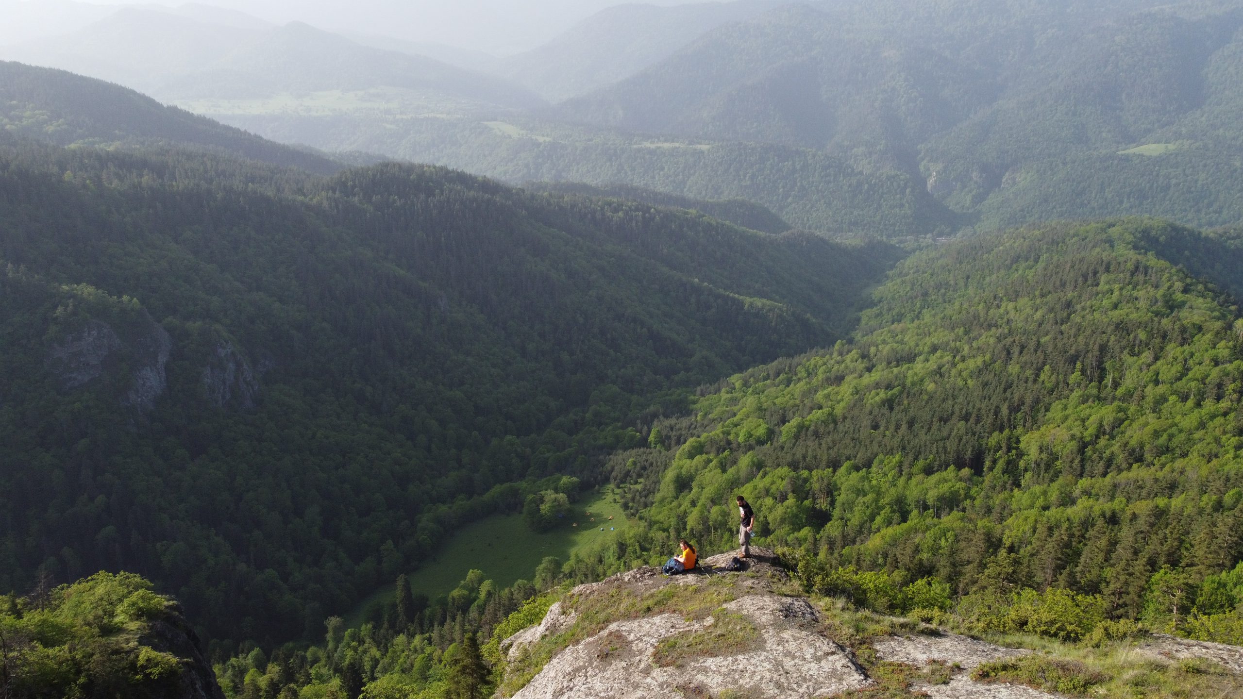
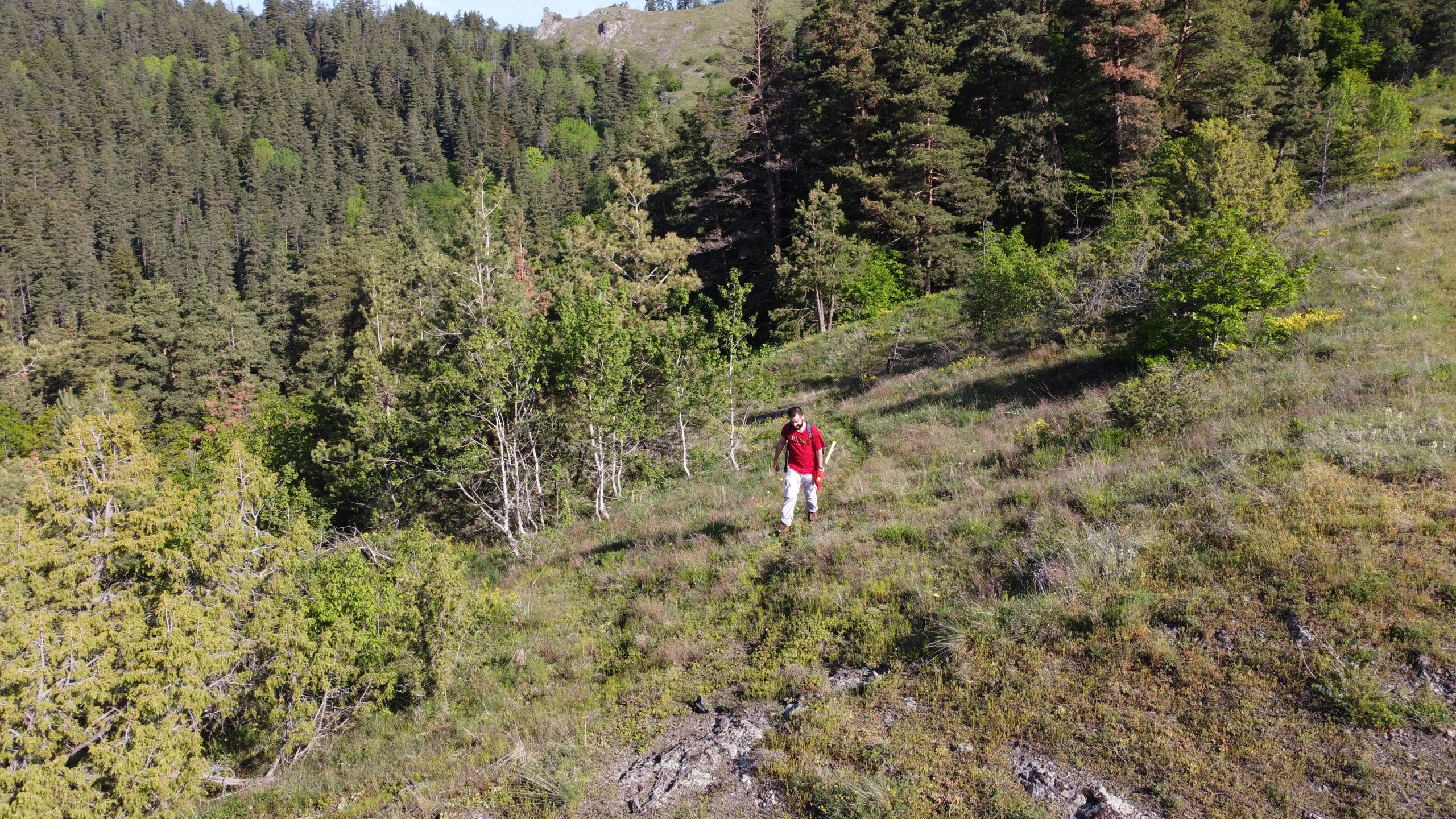
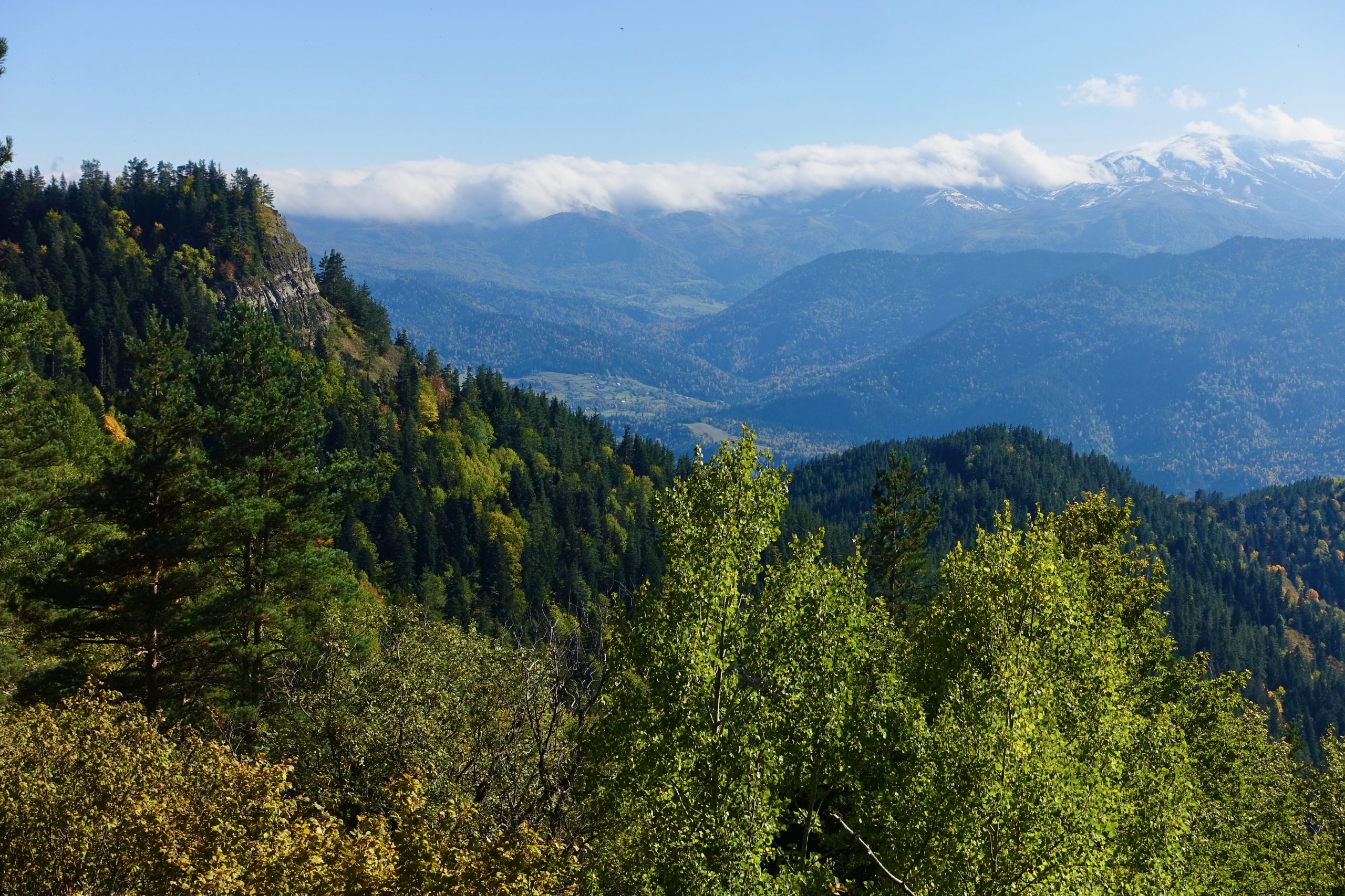
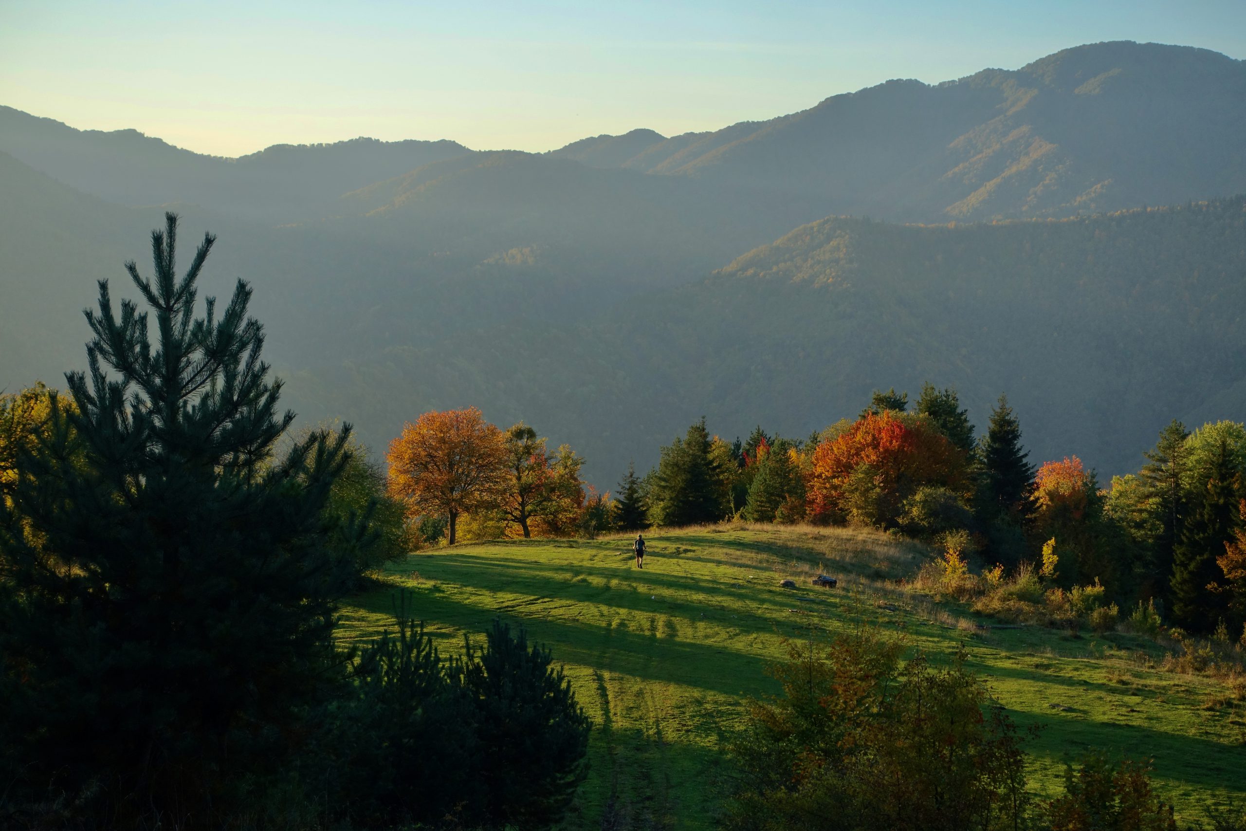
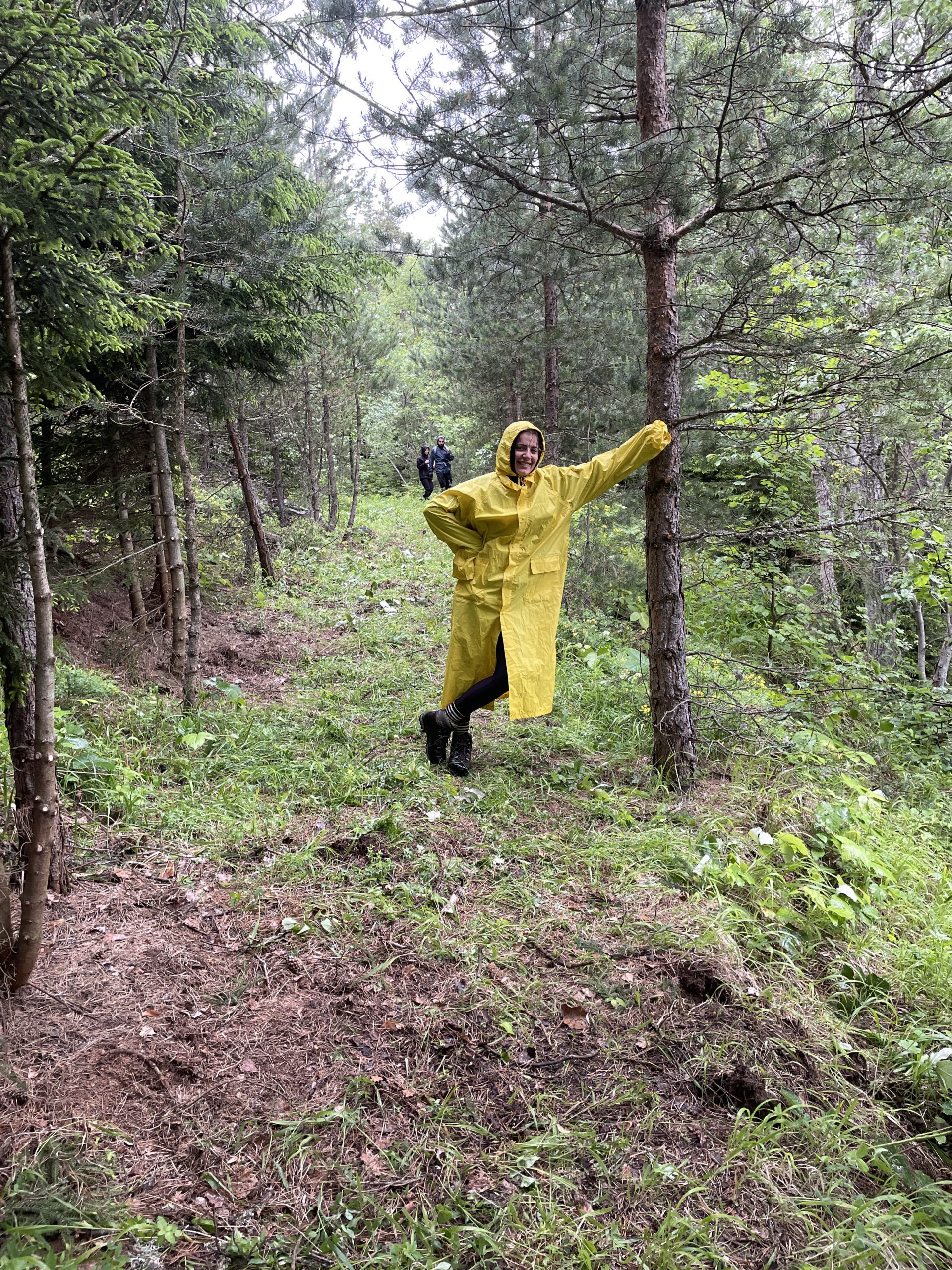
From the campsite at the southern end of the stage, the trail climbs a very steep Jeep track to gain the ridge. (Don’t hate us — we promise the cliff viewpoint along the way makes up for it.) At the top, it links up with a trail that follows the boundary of Nedzvi Managed Reserve, cleared and opened by TCT crews in 2022 and 2023. The route follows the ridge for some distance through mostly forested terrain with occasional open views, then begins a descent, gradual at first, then much steeper.
Partway down the descent, the trail splits. The northern branch (Option A) continues to Zanavi, where the TCT links with National Park Trail #4 into Borjomi-Kharagauli National Park. The western branch (Option B) descends very steeply to the village of Kvibisi, then follows roads on a mostly flat walk into Borjomi.
Both descents are steep but non-technical. Trekking poles are strongly recommended.
Trail Conditions
The stage opens on a very steep Jeep track climb out of the campsite, transitions to a forested ridge trail along the boundary of Nedzvi Managed Reserve, and ends with a steep descent on either branch. Option B’s descent leads to a mostly flat road walk from Kvibisi to Borjomi on paved surfaces.
This stage is unblazed. Rely on your GPS track, not trail markings.
Water
There are no water sources along the ridge or after the campsite at the southern end of the stage. Plan to leave camp with all the water you’ll need for the day. On Option B, water becomes available again once you reach Kvibisi and the road into Borjomi.
Trail Access
Zanavi (Option A) connects into Borjomi-Kharagauli National Park via Trail #4. You cross the main road between Tbilisi and Borjomi, where you might be able to hitch a ride to Borjomi or to the main highway. You could also try to flag down a passing marshrutka, although there’s no guarantee they’ll have empty seats.
Borjomi (Option B endpoint) has full marshrutka and train connections to Tbilisi and Kutaisi. See Practical Information (Getting To & From the Trailheads) for full details. Kvibisi village is also an access point along Option B, reachable by road; you might be able to hitch a ride into Borjomi from here.
There are no road access points along the ridge itself.
Trail Amenities
There are no shops, shelters, or services along this section until the towns at the end. Borjomi (Option B endpoint) has guesthouses across every budget, supermarkets, a pharmacy, and a hospital.
If you’re continuing into Borjomi-Kharagauli National Park from Zanavi (Option A), register at the ranger station at the start of Trail #4. You do not need to travel to the main visitor center in Borjomi.
Navigational Notes
The ridge trail is generally easy to follow through the forest, but there are a few intersecting trails, so keep your eye on the GPS track. The route is unblazed.
Pay particular attention to the trail split partway down the descent — this is where Options A and B diverge. Option A takes some animal paths down the steep hill, which can get a bit confusing; the most important thing is to keep moving in the general direction. On Option B, the road walk from Kvibisi to Borjomi is straightforward.
Hazards
The steep Jeep track climb at the south end and the steep descents on either branch are the main physical challenges. Trekking poles are your friend. Slow down on the descents, especially in wet conditions.
Giant hogweed can be found in the forested sections, particularly along disturbed ground near tracks and roads. Ticks are also sometimes present in the forest and long grass. Check yourself daily.
Trailmaker’s Notes
The ridge trail along the boundary of Nedzvi Managed Reserve was cleared and opened by TCT crews across the 2022 and 2023 seasons. The work extended the connecting trail network into the reserve and made this route possible.
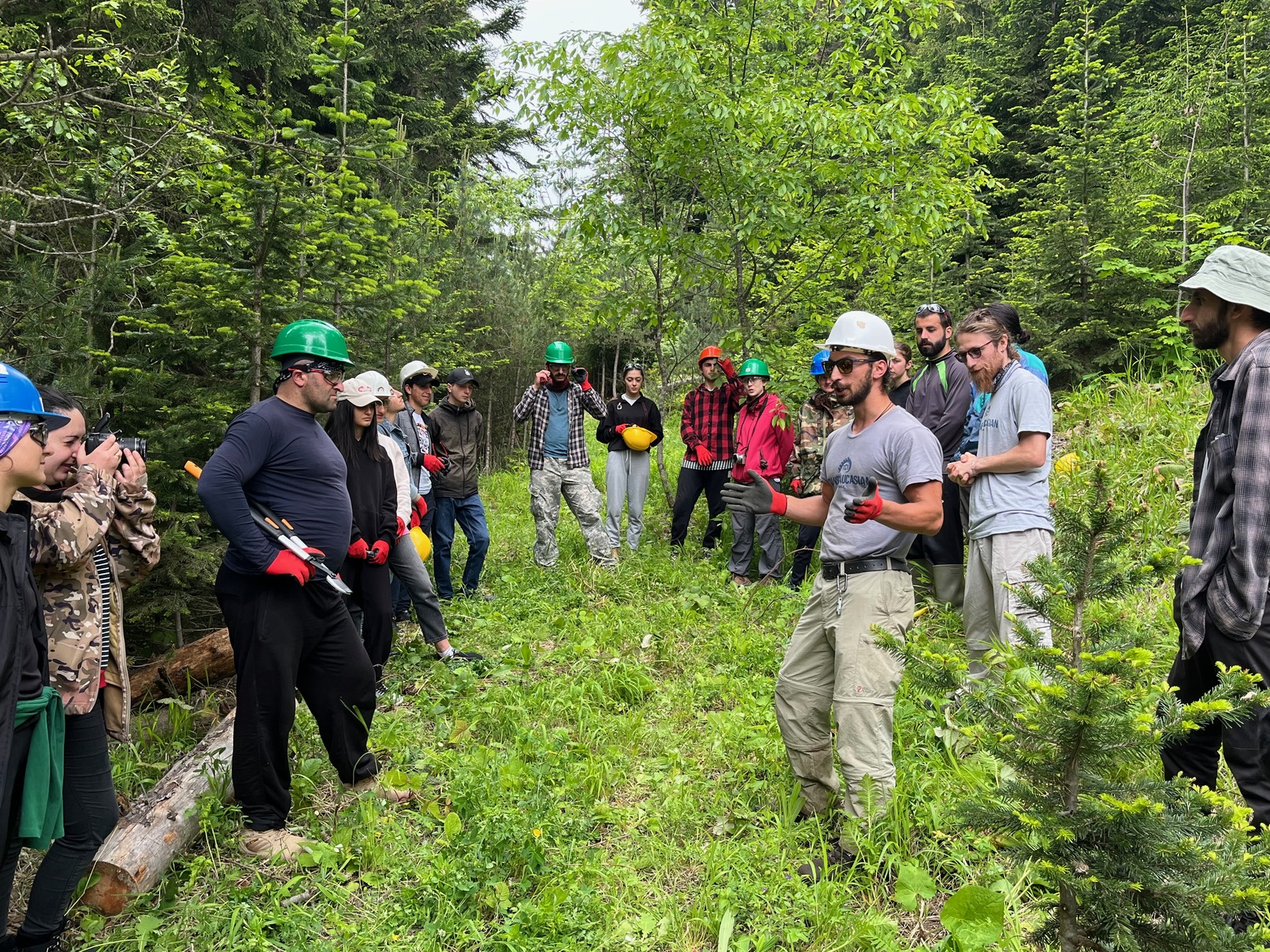
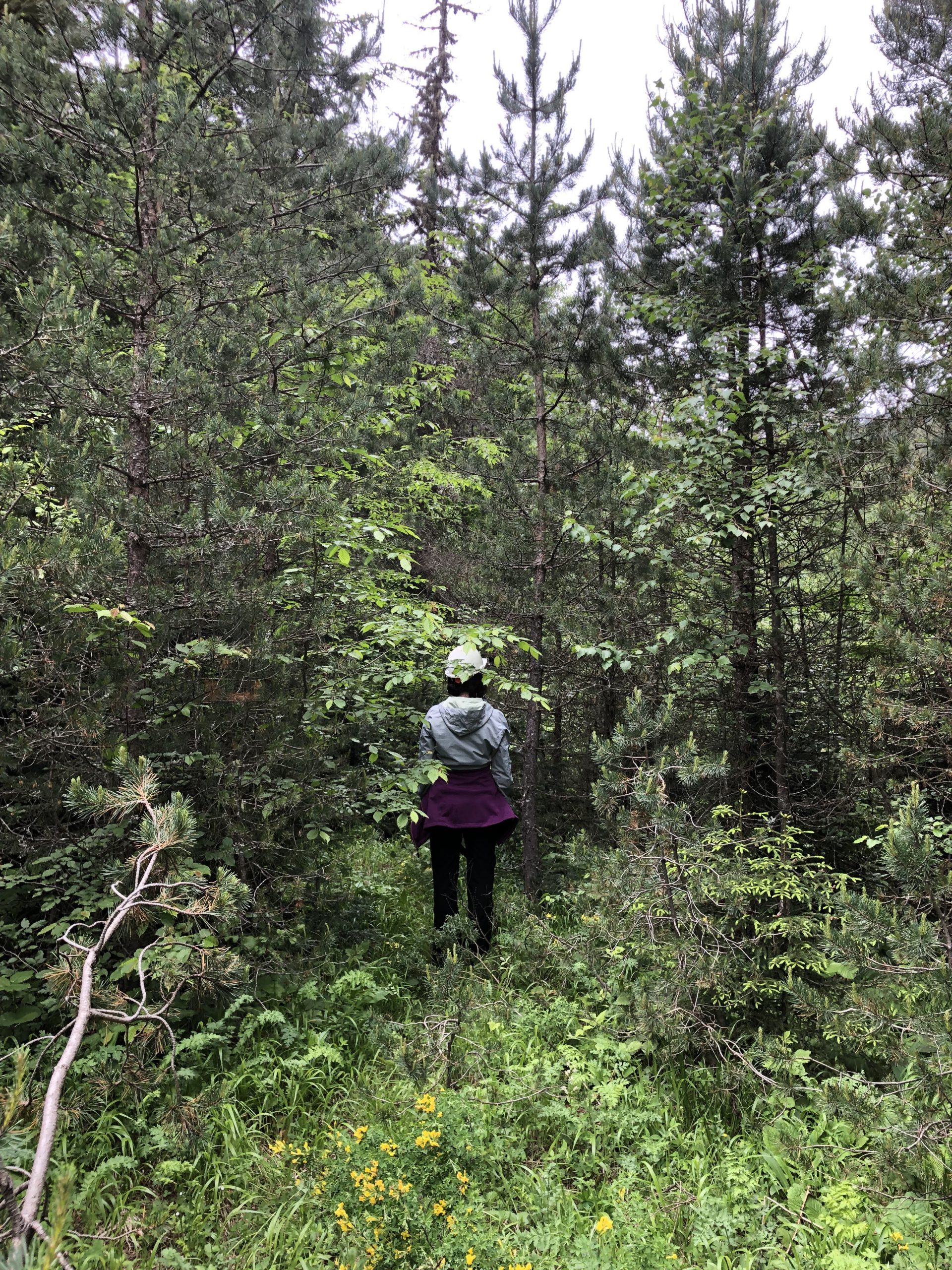
Before and after on the climb to the ridge.
Next: Alternate Routes and Major Side Routes →