This section has several side routes that serve different purposes — optional extensions, scenic detours, resupply or bailout access, and weather alternates around the most exposed terrain. They’re listed below from south to north.
GPX tracks for all routes are available on the interactive CalTopo map for this section.
On This Page
Southern Extension to the Armenian Border
- Distance
- 30.66 km
- Elevation change
- +369m / −488m
- Direction measured
- South to north
A roughly 30km extension runs south from Gandzani to the Armenian border at Bavra/Ninotsminda. This section is part of the full TCT thru-hike route and is relevant if you’re walking the full length of Georgia or continuing into Armenia. For standalone section hikers, we recommend starting or ending at Gandzani instead, to minimize logistical difficulty and maximize your time in the highlands. The terrain is less interesting than what follows, and transport links from the border are difficult.
Abuli Fortress Side Trail
- Distance
- 0.56 km
- Elevation change
- +22m / −22m
- Direction measured
- One way
A short, mostly flat 0.5km side trail near Patara Abuli leads to Abuli Fortress. We strongly recommend taking it. The detour adds minimal time and effort, and the fortress is well worth exploring.
Didi Abuli Summit
- Distance
- 5.71 km
- Elevation change
- +1,012m / −21m
- Direction measured
- One way
You can climb Didi Abuli, the highest peak in the Abul-Samsari Range at 3,301m, as a side route off the main trail. Descend the same way you came up, or pick your own way down the north side to rejoin the main route near Lake Levani.
Akhalkalaki Bailout
- Distance
- 21.31 km
- Elevation change
- +158m / −1,010m
- Direction measured
- West to east
A 21km side trail descends from the plateau to the small city of Akhalkalaki. It’s long but not technically difficult, and it’s the most useful bailout option on the southern half of this stage. Use it for medical emergencies, a major resupply, or as an alternate access point if you want to walk just part of this section, starting or ending at Akhalkalaki, which is reachable from Tbilisi or Kutaisi via marshrutka.
Lowland Alternate around Samsari Pass
- Distance
- 35.69 km
- Elevation change
- +769m / −987m
- Direction measured
- South to north
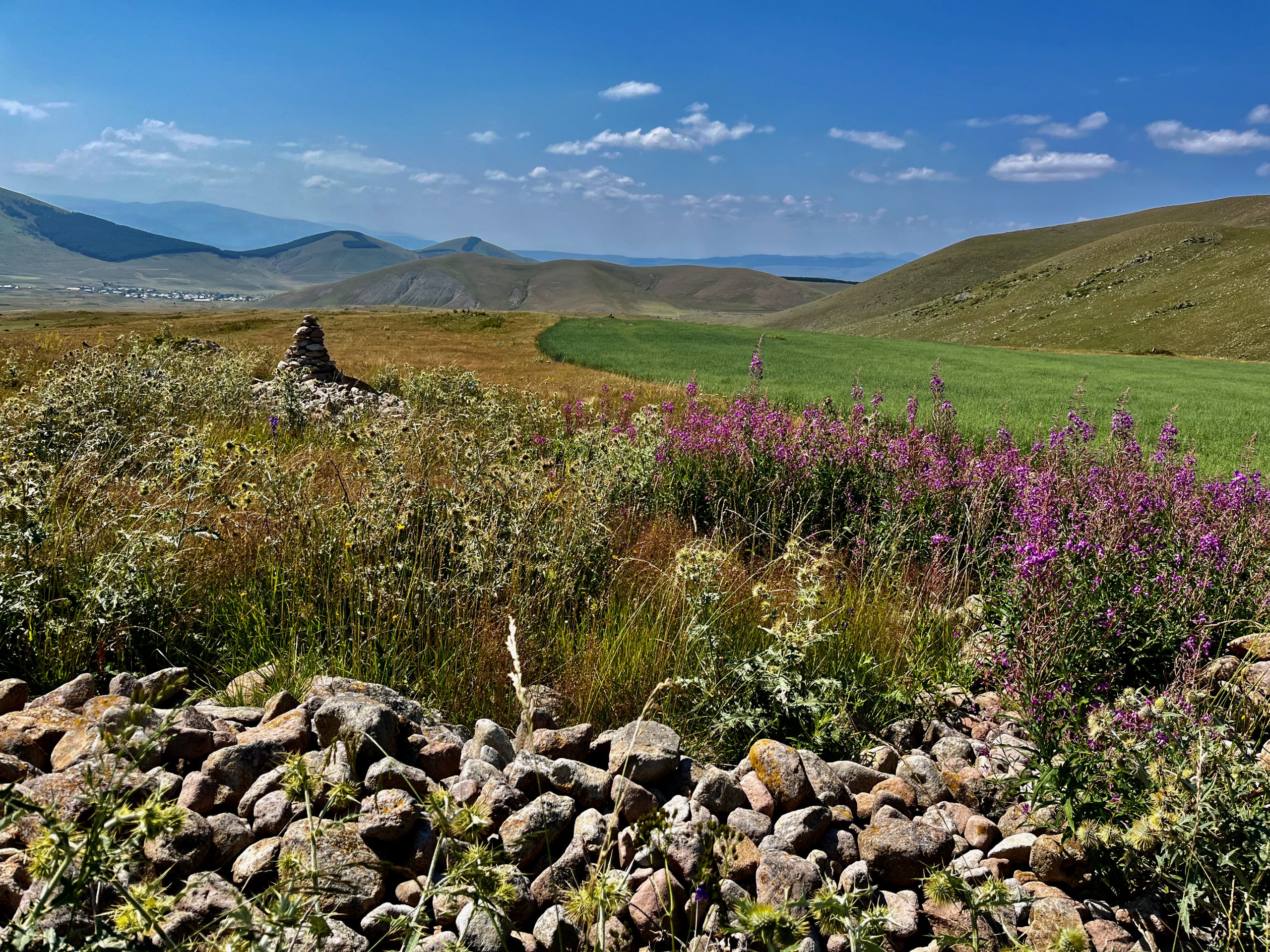
The major weather alternate on this stage. From Lake Levani, this route swings east around the Abul-Samsari Range and rejoins the main trail near Lake Tabatskuri, bypassing Samsari Pass entirely. The alternate adds distance — roughly 35km versus 17km for the direct route over the pass — but is significantly easier.
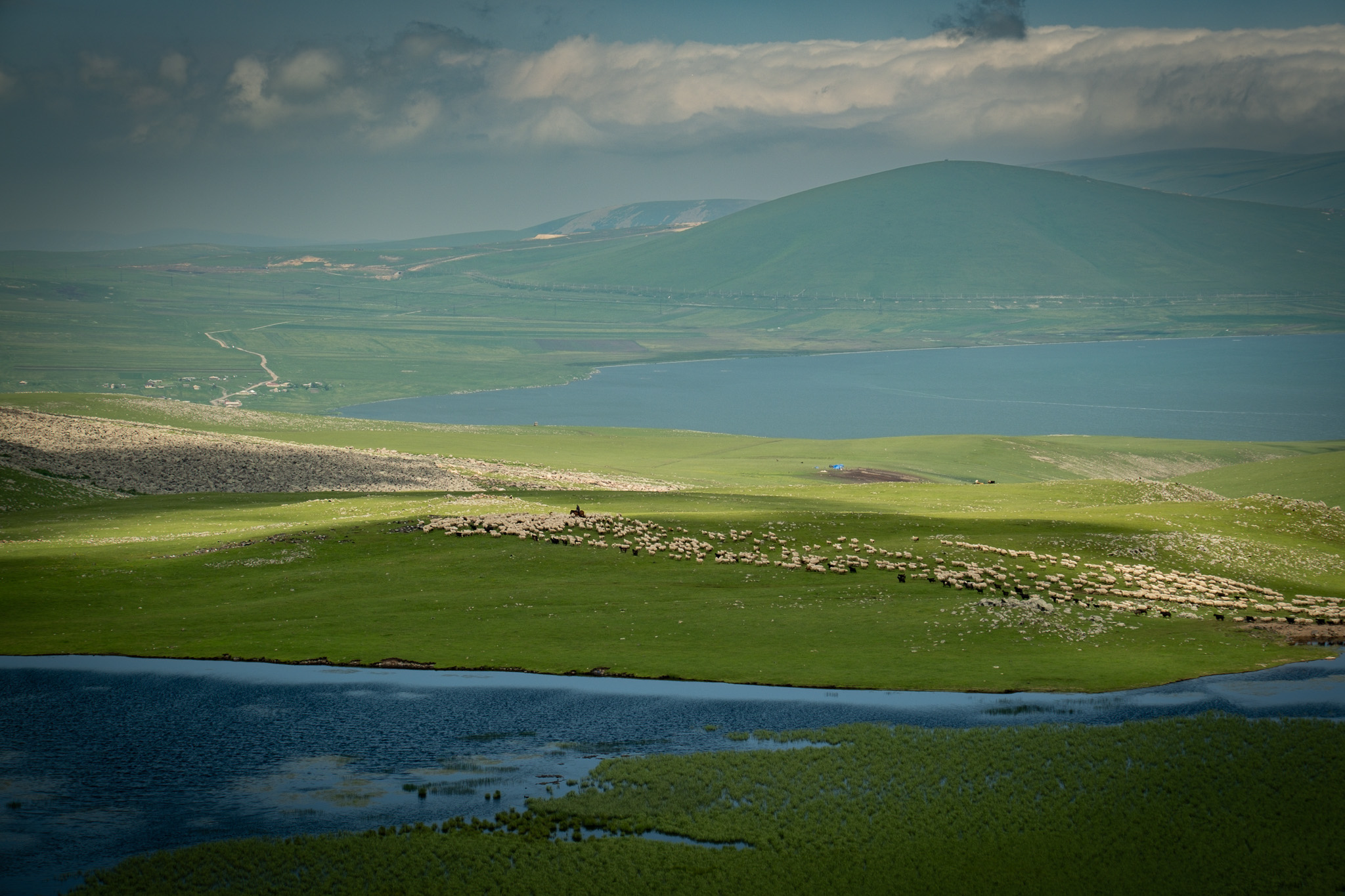
Take this route if the weather is bad, if snow is still lingering on the north face of Samsari Pass, or if you’re not confident on steep scree. It’s non-technical and relatively gentle. The route passes Lake Paravani — Georgia’s largest lake by surface area — with excellent lakeside camping. Along the way:
- The village of Tambovka sits directly on the route. It’s a former Doukhobor settlement with the community’s recognizable architecture: white-painted houses with blue window frames and shutters, some with sod roofs.
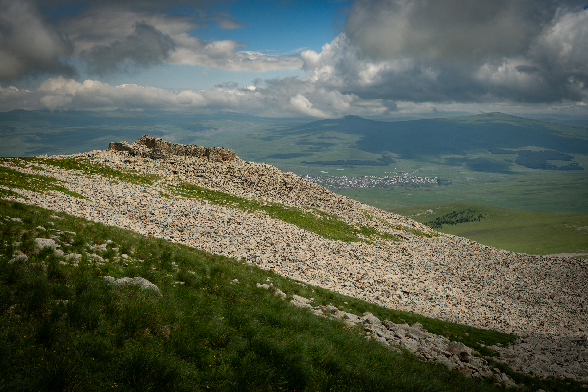
- A steep side route near Tambovka climbs to Shaori Fortress, a cyclopean structure on the summit of Shaori Mountain. The detour is 3km one way with 425m of elevation gain, mostly hiking over open terrain and clambering over boulder fields.
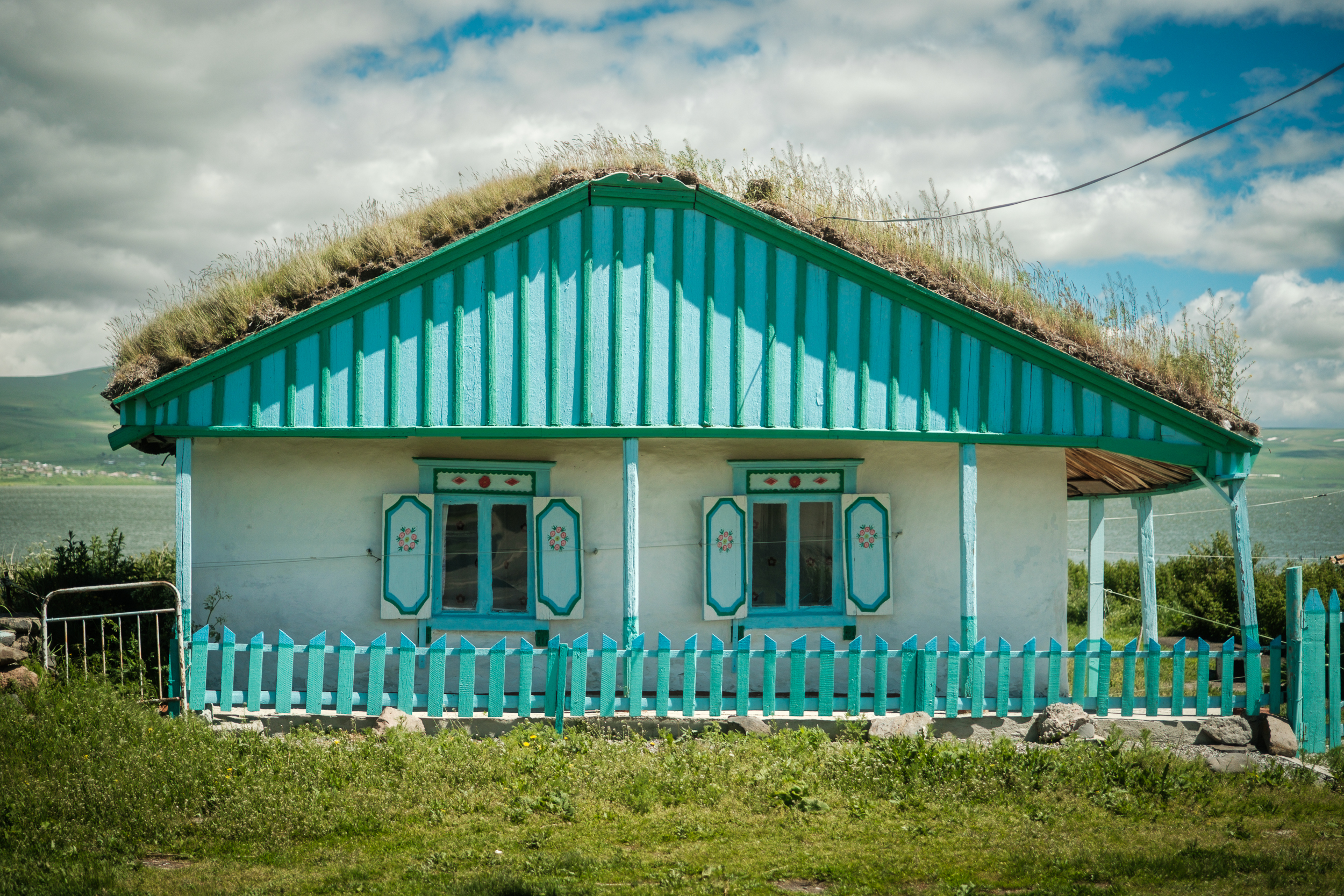
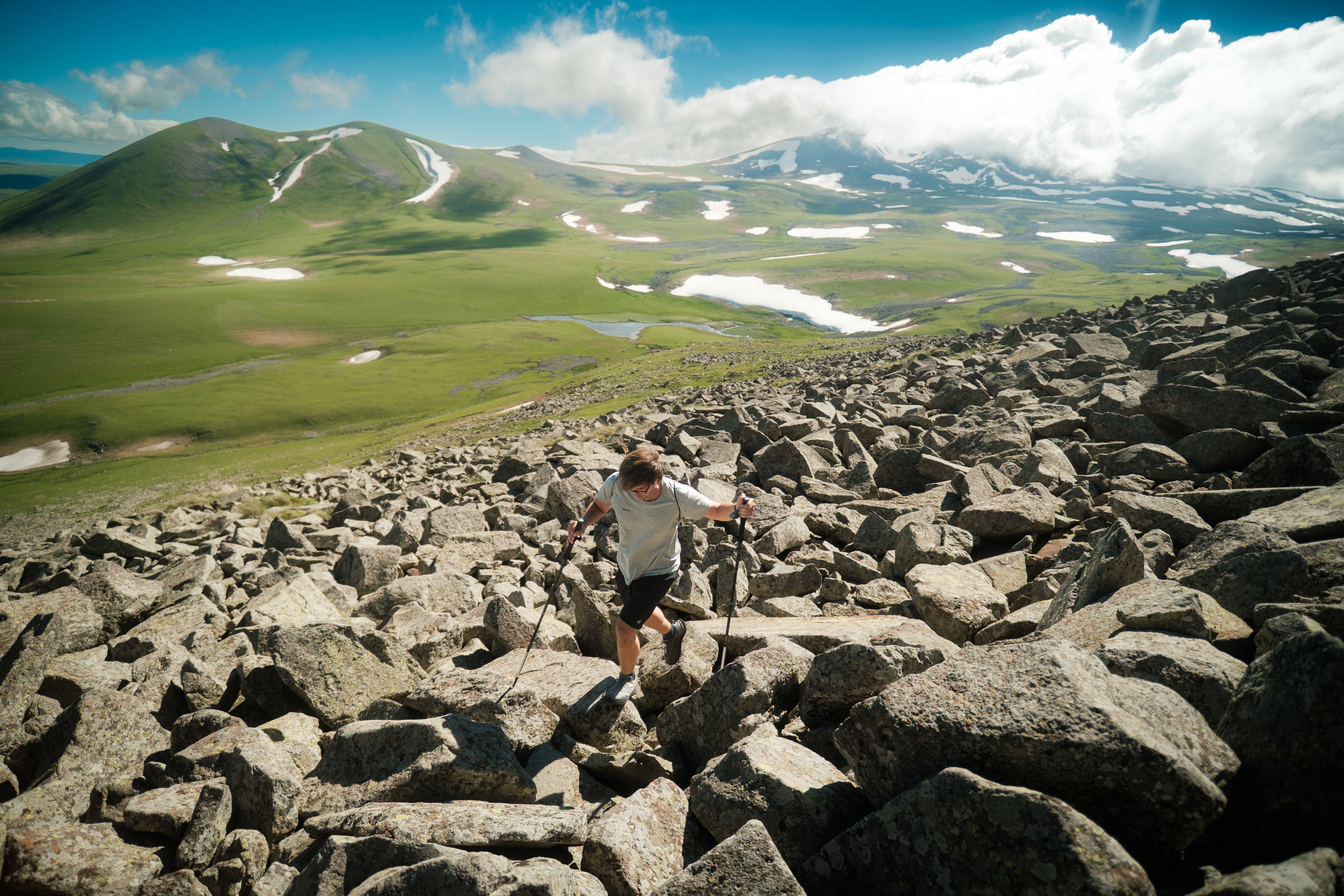
Doukhobor house in Tambovka (left); the climb to Shaori Fortress (right).
Bakuriani Side Trip and Exit Option
- Distance
- 5.42 km
- Elevation change
- +241m / −87m
- Direction measured
- One way (east to west)
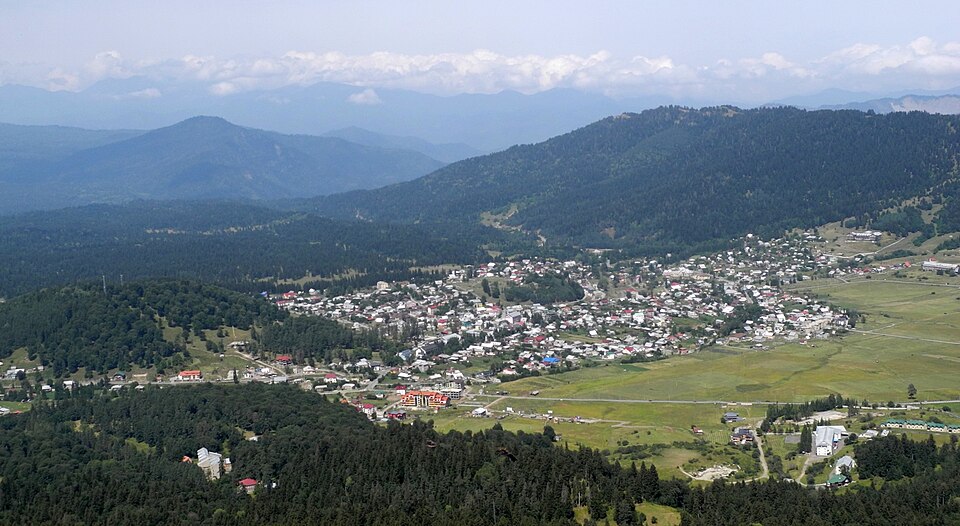
Near Didi Mitarbi on the northern half of the route, a side trail leads roughly 5km to the ski town of Bakuriani. Useful for a real resupply at proper supermarkets, a pharmacy stop, a guesthouse night, or a rest day.
Bakuriani also works as a start or end point for section hikers who only want to walk the Javakheti portion of this stage. Marshrutkas run regularly between Bakuriani and Borjomi, with onward connections to Tbilisi.
Borjomi Side Trail (Kvibisi)
- Distance
- 9.37 km
- Elevation change
- +167m / −739m
- Direction measured
- South to north
The main TCT continues north from Nedzvi to Zanavi, where it links with National Park Trail #4 into Borjomi-Kharagauli National Park. If you’d rather start or end your hike at Borjomi proper, take the side trail down from the main route to the village of Kvibisi, then road-walk into Borjomi. This is the standard option for most section hikers starting or ending the stage.