
The following notes describe what you’ll encounter along the trail. They’re written in the direction of travel from south to north, but the stage can be hiked in either direction.
Stage Overview
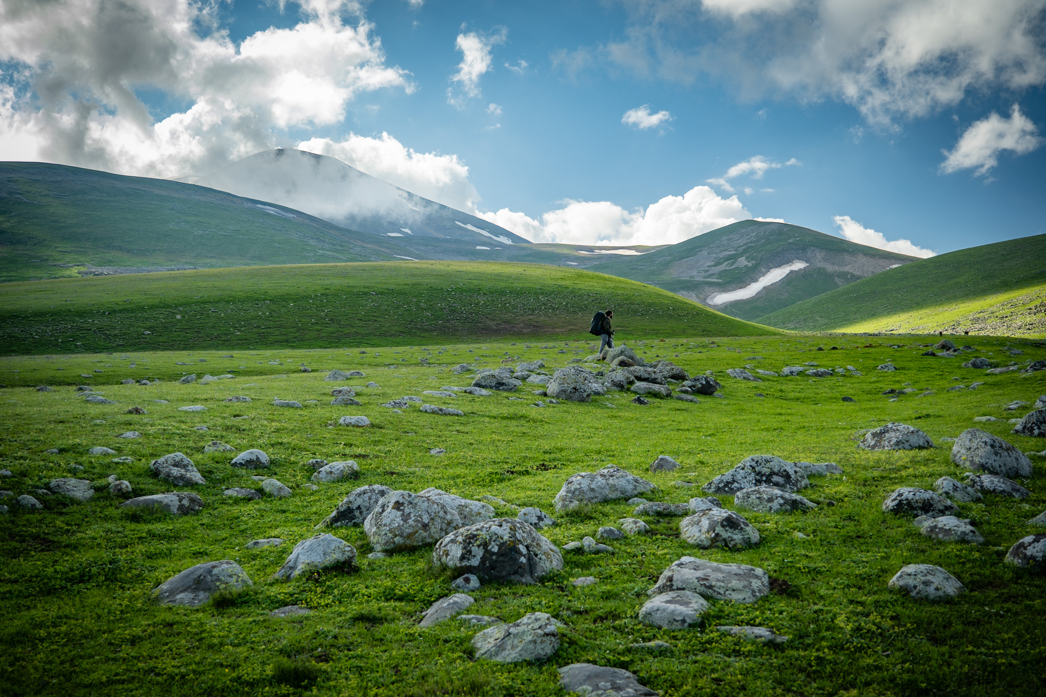
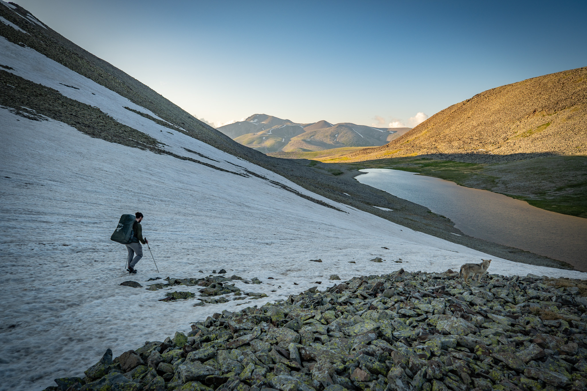
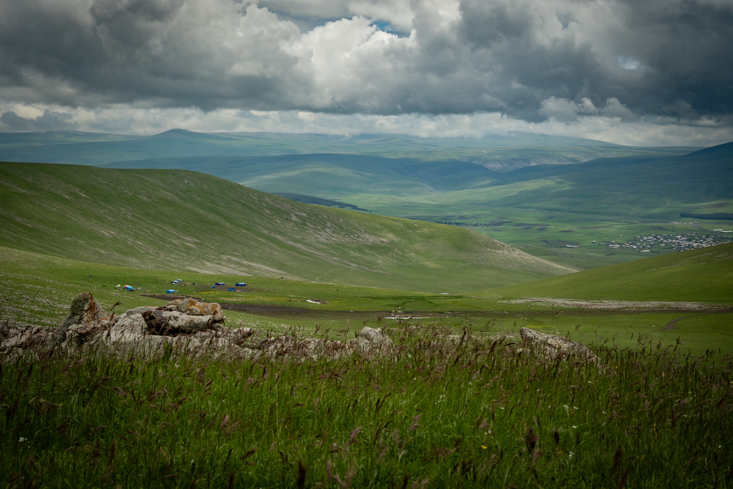
This stage covers the climb out of Gandzani onto the Abul-Samsari plateau and connects the village of Gandzani with Lake Patara Levani, one of the most scenic campsites on the route. Between Gandzani and the high plateau, the trail passes a chapel on the edge of the village and follows Jeep tracks across open terrain, with a seasonal shepherding settlement along the way. The climb continues on a mix of dirt and stone Jeep tracks to the base of Patara Abuli mountain. Near the pass, a short side trail leads to Abuli Fortress — we strongly recommend taking it (see Side Trails below). Between Patara Abuli and Lake Patara Levani, the route traverses open grassy highlands before dropping through a boulder field into the lake basin. The lake sits in a sheltered spot and offers excellent camping.
Quick Facts
- Distance
- 22.23 km
- Elevation range
- 2,031m to 2,899m
- Elevation gain (south to north)
- +1,346m / −560m
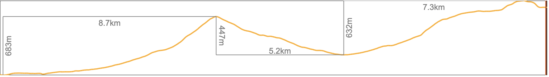
Northbound Elevation Profile
Trail Conditions
The route is a mix of dirt and stone Jeep tracks, open grassy terrain, and one section of boulder field between Patara Abuli and Lake Patara Levani. Footing is generally good across the Jeep tracks and grass. The boulder field requires rock-hopping and careful foot placement — a twisted ankle here is far from any road. The trail is blazed in white and yellow throughout this stage.
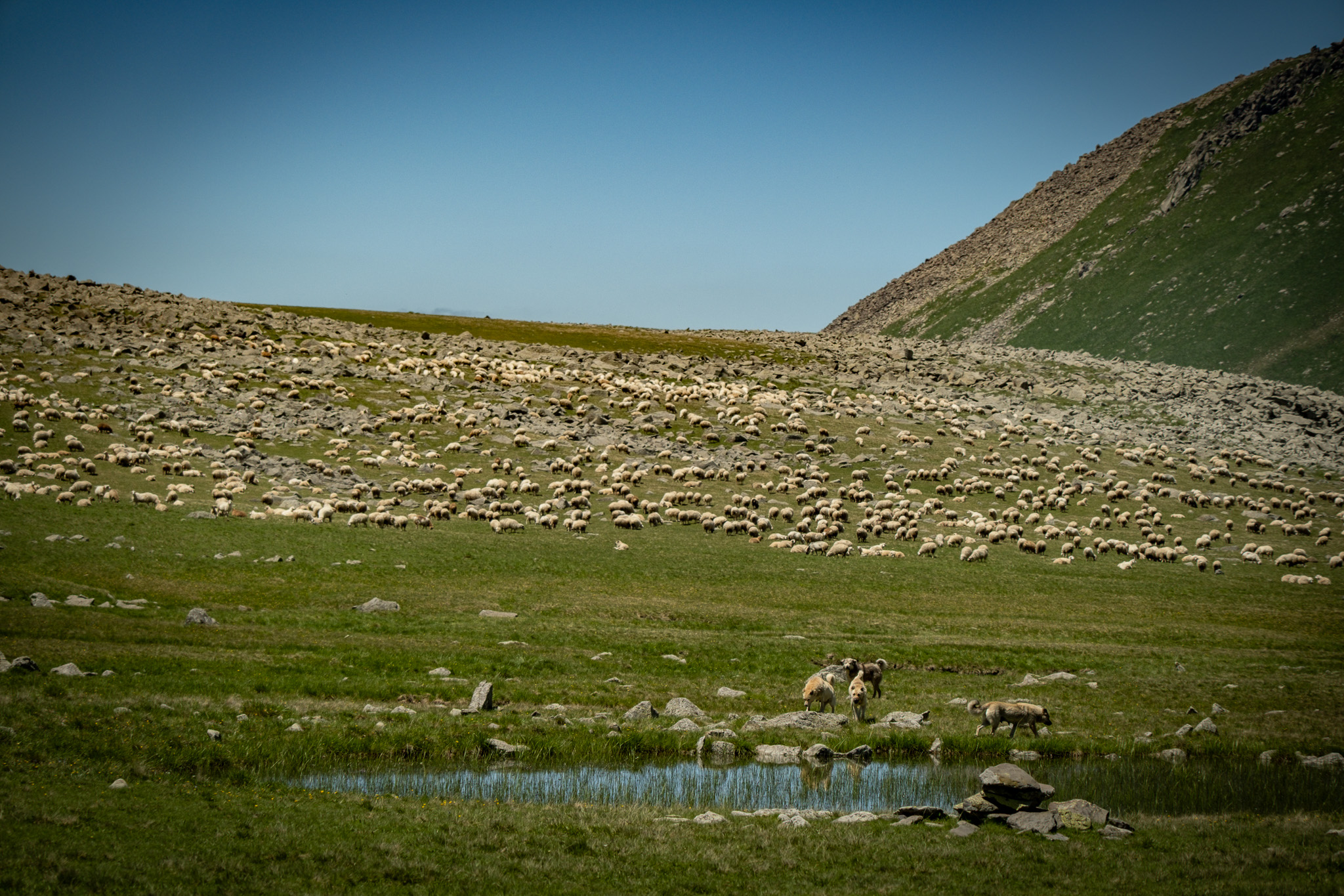
Expect to encounter local shepherds and their flocks in summer, and perhaps some other visitors arriving by 4×4 to see Abuli Fortress, but few other hikers on most of the stage.
Water
Water sources on this stage include seasonal streams along the climb between Gandzani and the plateau, and Lake Patara Levani itself. The streams run reliably in early summer but may dry up by August. By midsummer, plan to carry all of your water between Gandzani and Lake Patara Levani. Filter all surface water — the plateau is heavily grazed.
Trail Access
Many points along this stage are accessible via 4×4, but other than the occasional vehicle on the plateau near Abuli Fortress, you’re unlikely to see any. The main access points to the trail are Gandzani village (south), a Jeep track connecting to the pass near Abuli Fortress from the west, and the onward continuation toward Lake Levani (north). Gandzani connects to Tbilisi via the daily marshrutka run by Family Corner Guesthouse (see Practical Information for contact details).
Trail Amenities
Gandzani has a small bakery and a few village shops near Family Corner Guesthouse, useful for last-minute food before heading up. Other than that, there are no shops, shelters, or services until Tabatskuri at the end of Stage 3.
Navigational Notes
The trail follows clearly visible Jeep tracks and blazes for most of this stage. In clear weather, the open terrain makes navigation straightforward by sight. In fog, the plateau goes featureless — keep your GPX track loaded and a compass accessible. The boulder field between Patara Abuli and Lake Patara Levani is the one section where the route is less obvious; pay attention to blazes and your GPS through that stretch.
Side Trails
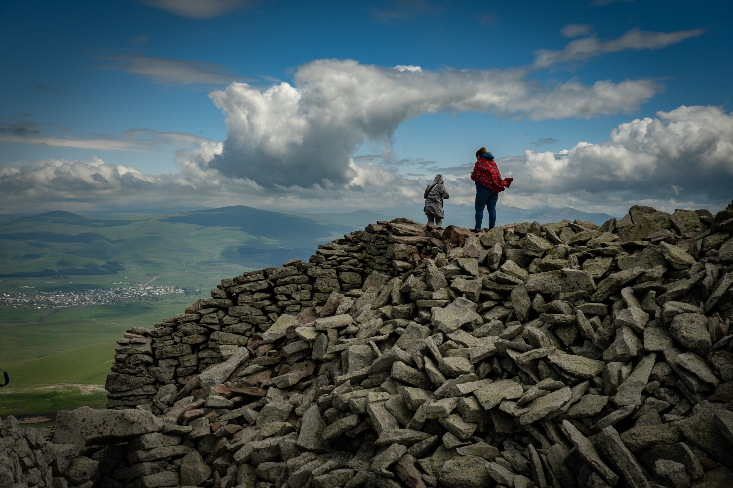
Abuli Fortress — a roughly 500m side trail leads off the main route near the pass. The detour is flat and adds minimal time. The fortress is a Bronze Age cyclopean structure built of unmortared basalt blocks and is one of the most remarkable sites on the entire stage. We strongly recommend taking the detour and giving yourself time to explore.
Didi Abuli summit — a side route off the main trail leads to the summit of Didi Abuli (3,301m), the highest peak in the Abul-Samsari Range. Descend the same way, or pick your own line down the north side to rejoin the main route near Lake Levani.
Hazards
In summer, expect encounters with seasonal shepherd camps and their livestock guardian dogs. Review the dog protocol in the Hazards section before this stage. Carry trekking poles.
The boulder field between Patara Abuli and Lake Patara Levani is the highest-risk terrain on this stage for falls and ankle injuries. Slow down.
Points of Interest
Abuli Fortress — see Background Information (History) for full context. The fortress dates to the 2nd–1st centuries BC and was built using cyclopean masonry techniques, with massive basalt blocks laid without mortar, concealed passages, and chambers integrated into the natural moraine of the mountainside.
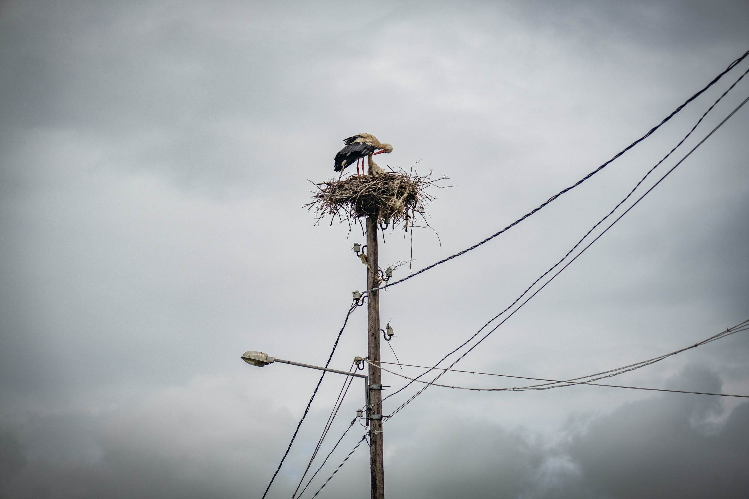
Walking through Gandzani, look up. The village has a population of white storks that nest on lamp posts, telephone poles, and rooftops, and Samtskhe-Javakheti is the only part of Georgia where white storks breed. Each of the traditional villages in the region has at least a dozen nests.
Trailmaker’s Notes
This section was first scouted as part of a cross-border tourism development project with the NGO People in Need, working in Georgia and Armenia. Separately, this section was also blazed through the initiative of the Samtskhe-Javakheti DMO. We thank both of them for their work to make hiking more accessible in this incredible region.
Close observers of TCT content may have noticed a small, very cute, jackal-like dog appearing in a lot of our photos. Her name is Mela — Georgian for “fox” — and she’s from Gandzani. TCTA Executive Director Meagan Neal found her while scouting this section. Mela followed Meagan for three days from the outskirts of Gandzani all the way through the highlands, and she’s been part of the TCT story ever since.
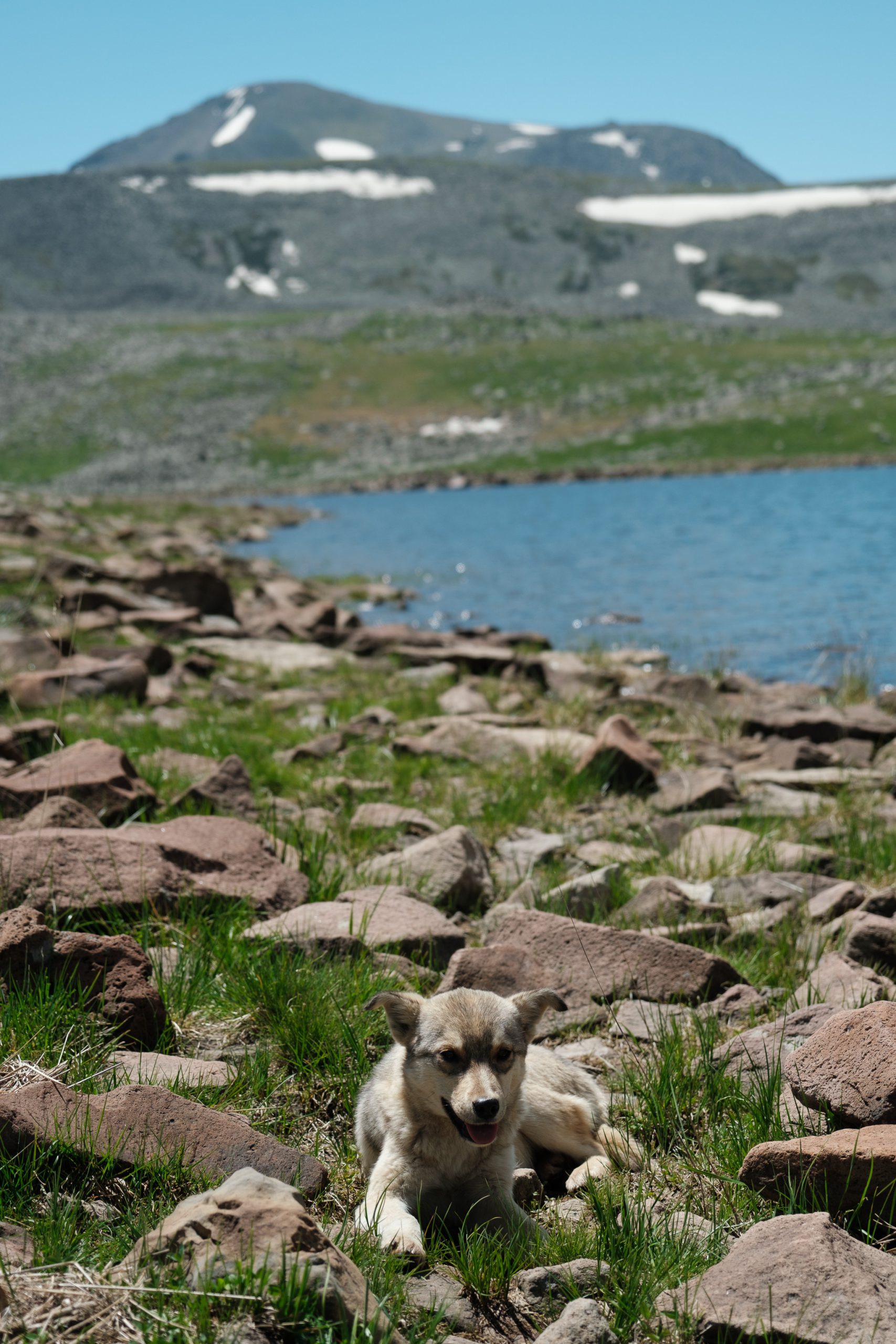
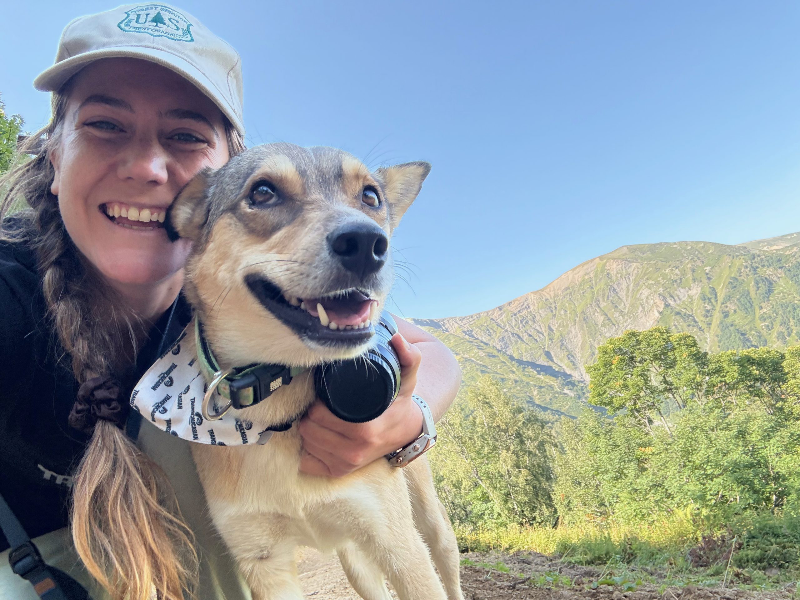
Mela as a puppy in Javakheti (left); Mela the resident trail dog at the TCT Camp in Zeskho, Georgia (right).
Next: Stage 2 — Lake Patara Levani to Samsari Caldera →