
The following notes describe what you’ll encounter along the trail. They’re written in the direction of travel from south to north, but the stage can be hiked in either direction.
Stage Overview
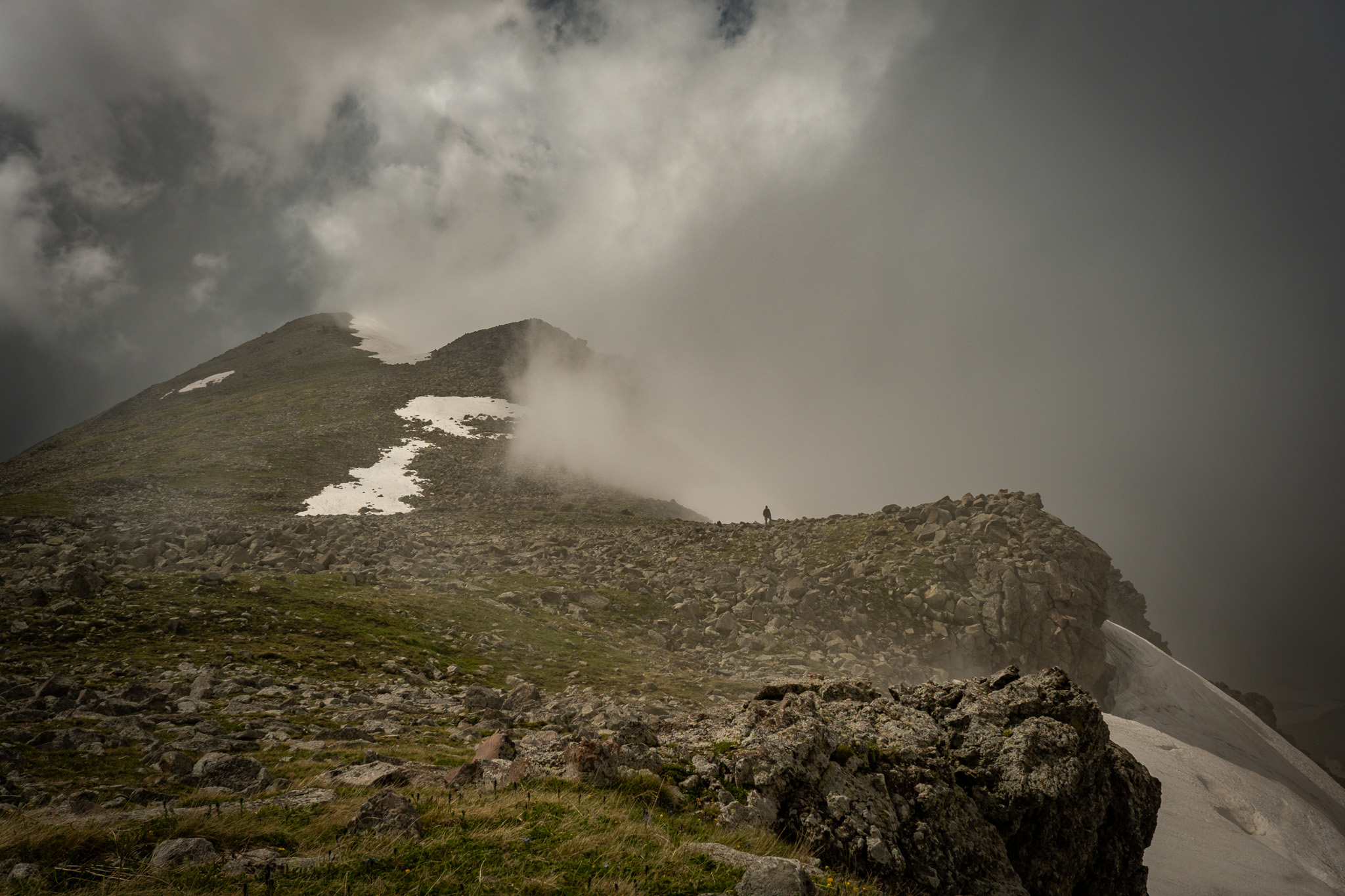
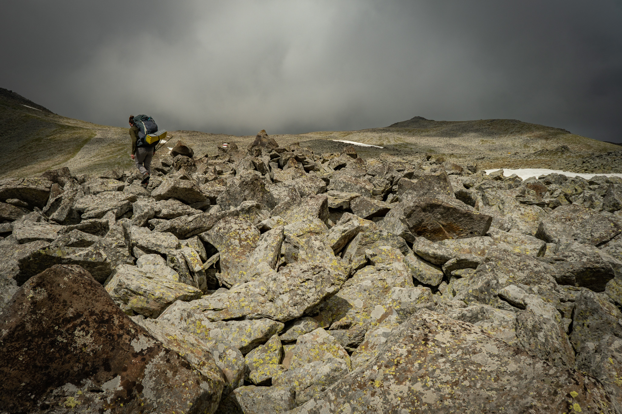
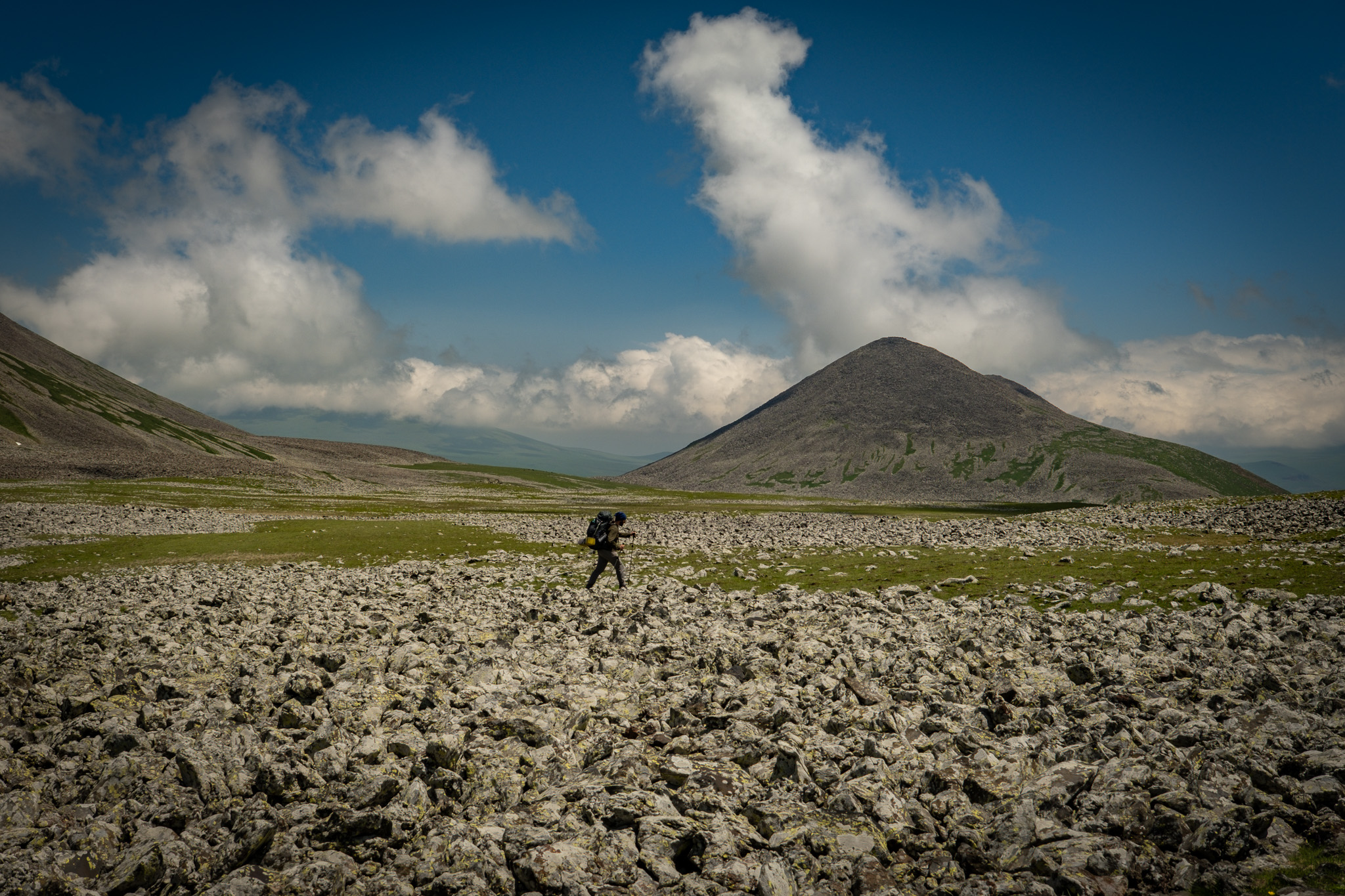
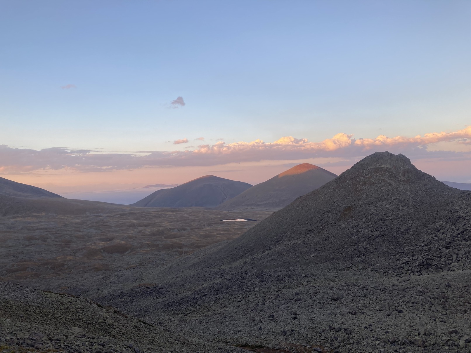
This stage is the heart of what we fondly call the Javakheti Alpine Lakes Tour. From Lake Patara Levani, an easy Jeep track connects to the larger Lake Levani. The trail traverses around the east side of Lake Levani, then begins a steeper climb north toward Samsari Pass with views of Didi Abuli to the south. As the climb continues, the terrain shifts into boulder fields requiring rock-hopping all the way to the pass.
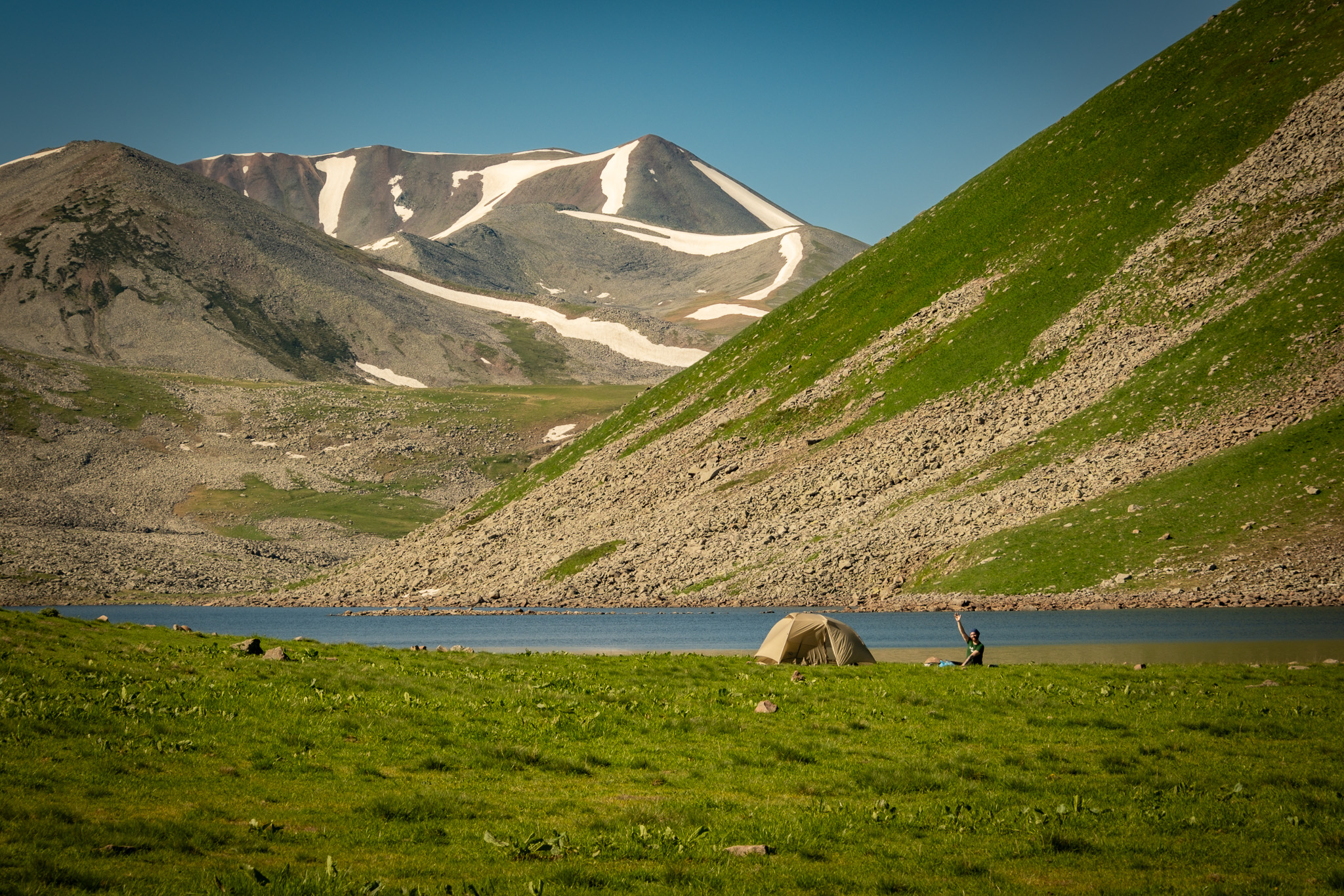
Samsari Pass itself is marked by a large exclamation point blaze — this is the decision point for continuing over or backtracking to the lowland alternate. Between Samsari Pass and the caldera floor, the route drops down a very steep, open scree slope with no defined trail. Beyond the steep section, the trail traverses open rocky terrain into the Samsari Caldera, where a small lake offers another excellent campsite.
Quick Facts
- Distance
- 14.68 km
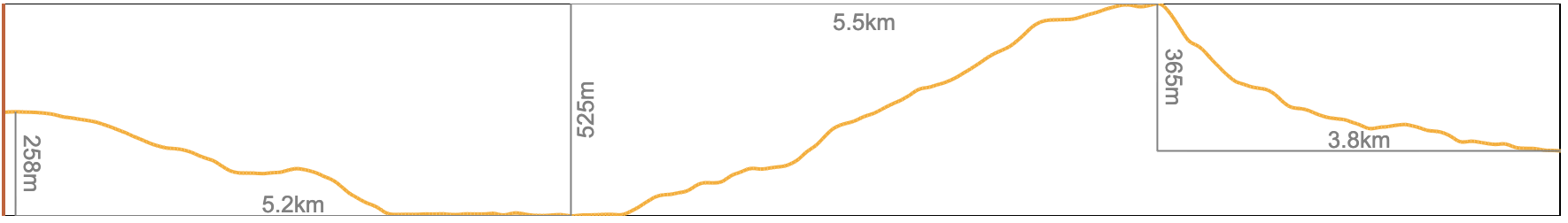
- Elevation range
- 2,565m to 3,091m
- Elevation gain (south to north)
- +576m / −670m
Northbound Elevation Profile
Trail Conditions
This stage covers a range of terrain. The section between Lake Patara Levani and Lake Levani is easy Jeep track. North of Lake Levani, the trail climbs more steeply and the surface transitions into boulder fields requiring rock-hopping toward Samsari Pass. The pass itself is the crux of the stage: a steep, open scree slope and boulders between the pass and the caldera floor, with no defined trail. The GPS track through that section is a rough approximation — the terrain is open and hikers pick their own way through.
The trail is blazed up to Samsari Pass. North of the pass, markings become sporadic.
You may encounter local shepherds and their flocks in summer, and perhaps some local fishermen from Akhalkalaki, but you’re unlikely to see many (if any) other hikers.
Water
Water sources on this stage include Lake Patara Levani, Lake Levani, and the small lake in the Samsari Caldera. All three are reliable. Between Lake Levani and the caldera, there are no reliable water sources, so refill before the climb to Samsari Pass. Filter all surface water — the plateau is heavily grazed.
Trail Access
Lake Levani is accessible via serious 4×4 (easier coming from the west). The caldera lake can be reached by 4×4 from the east. There are no other vehicle access points along this stage.
Trail Amenities
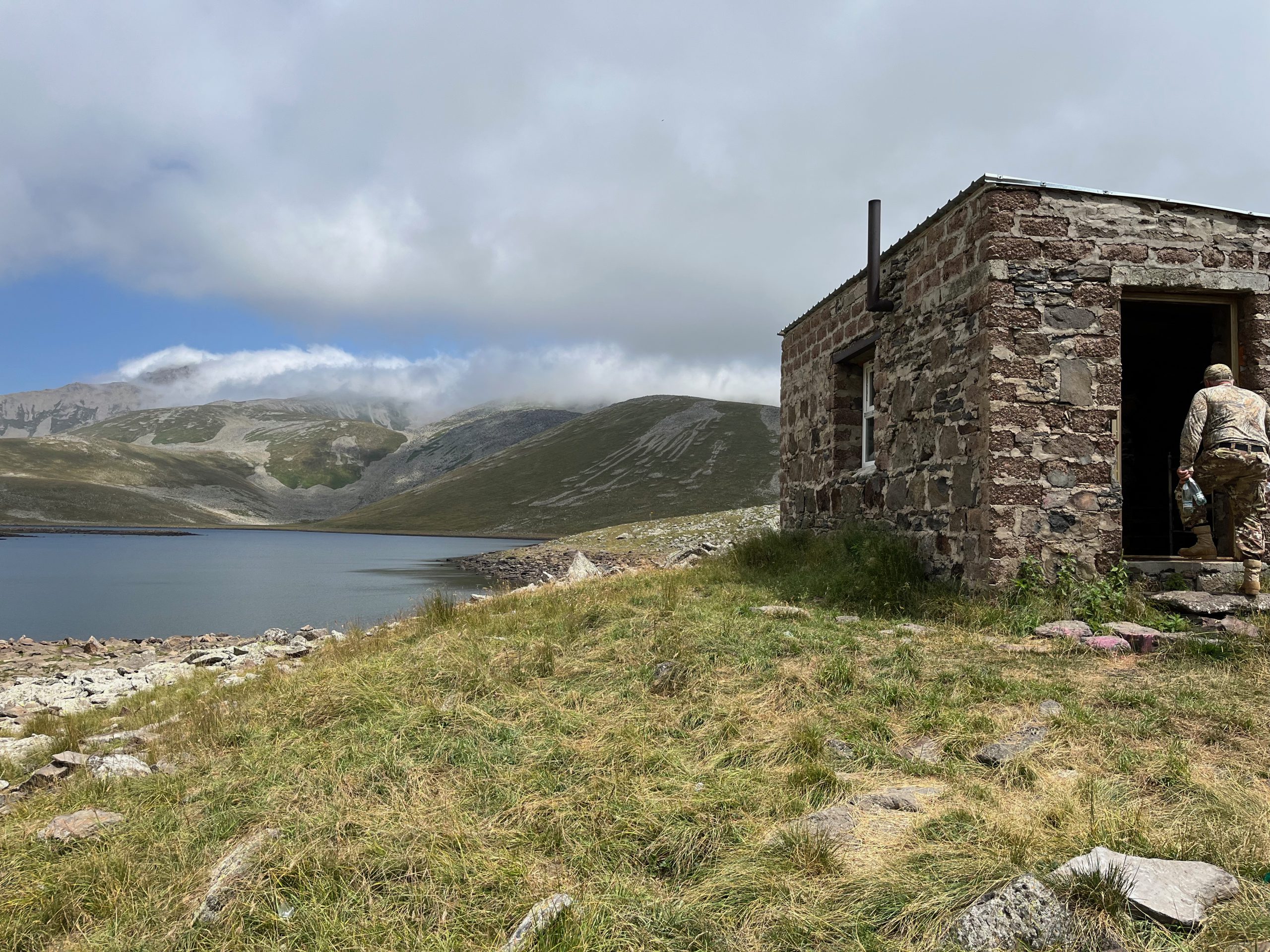
A small cabin sits on the southern shore of Lake Levani, built and maintained by Rafael from Hotel Riverside Inn in Akhalkalaki. Get in touch with him directly in advance to ask about staying there — he can also share local knowledge and other things to do in the area. The cabin is sometimes left open for hikers in bad weather. If you find it open, be a good guest: pack out what you bring, and leave it cleaner than you found it.
There are no other shops, shelters, or services on this stage.
Navigational Notes
Between Lake Patara Levani and Samsari Pass, the trail follows shepherd trails and blazes across rock fields. The boulder fields approaching the pass require attention, but the route is straightforward in clear weather.
Samsari Pass is marked by a large exclamation point blaze. Stop here and reassess before continuing. If snow is still lingering on the north side of the pass, we strongly recommend backtracking to take the lowland alternate, even if it adds significant distance. Crossing snow on this pass is not recommended — beneath the snowpack lies steep scree and boulders.
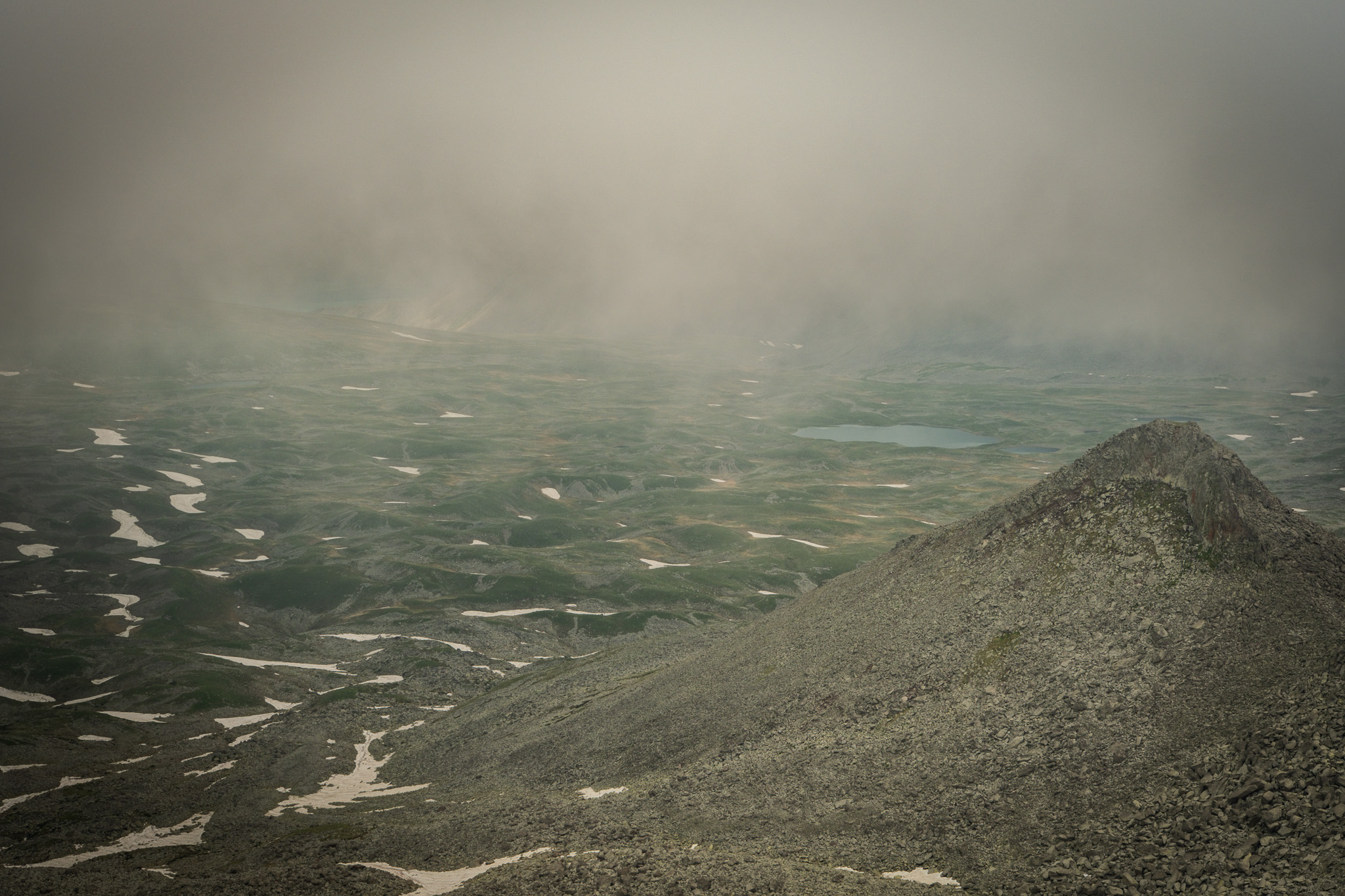
Between Samsari Pass and the caldera floor, there is no defined trail. The slope is very steep, open, and can feel exposed. Take your time. Pick your footing carefully. The GPS track is approximate — choose your own line down based on conditions.
In fog, the open terrain on either side of the pass goes featureless. Keep your GPX track loaded and a compass accessible.
Side Trails
Lowland alternate around Samsari Pass — see the Alternate Routes section for the full description. This is the recommended option in bad weather, lingering snow, or if you’re not confident on steep scree.
Hazards
In summer, you may encounter seasonal shepherd camps and their livestock guardian dogs. Review the dog protocol in the Hazards section before this stage. Carry trekking poles.
The steep scree slope between Samsari Pass and the caldera floor is the most serious terrain on the entire route. Falls and ankle injuries are real risks here. If conditions are wet, snowy, or you’re tired, take the lowland alternate.
The boulder fields approaching Samsari Pass also require careful footing. Slow down through any rock-hopping section.
Natural History
The Samsari Caldera, which the trail enters on the north side of the pass, is the standout geological feature of this stage. A caldera forms when a volcano erupts catastrophically and the ground above the emptied magma chamber collapses inward, leaving a circular depression bounded by the ring-shaped remnants of the original mountain. Samsari’s caldera is about 3 km across, with rocks from the last eruption, glacial debris, and small lakes on its floor. The rim shows cirques carved by Ice Age glaciers. See Background Information (Natural History) for more.
Trailmaker’s Notes
We first scouted this section as part of a cross-border tourism development project with the NGO People in Need, working in Georgia and Armenia. The blazes on this section were done by the Samtskhe-Javakheti DMO. We thank both of them for their work to make hiking more accessible in this incredible region.
While scouting this section, we received a lot of help from Rafael Darbinyan, owner of Hotel Riverside Inn in Akhalkalaki. Rafael is a local guide, avid fisherman, and builder of the Lake Levani cabin who regularly takes guests up to hike, fish, and drive offroad in the mountains. He also helped paint the blazes on several of the trail sections this route passes through. If you pass through Akhalkalaki, we can’t recommend staying at Hotel Riverside Inn highly enough.
Huge thanks to Rafael, Vova, and Artur — we have never forgotten your hospitality!
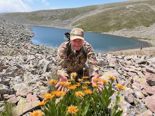
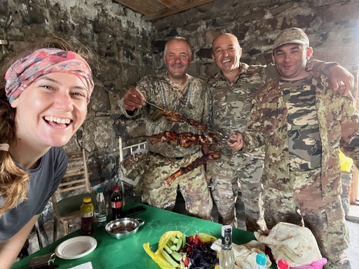
Rafael showing off the region’s wildflowers (left); Meagan sharing khorovats with Rafael, Artur, and Vova (right).
Next: Stage 3 — Samsari Caldera to Lake Tabatskuri →