Map & Trail Notes
Quick Facts:
Elevation Gain/Loss: 9,727 m / 8,806 m
Trail Notes
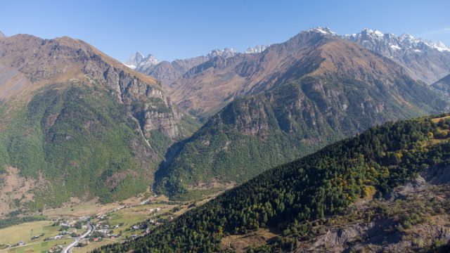
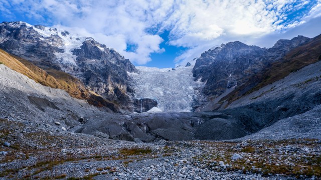
This trail takes hikers from Chuberi, a cluster of villages in the Neskra Valley, east to Ushguli, the highest villages in Svaneti. The trail crosses five major mountain passes, and the landscape changes quickly along the way, from deep forested valleys and rushing rivers to high alpine meadows overlooking the jagged peaks and glaciers of the Greater Caucasus.
Because of the altitude of the passes and the high levels of precipitation in the Western Caucasus, this trail does not become completely snow-free until July.
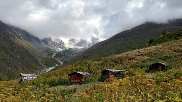
The trail passes through several villages as well as village clusters, which are usually referred to by a different name. When referring to village clusters we also list the name of the prominent village on the trail notes to help hikers understand what they are seeing on the map.
These trail notes are written from east to west, but the route may be hiked in either direction. See below for the trail notes for each stage of this section.
Chuberi (Village Kvemo Marghi) to Nakra
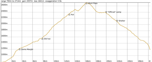
Overview
Distance: 27 km
Approximate Time: 10 hours
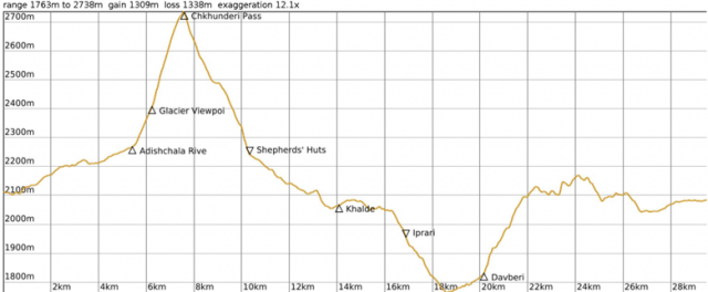
Elevation Gain/Loss: 2296 m / 1861 m
Difficulty Level: Difficult
Max/Min Altitude: 2707 m / 844 m
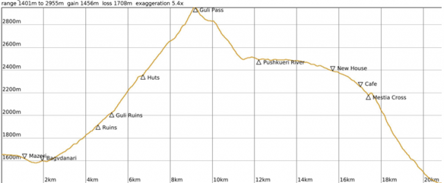
Elevation Profile
Route Description
This route contains a long steady climb and descent through the Utviri Pass. Although it is not as steep as other passes in Svaneti, the distance covered makes it a very long hike. Only very ambitious and fit hikers should attempt it in one day. Spending a night near the treeline on either side of the pass may be more enjoyable.
The route starts at the large sign with a map on it in the the village of Kvemo Marghi on the east side of the Nenskra River, just past the bridge Cross the bridge and turn left, following the road north through the village. The road curves towards the right and follows the Gvashkhara River, which will be on your left. When you come to a clearing where the river is visible (about 2km from the starting point), cross the river and follow the trail into the forest. The trail crosses the river again, and begins ascending. After 400 meters, turn left onto a narrow footpath that is easy to miss. You will pass a yellow directional sign soon after the turn.
Soon you will reach the outskirts of Zemo Marghi, and the trail follows a fence through heavy vegetation. Coming out of the forest, you will meet a clearing with expansive views over the valley on your left. To the right is a house. Pass straight through the clearing and meet the trail on the other side. Continue on this path through the forest and more vegetation, keeping the fence on your right. Watch your step, as the ridge is steep and the path is narrow. When the trail opens up into a meadow, cross the meadow to the jeep track on the other side. Turn left on the jeep track, which you will follow until the treeline.
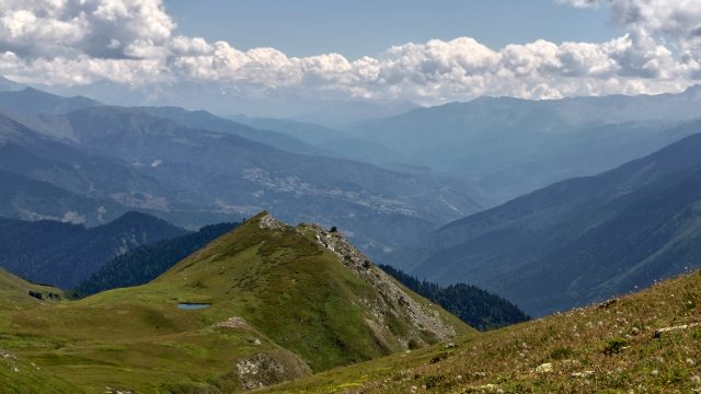
When you reach the treeline, the jeep track starts becoming a bit more overgrown, but the trail is still quite visible. To your right, you will see two huts below the trail, and then pass a small lake on your left. Soon, you will reach a solitary hut. Follow the trail through the alpine meadow, following the red and white blazes to the hill on the other side, where the trail through the rhododendrons is easily visible. The trail climbs steadily upward, along the south side of a fairly deep valley. In an hour or so, you will have a clear view of the pass you are aiming for.
Three large stones, which appear to have been arranged in formation, mark Utviri Pass, from where a small trail leads down to a lake (See Ltnari Lake Side Trail notes below). From the pass, the trail descends through the meadow to another jeep track leading to Nakra. Follow the cairns and red and white blazes until you reach the jeep track. Turn left on the track. You will cross a couple small streams before reaching an old campsite with huts which are not suitable for spending the night. Continue following the jeep track until another small hut is visible. Here, the track crosses a meadow, and may be difficult to navigate later in the season when the vegetation is heavy and overgrown. Beware of hogweed here. After about 300 m, the jeep track enters the forest and descends steadily towards Nakra. As you reach the village, you can either follow the track all the way to Nakra or take a small but steep shortcut down the hillside. The shortcut is unmarked, but the hill is easy to navigate down to the main road.
Ltnari Lake Side Trail
From the pass, a trail leads down to a small lake with a nice camping spot and views of the mountains to the east. If you take the side trail, however, you will need to return to the pass to continue onto Nakra, as there is a ravine between the side trail and the main trail.
Downloads
PDF Trail Notes
Menu
Route Resources
Interactive Map
To download the GPX tracks and waypoints from CalTopo, click “Export” in the top left corner. Then select the relevant sections and export in GPX or KML format.
Partners & Sponsors
This section of the Transcaucasian Trail was first developed between 2016–2017 with the support and hard work of volunteers from around the world.
The trail has been maintained by the Transcaucasian Trail NGO of Georgia with the support of the Transcaucasian Trail Association, the U.S. Embassy Democracy Commission, the U.S. Forest Service, and dozens of volunteers.
To become a TCTA member and support more trail development projects like this one, join here.