
Trail Conditions
Trail Conditions
29% (250km) of the route is on singletrack trails. Many of these are ancient trails that have been used for centuries to cross between passes, and a few are newly built by trail crews. Conditions on these can vary widely, depending on the season and frequency of maintenance. Some trails are well-maintained. Others can be quite overgrown, especially in mid-summer when the vegetation is thick. Be prepared to brush through thick undergrowth, overhanging branches, and lots of thorns. In addition, you should occasionally expect to encounter potentially challenging conditions including steep gradients, narrow paths, loose or rocky trail surfaces, stream crossings, and minor obstacles such as fallen boulders which may require scrambling.
44% (386km) of the route is on dirt roads (often referred to as jeep tracks or mountain roads). Most of these are from the Soviet period. Jeep tracks vary greatly in quality, from smooth pleasant tracks to deeply rutted nightmares of mud. As part of the route design process, we have tried to select the most pleasant path possible (and we hope you will agree). These sections are typically unmarked but straightforward to navigate.
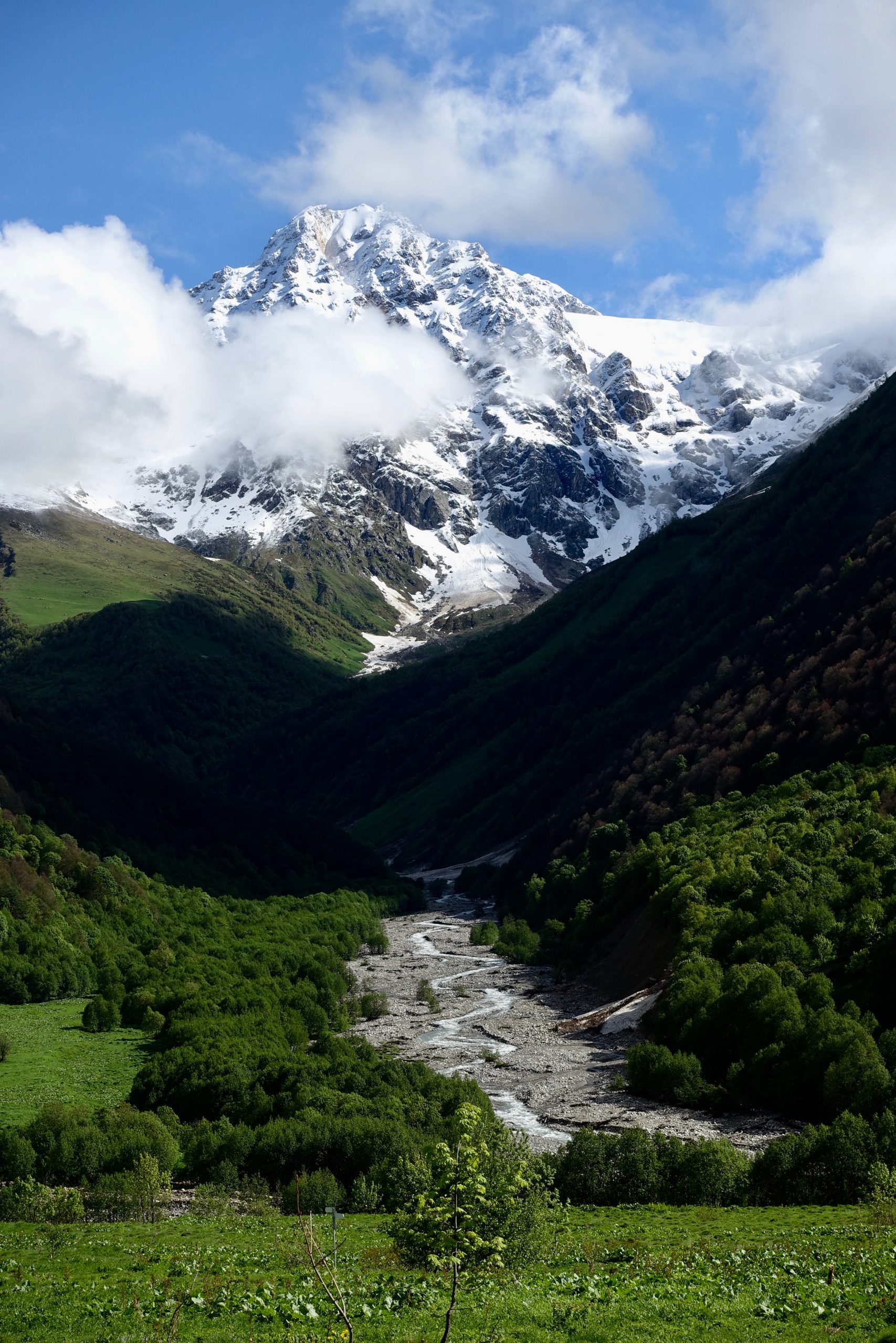
11% (93km) percent of the route is entirely off-trail. There is no path and no markings. You choose your own route across the terrain. You must be comfortable navigating off-trail, preferably with multiple methods in case one fails (e.g. your phone battery dies or you lose your map). The terrain of the off-trail sections ranges from open fields (e.g. the lower Geghamas) to high alpine volcanic terrain (e.g. the upper Geghamas) to steep, forested, thorn-covered slopes (e.g. Arevik National Park). Some of these sections have been flagged for future development and you may be able to follow the proposed route marked out with high-visibility surveyors’ tape. You should expect to move much more slowly on some of this terrain, as the lack of trail requires more attention to your footing and climbing through thick vegetation generally slows progress.
The remaining 14% (133km) of the route is on residential roads and sidewalks through the many towns and villages passed by the trail, or on short sections of paved road that lead into or out of these settlements.
If you are not comfortable with off-trail wilderness travel, we would recommend against attempting the full route at this time.
In the meantime, there are plenty of great trails to hike along more developed sections of the TCT. See our trail notes for more information on sections with better-developed hiking infrastructure.
Become one of the first thru-hikers on the full Transcaucasian Trail route through Armenia & Georgia
Got more questions? Excited about the route and want advice during your planning process? We’re seeking intrepid, experienced hikers to be some of the earliest thru-hikers on the brand-new 1,500km North-South Transcaucasian Trail route through Armenia and Georgia. In 2023, we’ll be running the second year of the TCT Trailblazers, a new hiker membership program to support them in the planning process.
You’ll have the privilege of being one of the first hikers on this new long-distance trail, and you’ll have the opportunity to help shape its future along the way.
Menu
Route Downloads
Recommended Apps
You can also find this trail on the following hiking and navigation platforms:

Printed Resources
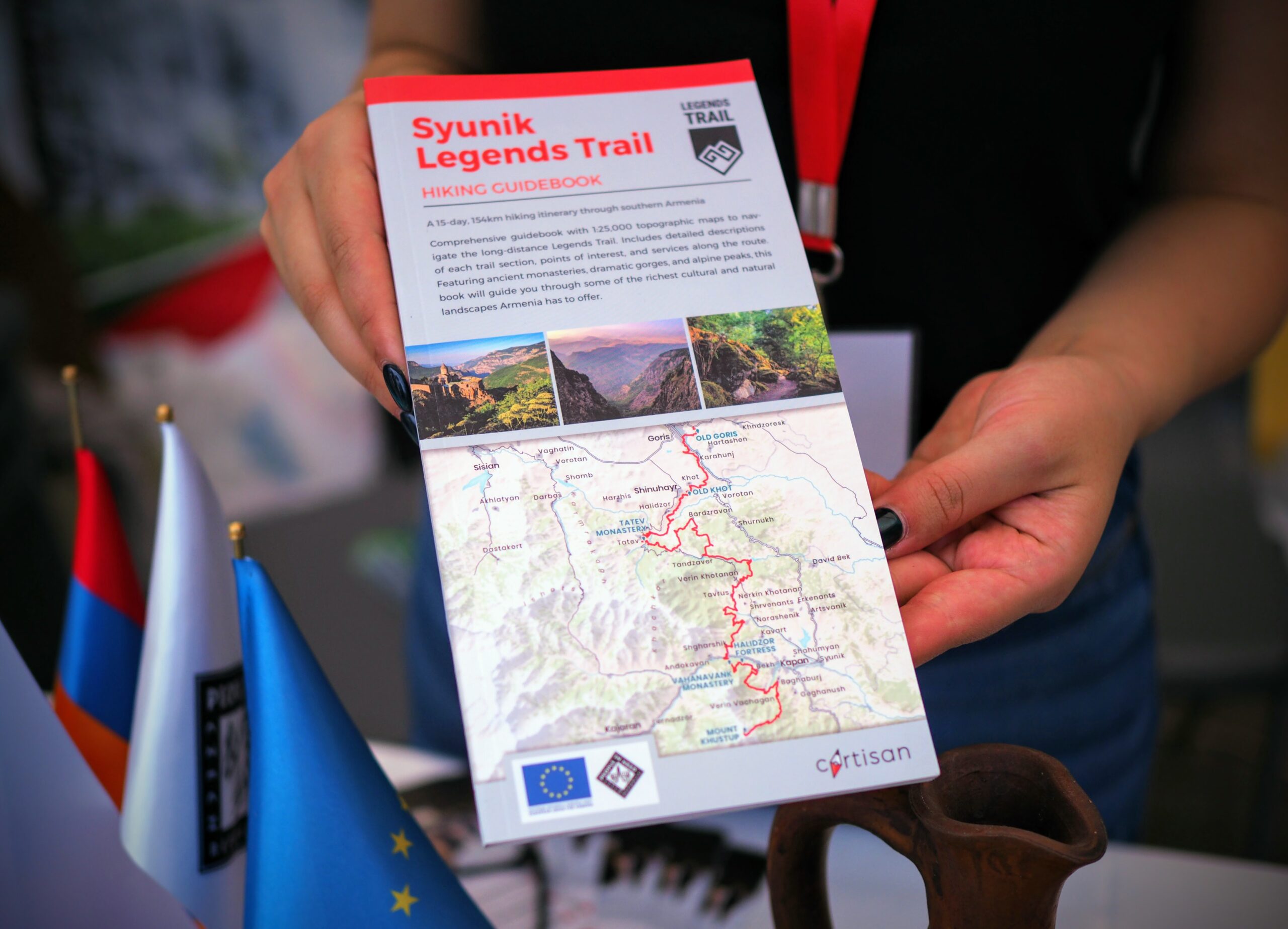
Browse & buy official topo maps & guidebooks for sections of the Transcaucasian Trail in Armenia from our partners at Cartisan.org.
Partners & Donors
This national stage of the Transcaucasian Trail was developed between 2016–2022 by the TCT Armenia NGO with the support and cooperation of many partners and donors, most notably the UK’s Royal Geographical Society (with IBG) and Land Rover, Caucasus Nature Fund, HIKEArmenia, Trails For Change, and People In Need Armenia (in partnership with ARK Armenia and with funding from the European Union), as well as many individual donors to the Transcaucasian Trail Association. Click the logos below to find out more.
To become a TCTA member and support our ongoing efforts to develop and improve the Transcaucasian Trail, join here.
