
Frequently Asked Questions
Frequently-Asked Questions
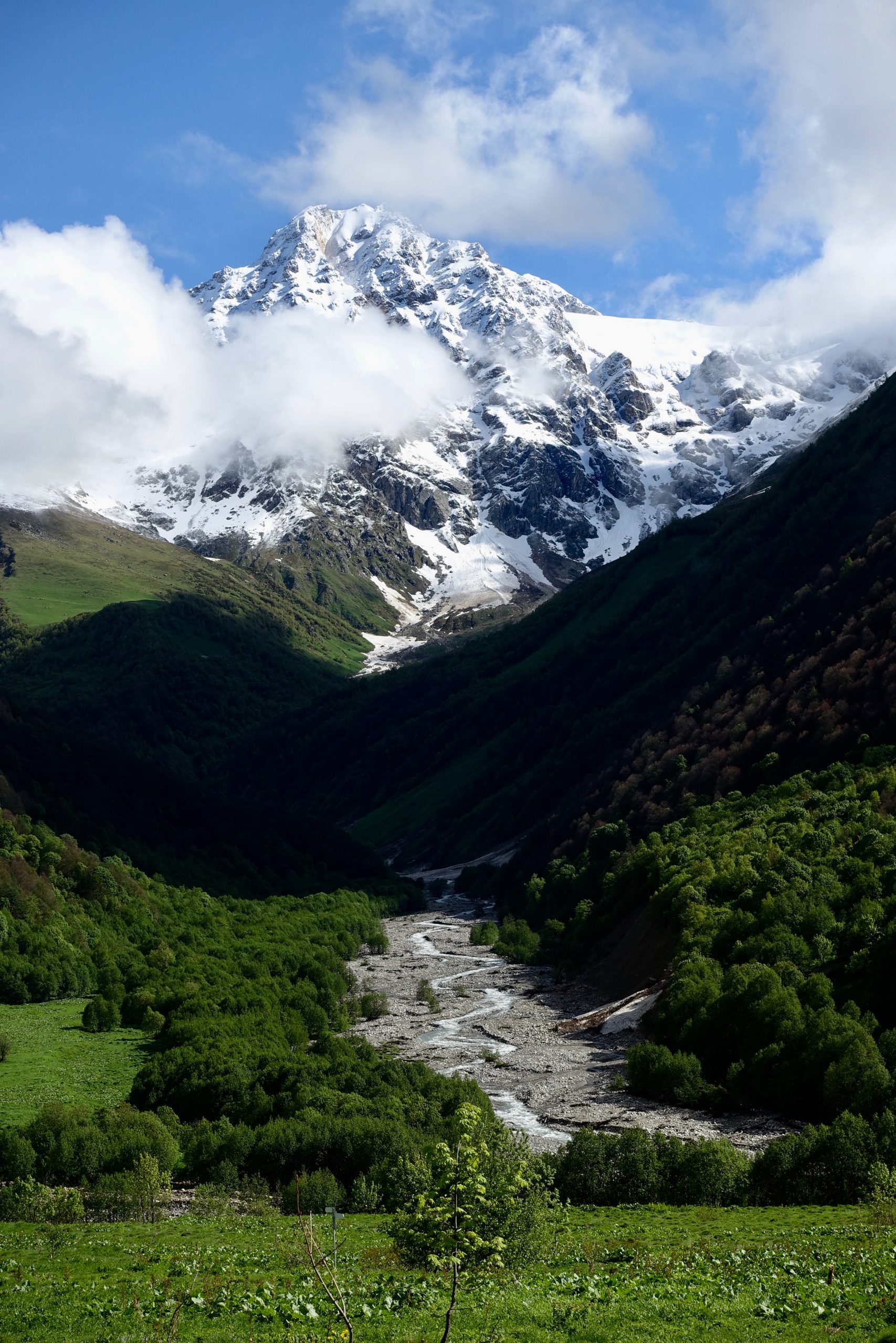
When is the best time to thru-hike Armenia?
In general, summer is the primary season for hiking the TCT. The thru-hiking window for the Armenia route is roughly from early June to mid-October. Earlier starts or later finishes may be possible, but you will likely have to contend with snow in the higher mountains and be prepared to take alternate routes if necessary. If you want to ask us detailed questions about the timing of your hike or alternate routes, join our new thru-hiker support program where we’ll discuss those topics in detail.
Should I hike northbound or southbound?
The route can be hiked in either direction (northbound or southbound) with slight shifts in timing. Southbound hikers are likely to find the challenging final stages between Kapan and Meghri easier with a few weeks’ conditioning; northbound hikers will be well and truly in at the deep end!
From either endpoint, we recommend timing your hike to make sure you can pass the Geghamas, where the higher parts of the range are reliably snowbound from October to June.
Those planning to continue a thru-hike into Georgia will want to pay careful attention to the weather windows in Georgia, as the high passes of the Greater Caucasus are typically only snow-free from July to September.
What permits do I need?
You don’t need any permits to walk most of the TCT, although you do need to check in with the rangers in certain protected areas, and some national parks require a small usage fee. Registration is currently required to hike the route through Arevik National Park and along the border of Shikahogh State Reserve. We will provide updated information for thru-hikers on how to obtain this permission in the spring.
In general, it is important to be mindful of your impact on the land and the people around you. The trail crosses lots of villages and multi-use land, including farming, grazing, and logging. Wild camping is widely tolerated, but you should ask permission before pitching up in someone’s field. Please be a respectful visitor and practice Leave No Trace habits so that we can continue our good relationships with people along the trail and so that future hikers can enjoy the experience.
What are the resupply options like en route?
The thru-hiking route passes larger towns with supermarkets roughly every 50–100km, either directly or via a short hitch. Larger supermarkets are available in Meghri, Kapan, Goris, Sisian, Jermuk, Yeghegnadzor, Sevan, Dilijan, Alaverdi and Stepanavan. Many, but not all, of the villages along the route have a small village shop, which tend to sell more basic and long-lasting staples. We’ll talk about food planning, water sources, fuel options, and other resupply questions in more detail in our spring prep sessions as part of our thru-hiker support program.
Can I stay at guesthouses along the whole route?
You can find guesthouses along many, but not all, sections of the route. Learn more about existing guesthouse infrastructure along our more developed trail sections. If you attempt the whole route, you should be prepared to camp.
Can I wild camp along the whole route?
If desired, it is easily possible to camp for all or most of the TCT route through Armenia. Camping away from the small number of designated campsites is widely tolerated, with most land being community-owned rather than privately owned. (Notable exceptions are state reserves such as Shikahogh State Reserve in the south, where overnight stays are forbidden.)
Please behave courteously and keep in mind that you may be camping on land that people use for their livelihood. Follow “Leave No Trace” principles to help ensure future hikers can camp with the same freedom.
Who can I contact with very specific planning questions?
We’re starting to feel like a broken record, but join our new thru-hiker support program! We designed this specifically so we can dedicate team time to answering your questions– and to help you connect with a community of fellow hikers that you can plan alongside and learn from.
Become one of the first thru-hikers on the full Transcaucasian Trail route through Armenia & Georgia
Got more questions? Excited about the route and want advice during your planning process? We’re seeking intrepid, experienced hikers to be some of the earliest thru-hikers on the brand-new 1,500km North-South Transcaucasian Trail route through Armenia and Georgia. In 2023, we’ll be running the second year of the TCT Trailblazers, a new hiker membership program to support them in the planning process.
You’ll have the privilege of being one of the first hikers on this new long-distance trail, and you’ll have the opportunity to help shape its future along the way.
Menu
Route Downloads
Recommended Apps
You can also find this trail on the following hiking and navigation platforms:

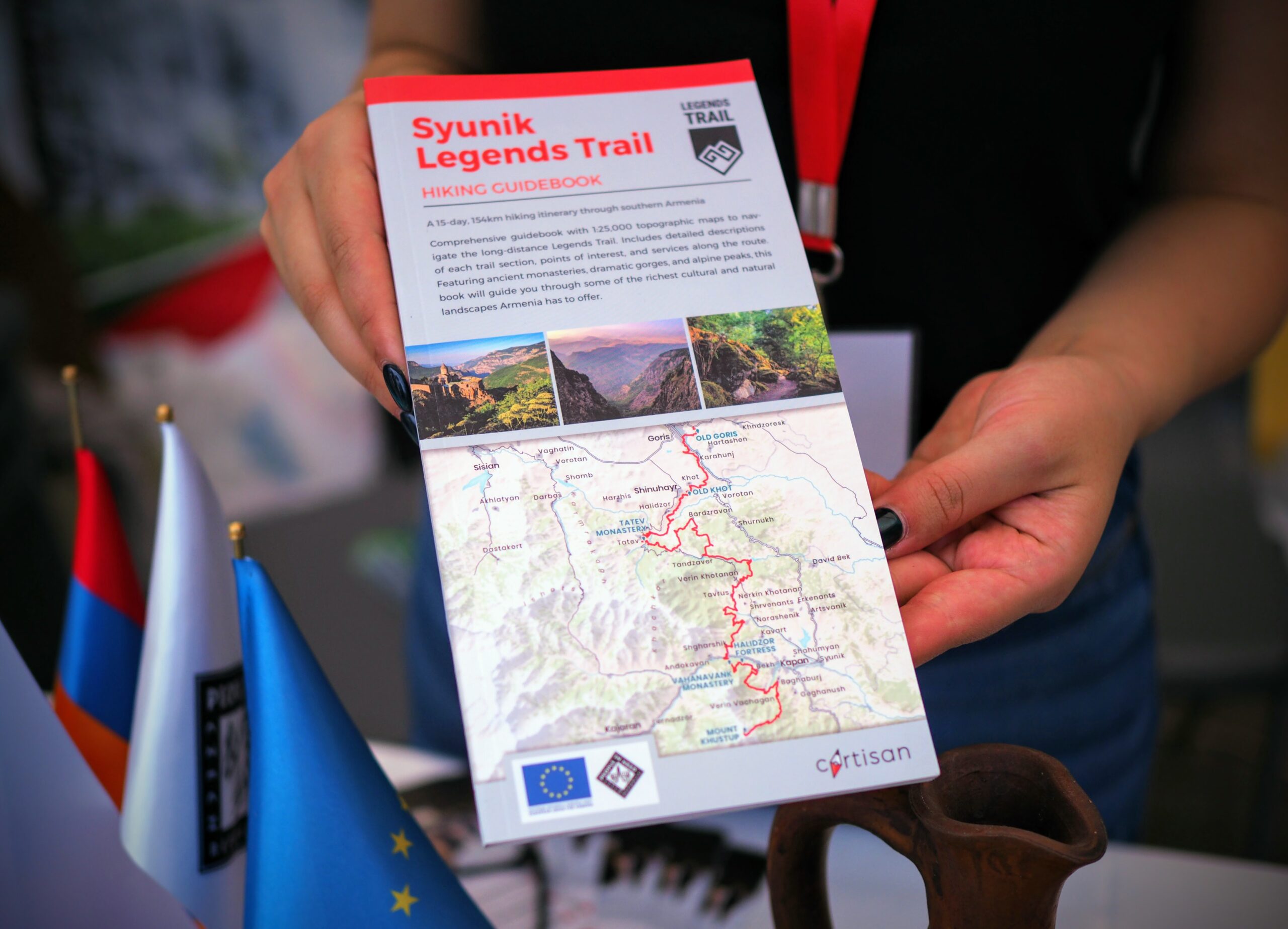
Printed Resources
Browse & buy official topo maps & guidebooks for sections of the Transcaucasian Trail in Armenia from our partners at Cartisan.org.
Partners & Donors
This national stage of the Transcaucasian Trail was developed between 2016–2022 by the TCT Armenia NGO with the support and cooperation of many partners and donors, most notably the UK’s Royal Geographical Society (with IBG) and Land Rover, Caucasus Nature Fund, HIKEArmenia, Trails For Change, and People In Need Armenia (in partnership with ARK Armenia and with funding from the European Union), as well as many individual donors to the Transcaucasian Trail Association. Click the logos below to find out more.
To become a TCTA member and support our ongoing efforts to develop and improve the Transcaucasian Trail, join here.
