
Abrikh – Abdalli
Abrikh – Abdallı (25.42 km / 15.80 mi)
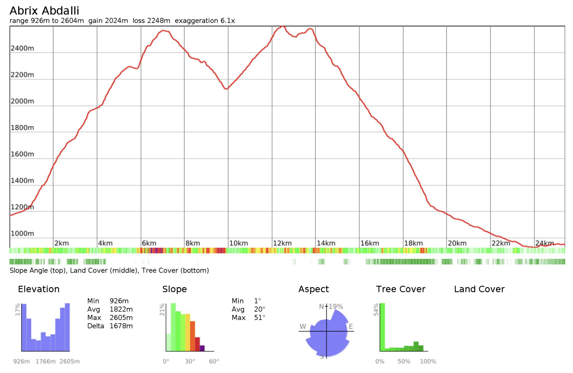
Distance: 25.42 km / 15.80 mi
Elevation gain: +2025 m / +6,644 ft
Elevation loss: –2249 m / –7,379 ft
Minimum elevation: 926 m / 3,038 ft
Maximum elevation: 2605 m / 8,547 ft
This stage crosses from the Gabala side into Oghuz, climbing steeply out of Abrikh through forest and open slopes before dipping into a more hidden valley tucked behind the range. It is a beautiful and varied stage, with a strong sense of entering a pocket of terrain that feels enclosed and removed. The route then climbs out again over the next mountain before descending through pasture, forest, and finally flatter valley tracks toward Abdallı. Navigation can be tricky in the upper parts, where movement follows animal trails rather than a single defined path.
Trail conditions
This stage is a mix of steep forest trail, faint animal paths, open alpine ground, pasture tracks, and flatter valley roads. There is no formal maintenance, and the more remote upper sections are shaped far more by animal movement and seasonal grazing than by regular human foot traffic.
Expected footfall is very low, aside from shepherds and local pastoral use in summer. Summer and autumn are generally the best seasons for this stage.
Water
There are a few springs along the route, though their availability is subject to dryness of the season. Treat water from natural sources near livestock presence.
Trail access
The entrance from Abrikh requires a long push along the river valley, while the entrance from Abdalli follows more roads and has less terrain along the waterway.
