
Abdalli – Khalkhal
Abdallı – Xalxal (7.71 km / 4.79 mi)
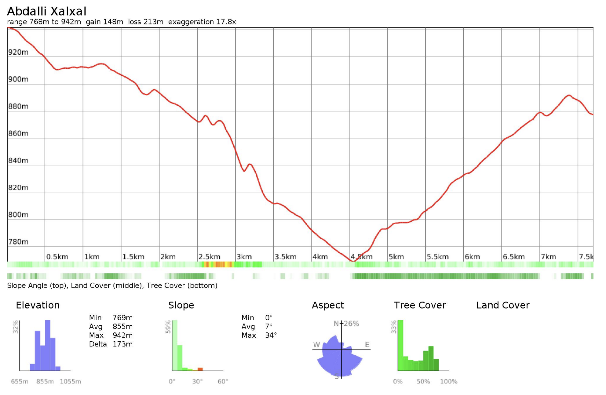
Distance: 7.71 km / 4.79 mi
Elevation gain: +149 m / +489 ft
Elevation loss: –213 m / –699 ft
Minimum elevation: 769 m / 2,523 ft
Maximum elevation: 942 m / 3,091 ft
This is a short and relatively straightforward stage connecting Abdallı to Xalxal along jeep tracks and rural roads. The route skirts around a low mountain between the two villages rather than crossing over it, resulting in minimal elevation change compared to previous stages. It serves as a transition out of more remote terrain and back into a more accessible and developed area. While navigation is not difficult, using GPS will help ensure you follow the most direct and efficient line.
Trail conditions
This stage follows mostly jeep tracks, rural roads, and village access paths, with little to no technical terrain. There is no formal trail maintenance, but the route is regularly used by local vehicles and residents.
Water
Water is accessible in both villages.
Trail access
Abdalli and Khalkhal are accessible at multiple points via rural roads. Bail-out or shortcut options are straightforward, as you are never far from vehicle-accessible tracks.
Cultural notes
This short connection links two rural settlements within Oghuz district and reflects a more everyday movement landscape rather than a remote crossing. Khalkhal/Xalxal is a relatively popular local destination, known for its small waterfall, with restaurants and easier access.
