
Route Statistics
Quick Facts
- Distance
- 102km / 63mi(+ optional 30km / 19mi extension to the Armenian border)
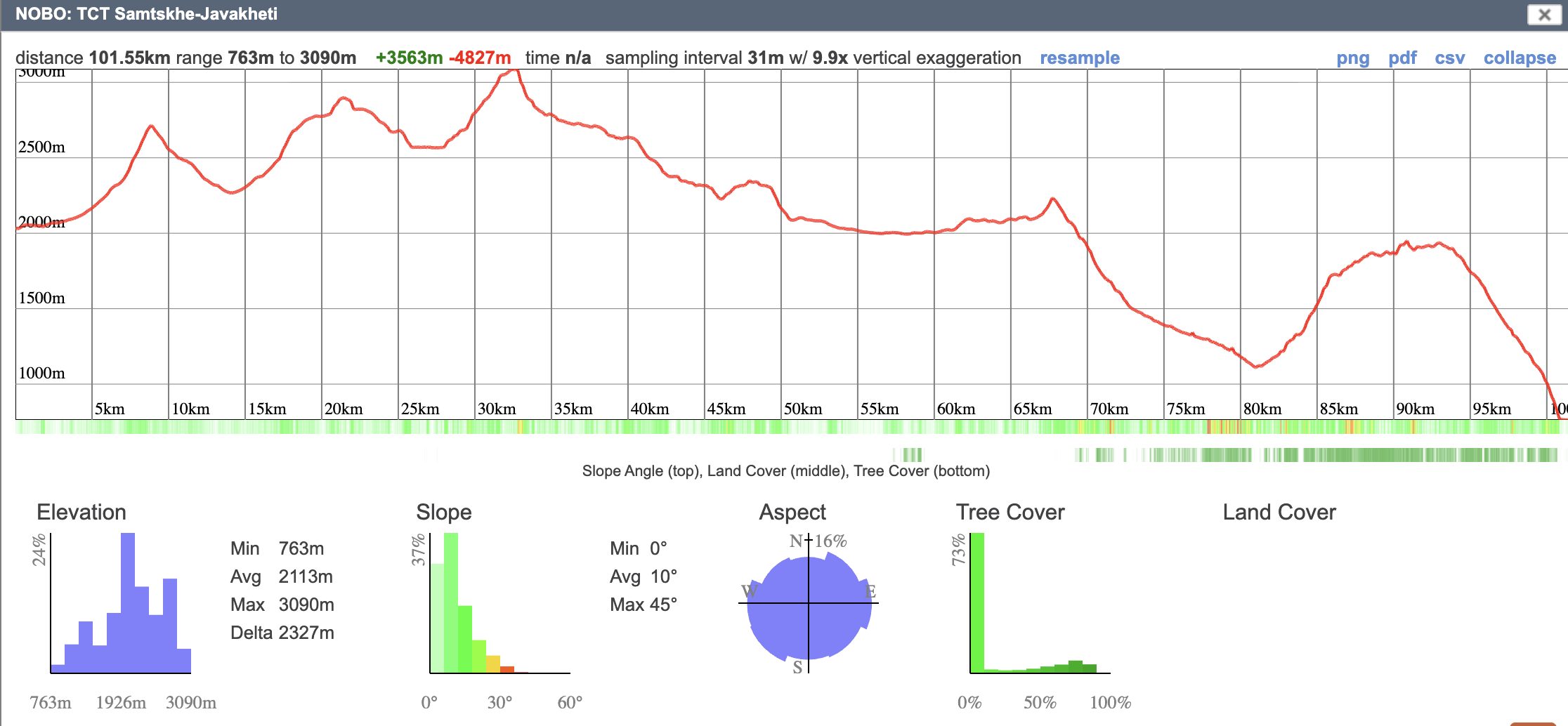
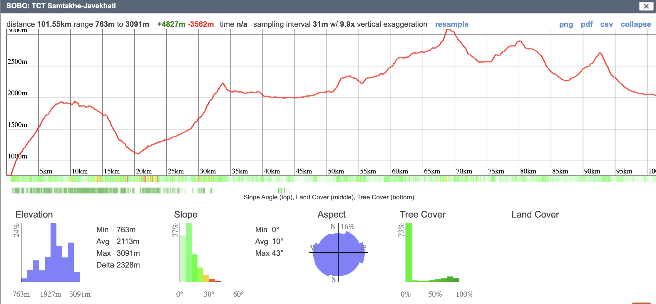
- Elevation gain
- Northbound: +3,563m / +11,690ftSouthbound: +4,827m / +15,837ft
- Elevation loss
- Northbound: −4,827m / −15,837ftSouthbound: −3,562m / −11,690ft
- Minimum elevation
- 763m / 2,503ft
- Maximum elevation
- 3,091m / 10,141ft
- Average elevation
- 2,113m / 6,932ft
- Status
- Open
- Marking type
- Partially blazed
- Emergency services
- 112
Elevation Profiles
Northbound Elevation Profile
Southbound Elevation Profile
Interactive Map
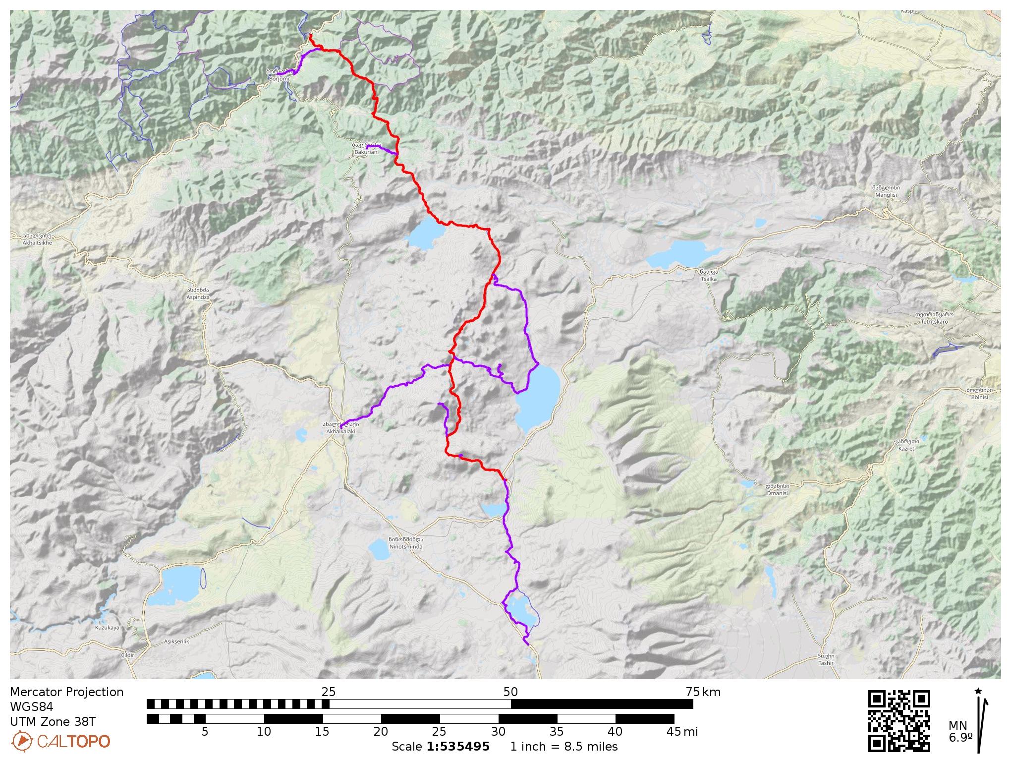
Download GPS Data
To download this route in GPX or KML format for GPS devices and smartphone apps, visit the interactive map on CalTopo.com and click the “Export” button at the top left.
Stage Overview
Stage 1: Gandzani to Lake Patara Levani
22.23 km · Elevation 2,031–2,899m · Gain/loss (S→N): +1,346m / −560m
Stage 2: Lake Patara Levani to Samsari Caldera
14.68 km · Elevation 2,565–3,091m · Gain/loss (S→N): +576m / −670m
Stage 3: Samsari Caldera to Lake Tabatskuri
22.54 km · Elevation 1,994–2,728m · Gain/loss (S→N): +247m / −972m
Stage 4: Lake Tabatskuri to Nedzvi Reserve
24.66 km · Elevation 1,111–2,233m · Gain/loss (S→N): +615m / −1,280m
Stage 5: Nedzvi Reserve to Zanavi or Borjomi
Option A (Nedzvi to Zanavi): 17.44 km · Elevation 763–1,948m · Gain/loss (S→N): +778m / −1,345m
Option B (Nedzvi to Borjomi via Kvibisi): 22.85 km · Elevation 787–1,948m · Gain/loss (S→N): +935m / −1,475m
