#BlazetheTCT Day 13: Tsana to Bak Pass
Welcome to Day 13 of #BlazeTheTCT!
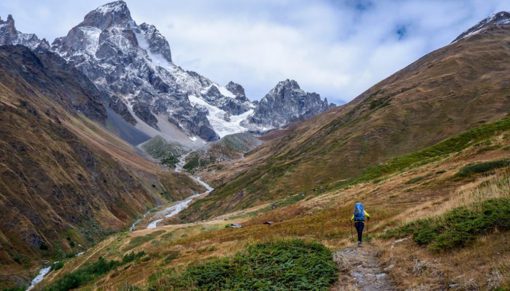
Today’s the day that you’ve probably been waiting for your whole trek: you’re finally entering the high mountains of Upper Svaneti.

Today we’ll walk through Ushguli (one of the highest continuously inhabited settlements in Europe), marvel at medieval Svan towers, admire the Adishi Glacier, and enjoy some truly lovely trails on our way to Mestia. And we’ll see how trail tourism is revitalizing small villages along the way.
Thanks for coming with us– and we’ll see you in the big mountains.
Happy trails,
Meagan

You’ll have cows for company on the TCT, as usual. Photo by hiker Tanel Tilk.
Follow the road from Tsana to Ushguli
After a well-earned rest in the small village of Tsana, it’s time to hit the road.
Unfortunately, in this case. we do mean an actual road. Until recently, the road connecting Upper Svaneti and Lower Svaneti was a quiet dirt road– pleasant to walk, the silence only occasionally interrupted by a rattling vehicle. But over the past few years, it’s been a massive road paving project, full of construction equipment and increasing numbers of cars.
While the paved road will help better connect Upper Svaneti to the rest of Georgia– and just as importantly, increase tourism in beautiful, underappreciated Lower Svaneti as visitors drive through on their way up to Ushguli– it’s not ideal for hikers. Over the long term, we’ll be working on developing a reroute for this section, which will veer north from Ushguli towards the high mountains before descending.
So let’s be real: you slog up this road. But hey, at least the views are awesome.

The abandoned settlement of Koruldashi on the road between Tsana and Ushguli.
Explore Svaneti’s ancient towers and new tourism in Ushguli
And the destination makes it worth it too. By the time you roll into Ushguli, you feel a world away from anything you’ve walked through on this trek so far.
That’s due to Ushguli’s ancient stone buildings and distinctive architecture, to its historical defensive towers dotting the clusters of villages, to the huge wall of Shkhara– the highest mountain in Georgia at 5,193m– looming on the horizon.


Ushguli.
But it’s also just due to the sheer number of fellow visitors and guesthouses. Ushguli has boomed as a destination over the past 5 to 10 years.
And the trail that you’re about to hike between Ushguli and Mestia has become one of the most popular trails in Georgia. For good reason– it’s spectacular, both in terms of scenery and culture.
The village of Chazhashi, part of the Ushguli community, is designated as a UNESCO World Heritage Site, thanks to more than 200 medieval-type villages and tower-houses. Most of the Svan towers were built between the 9th and 12th centuries, but there are also towers from earlier and later– up until the 18th century.

Ushguli. Photo by Tom Allen.
You’ll also begin to notice some linguistic differences, if you’ve picked up some Georgian phrases during your travels. The first language of most residents is Svan– an endangered language that is part of the same Kartvelian language family as Georgian, but totally unintelligible from Georgian.
So even though it’s a bigger crowd than the solitude of the trail that you’ve gotten used to, Ushguli is deeply charming. And wow, is it a nice change from the wilderness you’ve just walked through to sleep in a guesthouse that’s well set-up for visitors, to sit around the big kitchen table where you meet other hikers and share stories.
So you take our advice: It’ll only get busier over the next 50 km, so relax and enjoy the experience for what it is. Enjoy the social aspect of the trail, enjoy the clear trail smoothed by thousands of feet, and take the opportunity to engage with your remarkable hosts as much as you can to learn about modern life in Svaneti.

Walking through Ushguli. Photo by hiker Tanel Tilk.
Hike over Lagem Pass to the Khalde mineral spring
As you hike out of Ushguli, you have two options: the more well-traveled path through the forest, down the valley, or the unmaintained track over Lagem Pass. They’re both truly lovely in their own way, so it’s up to you to choose your own adventure.
But for the sake of promoting the wild and less-visited parts of Georgia like we aim to do with the TCT, let’s say you take the trail over the pass.
You walk towards the wall of Shkhara straight ahead on a dirt road, leaving Ushguli and its striking towers behind. Soon enough, you turn off into a side valley, following an old animal path.
You climb up the valley, the vegetation gradually growing taller and thicker, until you’re navigating by the scraps of a trail and your GPS track once more. You’re used to this by this point, though. It’s not that it’s easy – but after the bushwhack to Zeskho, it’s just that your definition of hard has changed.
You’re rewarded at the pass with an even better view of Georgia’s highest mountain in front of you, the wall of Shkhara and its neighboring peaks forming a fierce and impenetrable border.

Lagem Pass. Photo by Elizabeth Yancey.
Then it’s down to the other side of the valley, making your way down a steep grassy slope until you reach an old path that leads you down to the river.
Along the way, perhaps you pass an old bench and a lovely camp spot– in 2019, a TCT crew with a particular passion for building camp furniture stayed here as they worked to rebuild the bridge and improve some of the worst sections of that trail.

2019 TCT trail crew camp near Khalde.
As you reach the river, you make a stop at the Khalde mineral spring– sparkling water piped straight out of the ground that we rate as one of the best mineral springs in all of Georgia.
Soak in the views of the Adishi Glacier
From here, the trail is clear. You rejoin the popular Mestia to Ushguli route, passing dozens of hikers on your well-seasoned trail legs. It’s a little overwhelming, but pleasant, to see so many people on the trail out enjoying these beautiful mountains.
When you cross Chkhunderi Pass, you’re suddenly face-to-face with a magnificent view of the Adishi glacier. You sit for a while and watch, listening to small chunks of the glacier break off, the rumbles echoing down the valley. The literal crumbling beauty is a stark reminder of how much there is to protect in these mountains.

The Adishi Glacier. Photo by hiker Tanel Tilk.
Cross the Adishchala River
After a long descent, you reach the banks of the Adishchala River. Across the swift-moving river you see a group of horses and their riders, ferrying hikers across on horseback one by one.
This is one of the more interesting examples of enterprise along the TCT: A group of local men come out with their horses nearly every day in the summer to carry hikers across on horseback– for a small fee– since there is no bridge and the river is strong and swift, especially in the first half of the summer. If it’s later in the season, perhaps you brave the Adishchala river crossing on foot. But if there’s any doubt, we highly suggest you take the horses.

June crossing the Adishchala River. Photo by Elgan Larsen
Stay in Adishi
After crossing the river, you follow a gentle trail parallel to the bank of the river, gradually leading you towards the historic settlement of Adishi. This is one of the most scenic villages on the whole trail, with its clusters of Svan towers and churches from the 10th-13th centuries.

The village of Adishi. Photo by hiker Tanel Tilk.
Adishi is bustling with small family guesthouses. Like many villages along the trail, it’s had a revitalization since hikers started visiting this route in 2010.
Prior to the increase in tourism, only four families lived in Adishi– and that’s one of the larger villages in this section. Now, between 10 and 12 families live there during the summer season, running guesthouses, ferrying hikers across the river, and providing food and transportation.
You stop for the night at Elizabeth Kaldani’s place– a cozy spot hosted by a longtime friend and supporter of the trail. It’s another vibrant atmosphere at the dinner table, with hikers from all over the world.

Elizabeth Kaldani and trail runners at her guesthouse in Adishi (plus the local rabbit).
The next day, you continue your trek to Mestia, slowly getting up and close and personal with two of Svaneti’s favorite giants: Mt. Tetnuldi and Mt. Ushba.
These two peaks are the main characters in several local legends. The most popular version is a star-crossed love story: Ushba, the son of a poor family, and Tetnuldi, the daughter of a rich family, fell in love. But Tetnuldi’s family didn’t support the match, and forbade her from communicating with him. So Tetnuldi got dressed in a wedding dress and prayed to be turned into stone so that even if they couldn’t be together, no one could prevent them from looking at each other. Since then, Ushba and Tetnuldi have been gazing lovingly at each other on the Caucasus ridge, Tetnuldi in her wedding white and Ushba strong and handsome– and they say that when the clouds clear at sunset and Ushba shows his face, Tetnuldi blushes.


Mt. Tetnuldi and Mt. Ushba. Photos by hiker Tanel Tilk.
Resupply in Mestia
You eventually make your way to the regional capital of Mestia– a historical town busting with visitors, guesthouses, and the ubiquitous mountain 4×4 Delica vans.
Mestia is the hiking hub of the region– the only place outside of Tbilisi where you can buy gas canisters, for example– and it’s a wonderful place to rest and resupply while exploring the many day hikes in the area. Take some time to visit the Svaneti Museum of History and Ethnography and climb up the inside of one of the many Svan towers to enjoy the view. Careful on that rickety ladder! If you’re interested in mountaineering, don’t miss the Mikheil Khergiani House-Museum and learn about the “Tiger of the Rocks.”
But even with its modern cafes, Mestia has deep roots of history, visible in the defense towers scattered around the town, its narrow cobbled streets, and the clear feeling that even though there are a lot of visitors, it is still a small town… and everyone knows each other.

Mestia. Drone photo by hiker Tanel Tilk.
Hike Guli Pass to Mazeri
We’re on more well-developed trails now, but that doesn’t mean the challenge is over. Next up is one of the most demanding climbs along the trail in Upper Svaneti, gaining elevation steeply as you ascent to Guli Pass (“Heart Pass”).
The trail to Guli Pass is steep and rugged, but the sense of accomplishment when you reach the top is worth every drop of sweat. You look back at the glowing massif of Tetnuldi as you crest the pass and come face-to-face with the jagged walls of Mt. Ushba, the “Matterhorn of the Caucasus.” Ushba’s twin peaks are a magnet for serious alpinists– which, looking at the steep rock faces, is even more impressive up close.

Guli Pass. Photo by hiker Tanel Tilk.
Climb from Mazeri Village to Bak Pass
After descending from Guli Pass on the old shepherding trail, it’s time for our last climb of this section: the trail from charming Mazeri village up to Bak Pass.
As we get further west from Mestia, the number of fellow hikers drops dramatically. It’s back to you and your thoughts again, slowly winding your way up the hills– but there are plenty more opportunities to engage with Svan culture for the next 50 kilometers, and tomorrow we’ll meet more of the people that make the TCT so special.
The trail climbs through a beautiful old forest, following switchbacks that were built in 2017 by TCT volunteers. As you climb, you can see the remnants of the old trail– it goes straight up the steep slope, not something you particularly want to do– and you’re extra grateful for the winding, lovely forest path that you’re climbing.
You can thank the past TCT trail crews who put in weeks of sweat and hard work to make those gentle turns possible!

As you pass the treeline, you pass the 11th-century Church of the Archangels of Mezuri, with a striking panorama of the Svaneti range in the background.

And then it’s one last climb, following a beautiful ridge trail through rhododendrons and weaving along the steep hillside.

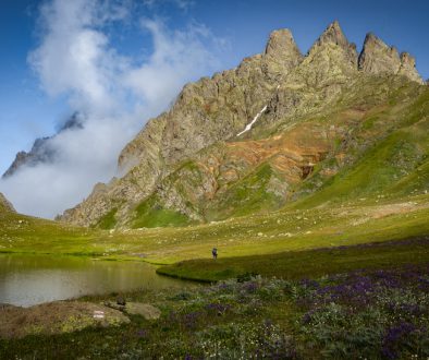
And we’ll leave you here today, at striking Bak Pass (2,416m)– surrounded by gently swaying wildflowers, eating a sandwich with a front-row seat to Mt. Ushba.
You’ll want to be there a while, anyway.

Bak Pass.
And that’s 1,300 km down on the TCT.
We’ll see you tomorrow to hike the TCT through some of Svaneti’s loveliest– yet still rarely-visited– villages and learn about how the trail has impacted people’s lives along the route.
With just 2 more days left in our campaign to blaze the TCT, now is the time to take action. Your support is what makes this incredible journey possible! The work we’re doing in Svaneti and across the Caucasus is about more than just building trails—it’s about preserving a way of life, protecting the environment, and connecting people to the wild places of the world.
Join us in making the TCT a reality. Every donation, every share, and every step you take on the TCT helps blaze the trail for future generations. Let’s make these last few days count!
We hope you’re enjoying coming with us on the trail and meeting some of the people and places behind it. Over our 15 days of hiking the TCT, we’re aiming to raise $30,000 to blaze new sections of the trail and to continue our work to make these spectacular areas accessible.
With just 2 more days left in our campaign to blaze the TCT, now is the time to take action. Your support is what makes this incredible journey possible!
The work we’re doing in Svaneti and across the Caucasus is about more than just building trails—it’s about supporting the rich cultural heritage of the region, protecting the environment, and connecting people to the wild places of the world.
If you’ve enjoyed the trail in the past or are dreaming of hiking it someday, please join us to make these efforts possible. Donate $15 or more and share with 15 friends today to blaze the TCT.
Thanks for all your support, and happy trails – we’ll see you back on the TCT tomorrow!
Meagan & the TCT team


