On This Page
When to Hike
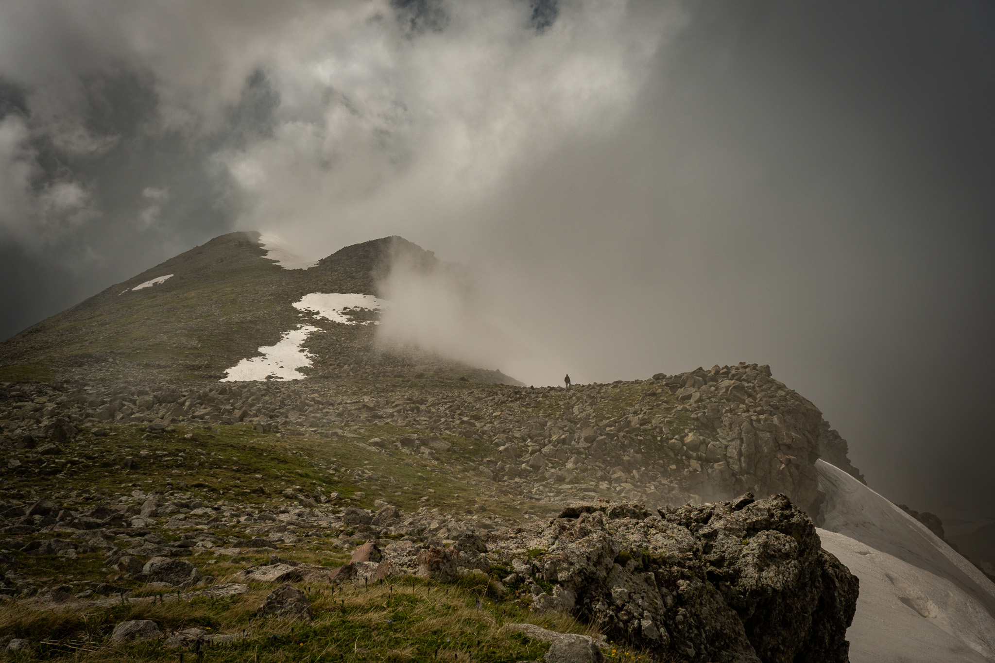
The hiking season on this stage is short, and the limiting factor is Samsari Pass: the main route over the pass is typically only open from July to September. Snow lingers on the north-facing approach well into July most years, and crossing on snow is not recommended unless you have the mountaineering experience to assess these conditions and the equipment to self-arrest a fall. Beneath the snowpack lie large boulders, which means it’s easy to get injured if you punch through in late-season snow. Assess your own comfort with those conditions and choose accordingly.
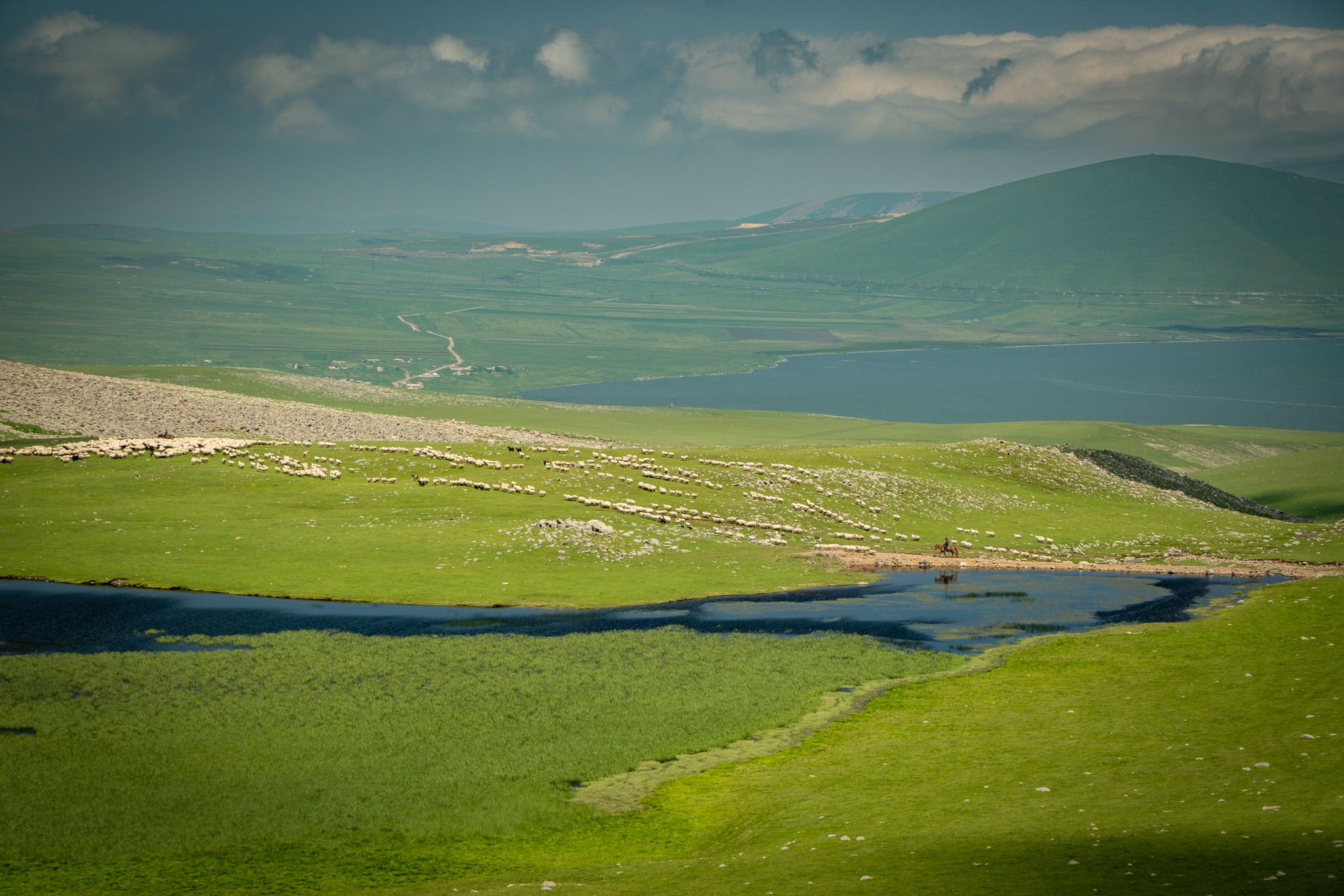
The lowland alternate, detouring around Lake Paravani to avoid Samsari Pass, opens a bit earlier and stays open a bit later, roughly June through October. Even taking this alternate, we don’t recommend going earlier than June. The high sections near Lake Levani sit above 2,500m and stay exposed; snow lingers into June and can return as early as September or October. Like the Gegham Mountains in central Armenia, this high-altitude volcanic section is typically the bottleneck for thru-hikers planning a season-long route.
The northern part of this stage, from Didi Mitarbi to Borjomi, sits at lower elevation and is far more forgiving. That section is typically hikeable from May through November. Autumn colors through the forests above Bakuriani and into Borjomi-Kharagauli National Park are spectacular and worth timing for if you have flexibility.
When packing, plan for the full range of weather conditions. The Javakheti Plateau is fully exposed to the often brutal wind, and it sits high enough that the sun is intense at midday, even in shoulder seasons — wide-brim hat, sunglasses, sunscreen, and long sleeves go a long way. The same days routinely drop to freezing or below at night, even in summer. You’ll sweat through one set of conditions and shiver through the other on the same day, so make sure you have a warm sleeping setup.
Local Weather
Weather conditions on the Javakheti Plateau change fast. When fog rolls in across the open highlands, the landscape goes featureless — there are almost no distinct geographic markers to navigate by. You need to be prepared for those conditions and comfortable navigating in them, which means a downloaded GPX track, a charged phone with extra battery pack(s), and a paper map and compass as backup (and the knowledge of how to use them).
The plateau is consistently windy. That affects tent pitching (use those guylines!), cooking (a windscreen is worth the weight), clothing layers, and where you choose to camp. It’s hard to find shelter from the wind, but depending on the direction, you may be able to find some strategic spots.
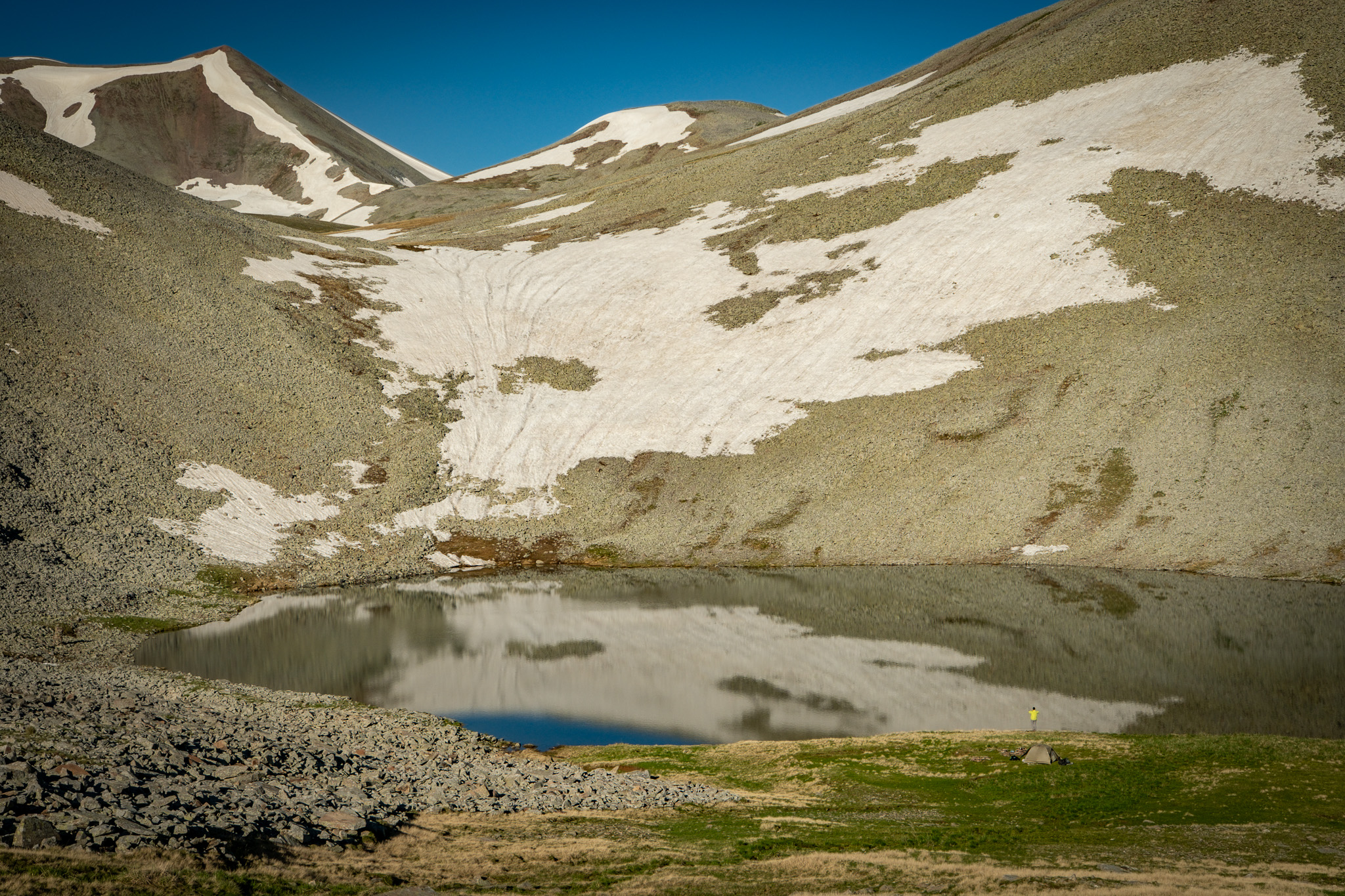
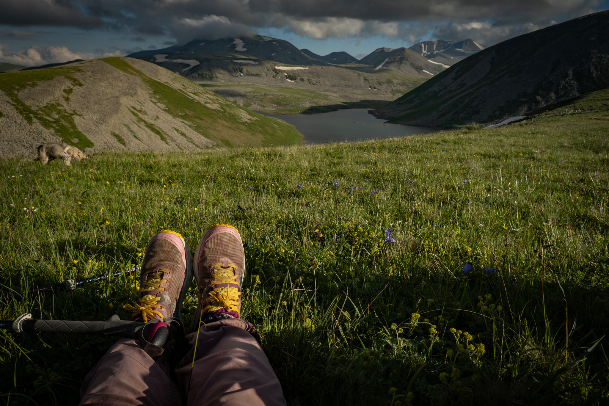
Thunderstorms develop quickly across the Caucasus, and the exposed plateau offers nowhere to shelter. Watch the sky in the afternoons, especially in July and August. If you see storm cells building, get off the high ground. When choosing campsites, avoid the most exposed terrain. Some of the lake basins along this route — Patara Levani and Levani — sit below higher surrounding peaks that offer some measure of protection and also happen to be the best campsites on the stage.
Weather forecasts in the Caucasus are not very reliable, and should be treated as rough estimates rather than precise. We typically recommend Windy — the weather radar will give you a much better picture of what’s happening than a specific prediction for a given area — and we sometimes cross-reference Meteoblue. As always, be prepared for the weather to change quickly.
Getting To & From the Trailheads
This stage runs between two very different access points. Borjomi is a well-established tourist hub with multiple daily connections to Tbilisi and Kutaisi. Gandzani is a small village with one daily marshrutka — the shared minibuses that are the standard regional transport — and a phone number you’ll need to call ahead. The optional extension starting or ending at the Armenian border is the trickiest of the three.
Marshrutka schedules and prices typically change every year at the start of the summer, and they are subject to change without notice. Use the information below as a starting point and verify locally within a week of your travel date — through your guesthouse, a recent forum post, or by calling the contact directly.
If you’re on an odd schedule, don’t want to fuss with public transport, or want to make some scenic stops along the way, booking a private transfer is always an option. We recommend services like gotrip.ge, which allow you to select a driver (and see what languages they speak), design a route with as many stops as you like, leave at your desired time, and clarify prices upfront. For this route, a typical GoTrip transfer to Gandzani, Bavra, or Borjomi will cost a little over 200 GEL.
To/from Gandzani (southern endpoint)
Gandzani Family Corner Guesthouse is reachable along the twice-daily marshrutka between Tbilisi’s Samgori station and Ninotsminda. The vans run once in the morning and once in the evening. You can contact Family Corner Guesthouse directly to confirm times, save a spot, and arrange the right pickup or drop-off.
- Contact: Family Corner Guesthouse, +995 599 148 528
- Fare: 20 GEL
- Travel time: roughly 2.5 hours each way
To/from the Armenian border (optional extension start)
There is no direct transport to the Bavra/Ninotsminda border crossing from major Georgian hubs. Plan to combine a marshrutka with a local taxi or hitchhike.
- From Tbilisi: marshrutka to Gandzani or Ninotsminda from Didube, then taxi or hitchhike to the border (roughly 20 km from Ninotsminda).
- From Kutaisi: marshrutka toward Ninotsminda, usually with a change at Akhaltsikhe, then taxi or hitchhike.
- Hitchhiking in this region is straightforward and locals are accustomed to it. A few words of Georgian, Russian, or Armenian helps. Bring small bills to buy the driver a coffee or offer to chip in for gas.
To/from Borjomi (northern endpoint)
Borjomi has frequent connections to Tbilisi and Kutaisi, plus a slow scenic train.
From Tbilisi
- Marshrutka: Hourly from Didube Bus Terminal, 8am to 7pm. Fare 15 GEL, travel time ~2.5 hours. Vans depart early if full, so arrive 30 minutes ahead. Terminates at Borjomi Bus Station in the southern part of town; ask the driver to drop you earlier along the main road if it’s closer to your guesthouse, or at Zanavi if you want to start hiking directly.
- Train: One daily departure from Tbilisi Central Station at 6:25pm, arriving Borjomi Parki Station at 10:40pm. Fare 2 GEL, cash only, purchased at the station. Hard plastic seats, no AC. Slow and atmospheric, but not comfortable. (Current as of early 2026 — the schedule was reduced to one train per day; confirm before relying on it.)
- Private transfer: Roughly 2 hours, around 200 GEL via GoTrip or similar. Useful if you’re on an odd schedule, have a lot of gear, or want to make stops along the way.
To Tbilisi
- Marshrutka: Hourly from Borjomi Bus Station, roughly 8am–6:30pm with some gaps in the afternoon. Confirm times locally.
- Train: Departs Borjomi Parki Station at 5:50am, arrives Tbilisi at 10:10am. Fare 2 GEL.
To/from Kutaisi
- Minivans from Kutaisi Central Bus Station four times daily (8:20am, 9:30am, 11:30am, 1pm). Fare 15 GEL, travel time ~3 hours. Vans pass through Borjomi on the way to Akhaltsikhe.
- From Borjomi to Kutaisi, a dedicated van leaves at 8am. Otherwise, try to catch an Akhaltsikhe–Kutaisi van passing through, though they often arrive full. Ask your guesthouse to call ahead and reserve a seat.
Huge thanks to Emily at Wander-Lush for compiling many of these travel tips and updated schedules. Her website is an excellent English-language resource for figuring out transport logistics in Georgia and places to stay across the country.
Where to Stay
Wild camping
Wild camping is required on this stage. There are no guesthouses between Gandzani and Lake Tabatskuri — roughly half the trail — and the open plateau offers more than enough beautiful campsites to make up for it. The alpine lakes along the route are the standouts: Lake Patara Levani and Lake Levani both sit in basins with sheltered, scenic spots that double as the (comparatively) safest places to be in a thunderstorm.
Practice good Leave No Trace habits. Pack out everything, camp on durable surfaces, keep fires small and only where appropriate, and bury human waste at least 70 meters from water sources. Learn more about how to be a good environmental steward of the TCT here.
Guesthouses along the route
Gandzani. Guest House Family Corner is a family-run guesthouse with excellent home cooking, real local hospitality, and an incredible amount of regional knowledge. They can also help you out with the daily marshrutka to/from Tbilisi. Contact: +995 599 148 528.
Tabatskuri. Multiple family-run guesthouses operate in the small town on the shore of the lake. There are also good camping options along the lakeshore for hikers who prefer to stay outside. This is the first guesthouse option since Gandzani, roughly the halfway point of the stage.
Bakuriani (side trip). A short detour off the main route near Didi Mitarbi leads to Bakuriani, a small ski town with a range of guesthouses across budgets. Useful as a resupply stop or a rest day if you want a shower and a real bed before the final descent.
Borjomi. The northern endpoint has guesthouses across every price range, from budget rooms to boutique hotels.
See the interactive map for specific locations, contact details, and additional accommodation options in Gandzani and Tabatskuri.
Supplies
Resupply is limited on this stage. Plan to leave Gandzani with most of what you need to reach Bakuriani, and don’t count on finding specific items along the way.
Markets. Gandzani has a couple of small village shops with basic supplies. Tabatskuri has a very small shop with a more limited selection. Bakuriani, on the side trip from Didi Mitarbi, has proper supermarkets and the most reliable resupply on the route. Borjomi has full supermarket options at the start or end of the stage.
Gas canisters. To the best of our knowledge, screw-top gas canisters are not available anywhere along this route, including Borjomi. Pick them up in Tbilisi before you start. If you’re thru-hiking, an alcohol stove provides much greater flexibility — you can pick up pharmaceutical spirit for burning — or carry an adapter for a classic canister stove that lets you use the butane canisters available at hardware stores across the region.
Pharmacies. Pharmacies are only in Bakuriani and Borjomi. Carry what you need for the days between.
Local Food
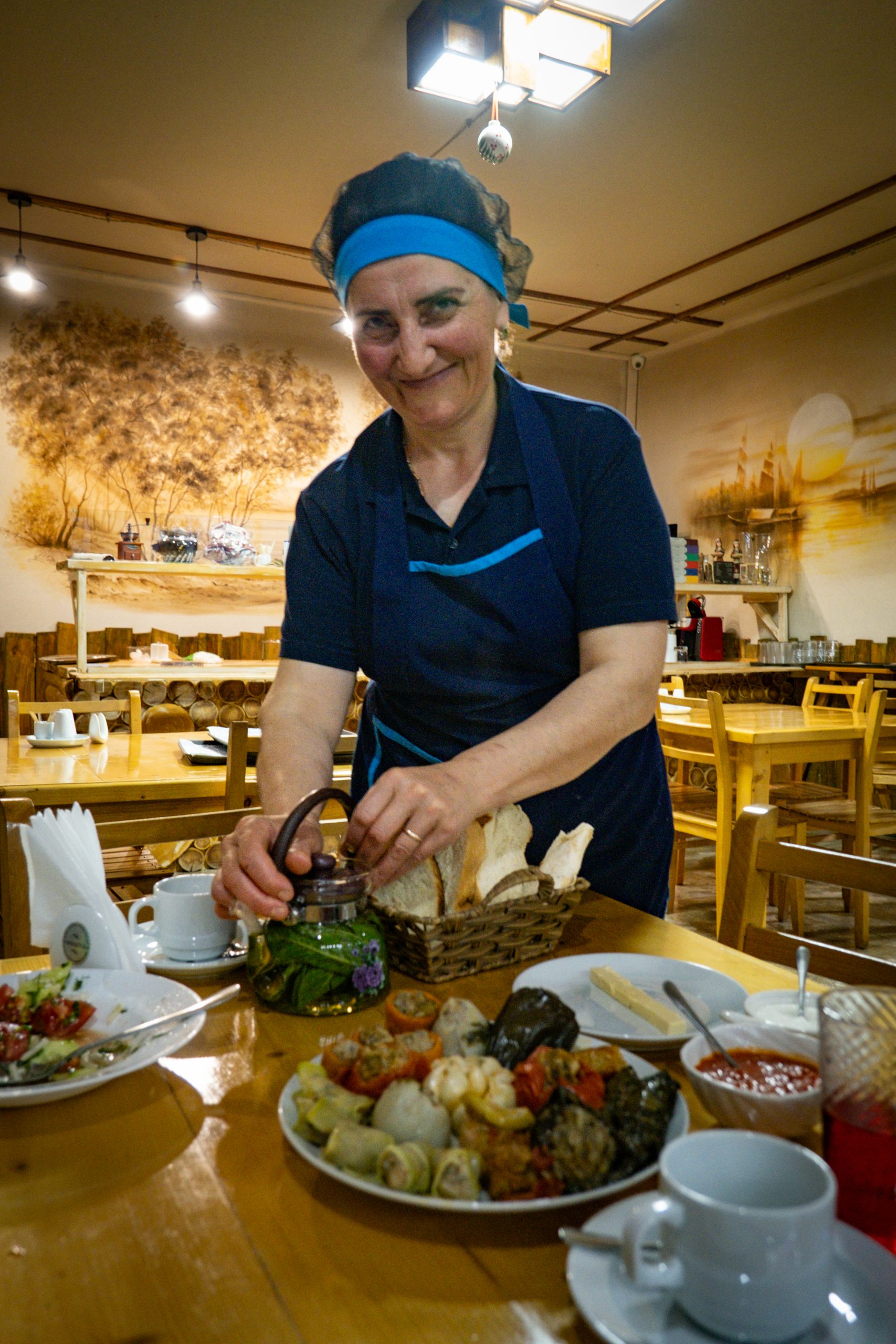
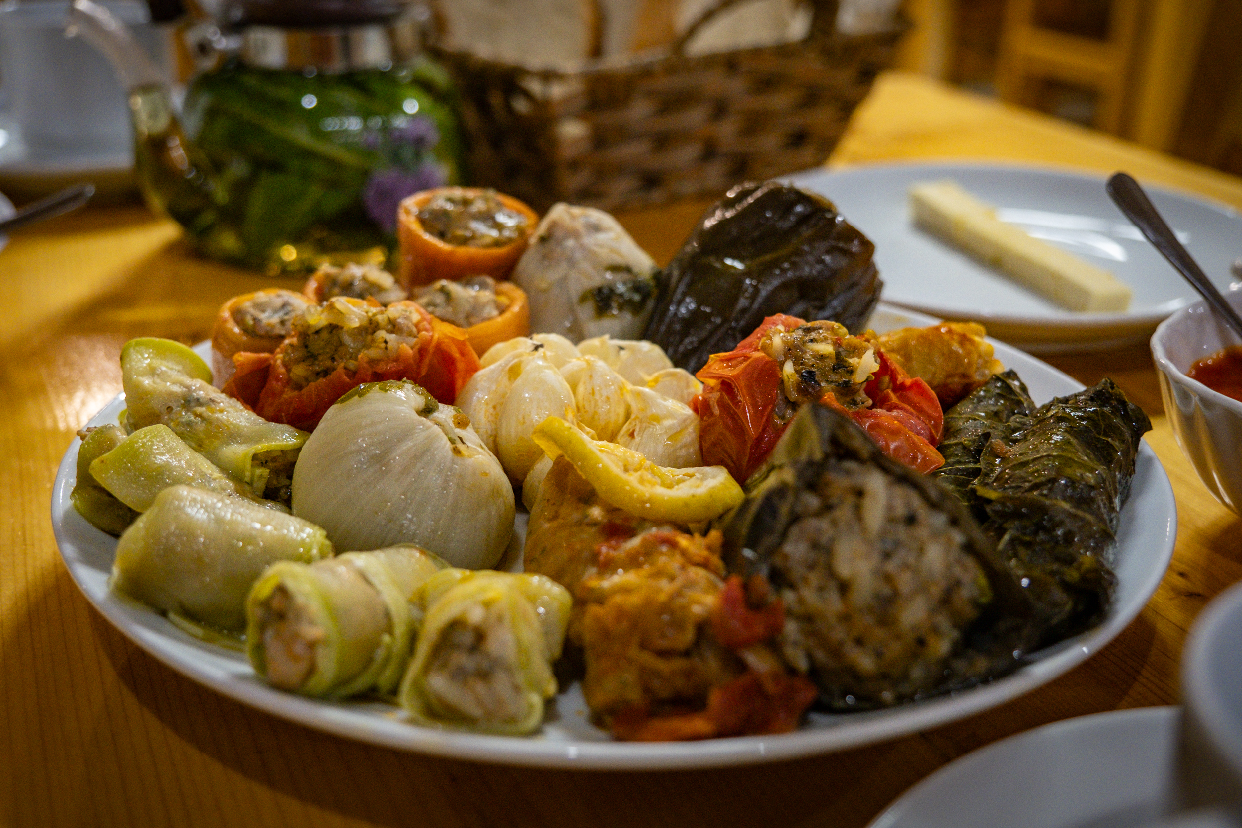
If you stay at guesthouses, you’ll be fed well. The Javakheti section of the region, from Gandzani up to Tabatskuri, is predominantly ethnic Armenian, and the food reflects that: fresh fish from the lakes, dolma (a specialty across the Caucasus consisting of stuffed grape leaves or vegetables, though each region has its own slight twist), Armenian lavash, and herbal teas gathered from the surrounding mountains. North of the pass, the cooking shifts toward Georgian standards — khachapuri (cheese-filled bread), soups, and grilled meats.
Bring an appetite. Portions are generous and guesthouse meals are one of the real pleasures of this stage. For more on regional food and what to expect at homestays, see Local Food on the TCT.
Water
This stage has several stable water sources, thanks to the chain of alpine lakes spaced at good intervals — Patara Levani, Levani, the unnamed lake in the Samsari Caldera, Tabatskuri, and Paravani on the lowland alternate. Camping near a lake means water access without rationing.
Between the lakes, water comes from seasonal streams and springs. The streams run reliably in the first half of summer and dry up as the season progresses; by late August and September, plan to rely on the lakes and springs rather than counting on stream crossings to deliver. Springs are scattered along the route and shown on the interactive map. Treat the map as your planning tool — note which sources are stable versus seasonal, and build your daily distances around the stable ones.
Treatment. Filter everything. The plateau is heavily grazed by sheep and cattle in summer, and that includes the areas above most water sources. (If you’re ever looking at a hill and thinking, “there’s no way cows can get up there”: think again.)
The exception is springs piped directly from the ground — those are generally safe untreated, but use judgment. If you can see areas where the water source is exposed, or if you have a particularly sensitive stomach, filter it.
If you’re carrying water for the whole day, we recommend a carrying capacity of at least 3 liters. Keep in mind that streams can be unreliable depending on the time of year and the previous winter’s snowfall, so don’t rely on any one source other than the lakes.
Language
This region is one of the most linguistically diverse in Georgia, and what you’ll hear depends on where you are on the route.
From Tabatskuri further south, villages are predominantly ethnic Armenian, and Armenian is the first language. Most residents also speak Georgian, and many speak Russian as well — bilingualism is common, trilingualism not unusual. North of the pass towards Bakuriani, Georgian becomes the default. Among the shepherds you’ll encounter in the highlands, you may also hear Azerbaijani or Georgian.
For most hikers, a handful of phrases in Armenian and Georgian goes a long way. Armenian phrases land particularly well in the southern villages — it’s a meaningful gesture in a region where Armenian identity is strong and visitors rarely bother. North of the pass, start with Georgian. Russian works as a language to communicate with many older residents, but basic greetings in the local language always help you get off on the right foot.
A few practical greetings to start with:
- Georgian: gamarjoba (hello), madloba (thank you), ki / ara (yes / no)
- Armenian: barev dzez (hello), shnorhakalutsyun (formal thank you), merci (informal thank you), ayo / voch (yes / no)
- Azerbaijani: salam (hello), sağ olun (thank you), bəli / xeyr (yes / no)
- Russian: zdravstvuyte (hello), spasibo (thank you), da / nyet (yes / no)
Health & Safety
The general emergency line for police, ambulance, and fire all across Georgia is 112.
Medical facilities
The nearest hospital to the southern half of the route is in Akhalkalaki, with a medical clinic in Ninotsminda for less serious issues. Both are off-trail but reachable by marshrutka or taxi from Gandzani. On the northern half, there’s a medical center in Bakuriani (a short detour from Didi Mitarbi) and a hospital in Borjomi.
There are no medical facilities along the trail itself between Gandzani and Bakuriani — roughly the entire Javakheti section. Plan accordingly. Carry a comprehensive first aid kit, know how to use it, and don’t rely on phone signal to summon help across the plateau.
Pharmacies
Pharmacies are available in Ninotsminda (off-trail), Bakuriani, and Borjomi. Nothing in between. If you take prescription medication, bring enough for the full stage plus a buffer.
Police
Police stations are located in Gandzani, Ninotsminda, Bakuriani, and Borjomi. For any emergency anywhere along the route, dial 112.
Communication Availability
Cell service across Georgia is generally good, but this stage has some substantial gaps. Expect no signal across much of the Javakheti Plateau between Abuli Fortress and Lake Tabatskuri. Climbing higher usually gets you back into coverage. In the forested descent toward Borjomi, signal comes and goes with the terrain.
Many guesthouses have Wi-Fi, but it’s usually slow. Your cellular data will usually be faster.
We recommend carrying a satellite communicator (Garmin inReach, ZOLEO, or similar). It lets you call for help from anywhere on the route, but keep in mind that given the remoteness of this region, help may still take hours or longer to arrive.
Hazards
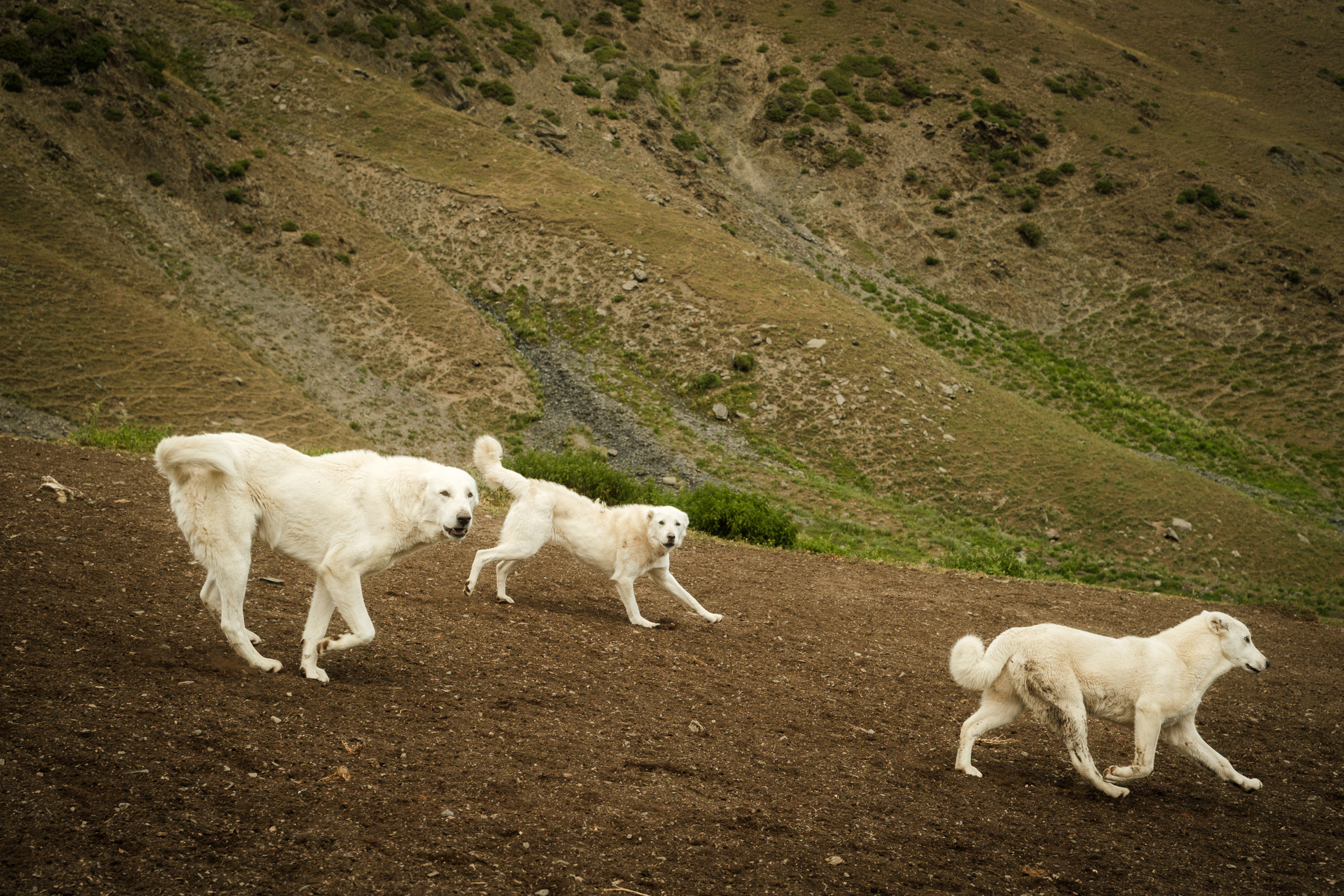
Livestock guardian dogs
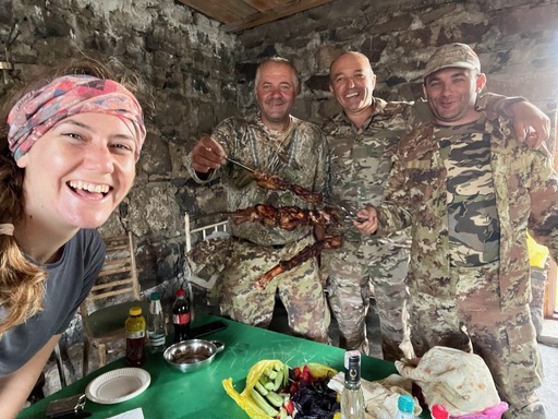
The most serious hazard on this stage is shepherd dogs. In summer, the Javakheti Plateau is populated with seasonal shepherd camps, large flocks of sheep, and the livestock guardian dogs that protect them. Encounters are part of hiking this section. The dogs are doing their job, which is to keep wolves and bears away from the flock. They take that seriously, and they don’t distinguish between you and a predator until told otherwise by the shepherd.
Before an encounter:
- Carry trekking poles. They’re your primary tool for keeping distance.
- If you can see a camp from far off, try to detour wide around it, even if it costs you time.
During an encounter:
- Don’t run. Running triggers the chase instinct.
- Don’t turn your back.
- If dogs see you and start barking from afar, crouch or sit to make yourself look smaller and less threatening. This is advice that can be terrifying to implement in the moment, but it’s something we hear repeatedly from shepherds and locals.
- Be ready to stand and act assertive if the dog gets too close or shows aggression (teeth bared, snarling). Use your poles to maintain distance.
- Bend down and pick up a rock, or pretend to. The dogs recognize the gesture from the shepherds and usually back off.
- Signal for the shepherd as soon as you can. They’ll typically call the dogs off and often walk you through their territory.
- If no shepherd arrives, keep moving away from or parallel to the flock as you continue in your direction. Often the dogs will circle and snarl but won’t attack as long as you aren’t getting closer to the flock.
If a dog attacks and no shepherd is present: on very rare occasions, a dog does actually attack. If this happens, you must fight back. Use your poles, rocks, anything at hand. At that point you may be fighting for your life. This is rare, but it happens.
After a bite: get a rabies shot. This applies to any dog bite in the Caucasus, shepherd dog or stray. The shots are cheap and widely available in Tbilisi — it’s a four-shot sequence if it’s your first time. You can also get preventative rabies shots in Tbilisi before the trail. These don’t fully protect you, but they extend the window you have to get a booster after a bite.
Some hikers carry additional deterrents: a dog whistle, pepper spray or bear spray, or a small taser. Whether any of these are worth the weight depends on your own risk assessment and what gives you peace of mind.
Bears
Brown bears live in the forests around Borjomi-Kharagauli, and locals will warn you about them. In practice, bears in this region are very wary of humans, and actual sightings are rare. You’re far more likely to see tracks or scat than an animal. Even so, we strongly recommend storing your food properly in a bear-safe manner — hung from a tree or in a bear canister — both for your safety and to avoid habituating bears to human food as backpacking grows in the region.
Ticks
Ticks can be a concern in the forested sections around Borjomi. Check yourself daily, especially around the waistband, behind the knees, and along the hairline. Pull any ticks promptly with tweezers, removing the whole insect including the head.
Lightning and storms
Thunderstorms develop quickly across the Caucasus, and the exposed Javakheti Plateau offers few options to shelter. Watch the sky in the afternoons, especially in July and August. If you see storm cells building, get off the high ground.
When choosing campsites, avoid the most exposed terrain. The lake basins along this route sit below higher surrounding peaks that offer some measure of protection. Bring a tent that handles wind well, stake it down properly when you can, and weight the corners with rocks where the ground is too hard for stakes to hold.
Cold and sun exposure
Nights on the plateau routinely drop to freezing or below, even in midsummer. Pack a real sleeping bag and warm layers. During the day, the sun at this altitude on an exposed plateau is intense — wide-brim hat, sunglasses, sunscreen, long sleeves.
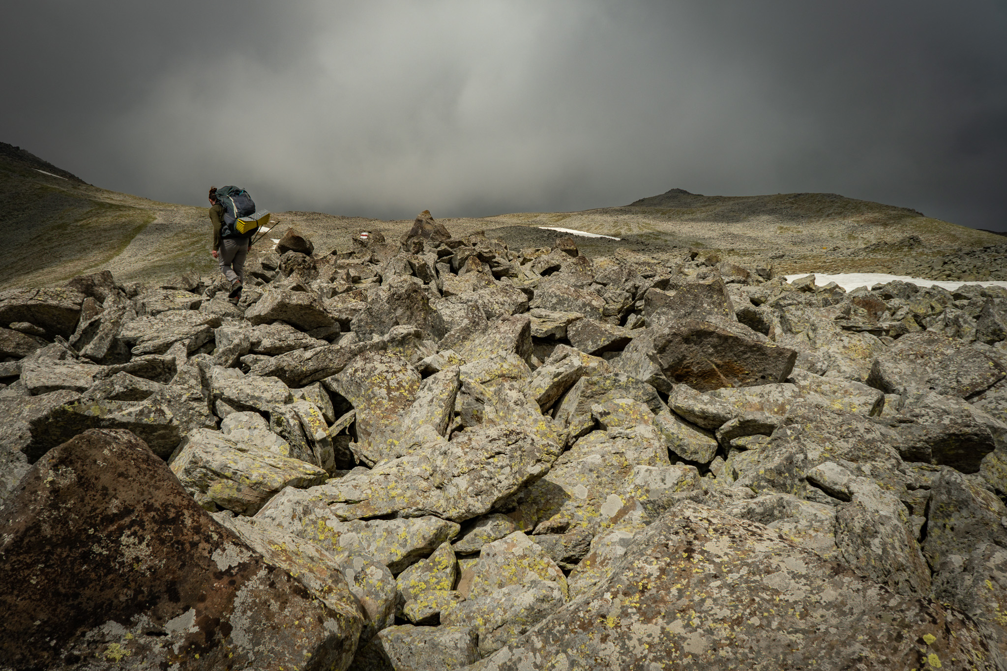
Boulder fields and footing
Stretches of the route cross boulder fields where you’ll need to rock-hop across uneven ground. Watch your footing carefully. A twisted ankle or fall in this terrain, far from any road or rescue, becomes a serious situation fast.
Giant hogweed
Giant hogweed is a phytophotosensitive plant whose sap reduces your skin’s ability to protect itself from sunlight. If sap contacts your skin and is then exposed to the sun, you can get severe burns and blistering. The plant is tall (often 2 to 4 meters), with large white umbrella-shaped flower clusters and broad lobed leaves. It thrives in disturbed soil, so you’ll find it along roads, Jeep tracks, trails, and stream banks.
This is not a concern on the Javakheti Plateau, but you may encounter it in the forests around Bakuriani and Borjomi.
If sap contacts your skin: wash the area immediately with soap and water, cover from sunlight for at least 48 hours, and seek medical attention if blistering develops.
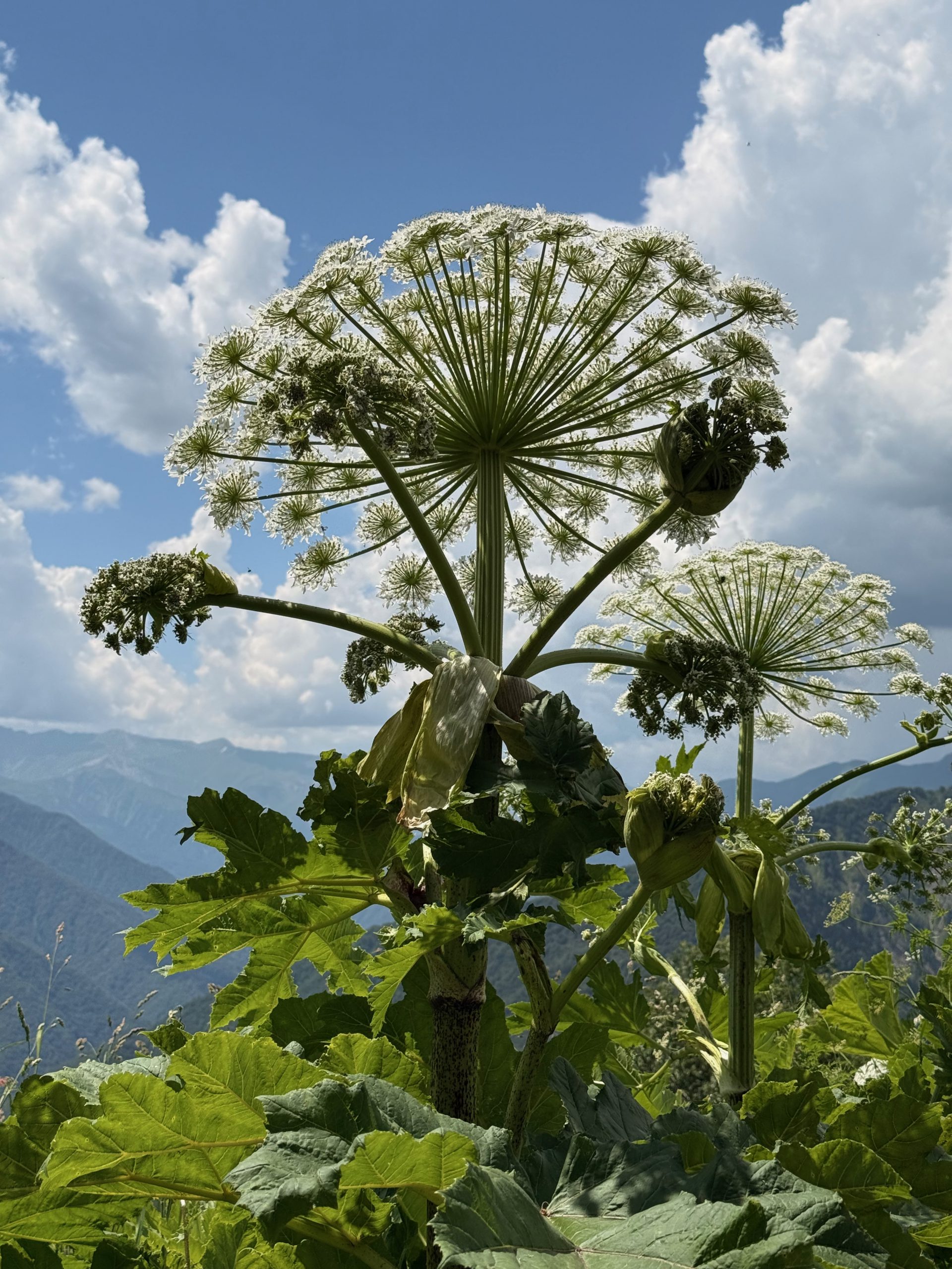
Giant hogweed can easily reach 2 to 4 meters in height. Luckily, it’s easy to spot!
Other Resources about the Region
General travel and regional context
Wander-Lush is the strongest English-language travel blog covering Georgia. Recommended reads for this stage:
- Javakheti and Tsalka travel guide
- Samtskhe-Javakheti travel guide
- Meskhetian cuisine
- Things to do in Borjomi
The Samtskhe-Javakheti DMO has done strong work promoting the region and maintains a useful resource with cultural and natural attractions, trail information, and event listings.
Maps
If you’re doing further hiking in Borjomi-Kharagauli National Park, printed maps of the park are available at the Borjomi-Kharagauli National Park Visitor Center in Borjomi (Meskheti St. 23). The Agency of Protected Areas maintains official park information online.
To the best of our knowledge, no printed trekking maps are available for Samtskhe-Javakheti. However, you can order custom map tiles at a 1:50,000 ratio from Geoland in Tbilisi.
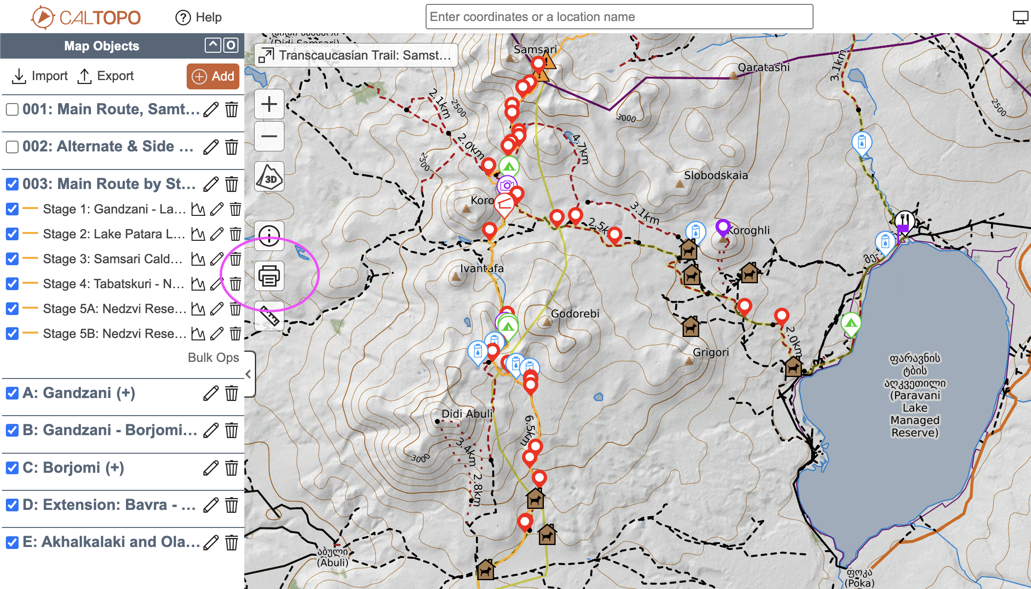
Alternatively, you can simply print topographic maps for the sections you’ll hike directly from the TCT Interactive Map of Samtskhe-Javakheti on CalTopo. Click the printer icon on the left, select the area you wish to print, and choose the map layers you want visible.
Extending Your Stay: Nearby Areas Worth Visiting
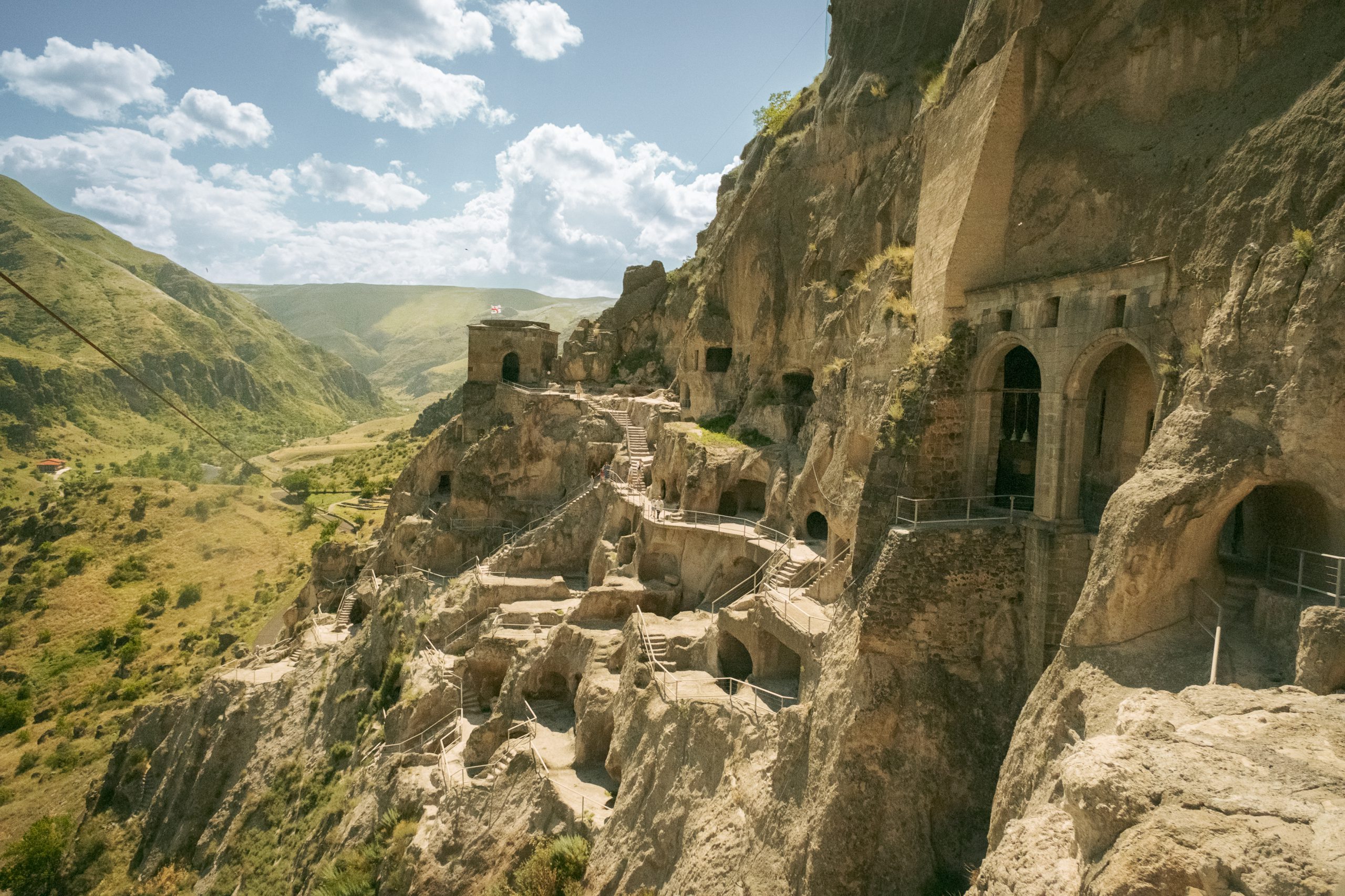
Vardzia. A 12th-century cave city carved into the cliffs of the Erusheti Mountains, south of Akhaltsikhe. Originally a monastery and fortress complex built during the reign of Queen Tamar, it once held hundreds of rooms across multiple levels. An earthquake in the 1280s sheared off the outer cliff face and exposed the interior. Many of the rooms are still accessible.
Akhaltsikhe. The regional capital, an easy detour on the way to or from Vardzia. The reconstructed Rabati Fortress dominates the town, and Akhaltsikhe is one of the best places in the country to try Meskhetian cuisine.
Javakheti National Park. Not on the TCT, but the park’s wetlands form a transboundary protected area connected with parks across the borders in Armenia and Turkey, including Lake Arpi National Park — the northern terminus of the TCT in Armenia. The park is one of the best birdwatching destinations in Georgia, with viewing towers along the lakes.
Borjomi. The town at the northern end of this stage is worth a rest day or two. The Wander-Lush guide linked in the previous section covers things to do.
More hiking nearby. Borjomi-Kharagauli National Park has an extensive network of multi-day trails beyond the TCT route, with tourist shelters and campsites along the way. The Nedzvi Managed Reserve, which the TCT crosses near the end of this stage, also has additional trail options worth exploring.