Let’s Teach The Next Generation Of Armenians To Map Their Country For All
It’s no secret that detailed mapping of Armenia needs to be vastly improved, for locals as well as for foreign visitors. It’s why the Transcaucasian Trail is supporting a crowdfunding campaign to produce an all-new hiking map of Dilijan National Park.
But collecting the data needed to map a whole country in such detail is a truly enormous task. How can efforts be scaled up from the current tiny handful of volunteers? And how can members of the public get involved?
Alessandro Mambelli, co-founder of Cartisan and initiator of the “Maps for Hikers” campaign, thinks he has part of the answer: to train the next generation of Armenians in how (and why) to get involved in collaborative, grassroots map-making using OpenStreetMap. We spoke to him to find out more about how he plans to achieve this.
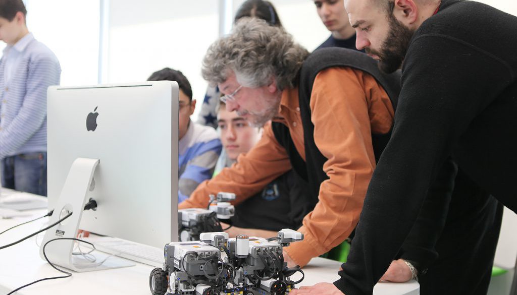
“Back in 2012, I was running robotics workshops at the TUMO Center for Creative Technologies in Yerevan,” says Alessandro. “I was previously on the IT team, but teaching was the best part of my experience by far. Being in those classes was special – the kids were awesome, and I still bump into them in the streets. It is one of the fondest memories of my time in Armenia back then.”
Alessandro thought that TUMO’s state-of-the-art facilities and extracurricular workshop format would be the perfect means to deliver a brand new educational opportunity. TUMO agreed: donors who pledge USD $600 or more to Cartisan’s campaign may now choose a perk entitled ‘Help 10 students learn to map’. As well as helping bring the Dilijan National Park hiking map to life, each such pledge will also sponsor a specially-created mapping workshop in one of TUMO’s locations around Armenia.
“Each workshop will be a week-long intensive dive into open source mapping, getting students quickly up to speed with the basic mapping software, tools and techniques, then heading out of the classroom to improve the quality of the maps of familiar nearby places, such as the neighbourhoods where the students actually live,” explains Alessandro. “They’ll be exposed to the fundamental concepts of the geographic information systems (GIS) field, as well as learning how to use modern tools for open source digital mapping, such as the powerful, free JOSM OpenStreetMap editor and the HotOSM task management tools used for humanitarian mapping efforts all over the world.”

During each workshop, Alessandro and Cartisan co-founder Simon will teach a minumum of 10 young people from the local area how to use the freely accessible tools in TUMO’s computer labs, in combination with corresponding apps for the smartphones in their pockets, to help bring the maps of their local areas up to a high level of detail and accuracy.
“The OpenStreetMap community is where a lot of the data we use to make our maps comes from,” says Alessandro. “It’s a map of the world that follows the Wikipedia model, which means that anyone can contribute. From the early days of the project, we realised that this open-source database – the points of interest, roads and paths, amenities, geographical details and other information added by members of the public – was the best possible starting point for creating comprehensive maps like this one.”
Indeed, the OpenStreetMap database is the foundation for almost every currently available smartphone app for hikers, cyclists and other outdoor enthusiasts. The list includes Maps.me, Viewranger, Komoot, Backcountry Navigator, OsmAnd, Strava, RidewithGPS, MapmyRide, MapmyRun, and even the HIKEArmenia app. Why aren’t these apps based on Google Maps or something similar?
“Google is pretty much exclusively interested in mapping areas of commercial value,” says Alessandro. “Their main business being advertising, there is not much advantage in mapping forests and cliffs, so they focus on urban areas where there’s money to be made. Google Maps does borrow ideas from the open source philosophy by giving users little incentives to contribute, but the data you submit to Google becomes their legal property. With OpenStreetMap, the data belongs to everyone.”

When Alessandro and Simon began their work, OpenStreetMap’s map of the region was not, of course, a completely blank page. But they found the coverage to be highly inconsistent and unreliable in the areas of most interest to hikers and outdoors enthusiasts. Why? Because it was mostly contributors with no first-hand experience of the land who were filling in the gaps from satellite imagery, which itself was of varying quality. In spite of the advances in technology, it is only by ‘ground-truthing’ the data – going out with a GPS or smartphone app and verifying map features on the ground – that a map can truly be said to be reliable.
“It took Simon and I two years to feel the data [for Dilijan National Park] was good enough to print, and that’s because we did most of the work ourselves,” says Alessandro. “But working to improve it cannot be done in isolation.”
With no government agencies producing civilian mapping of Armenia, it falls to the private sector to fill in the blanks. Improving OpenStreetMap coverage of Armenia will play a critical role – and the more people working on doing so, the better.

“We want to teach our students how to do this not just because the quality of the data is not yet good enough,” says Alessandro, “but also because mapping can actually be fun.”
The hope is that this initial workshop series – just like the map of Dilijan National Park – will only be the beginning. But what about the ‘alumni’ of these workshops?
“We’ll do our best to keep them in the loop,” says Alessandro. “We’ll help them grow further, we’ll watch them become better than us – who knows? Maybe they’ll join our team, or maybe they’ll just keep it as a hobby. If they stay with it, the open-source mapping community will have won some capable mappers for Armenia. If not, at the very least we’ll have offered a positive experience and made a meaningful contribution to the mapping of that area.
“And all of that, I really believe, is worth investing in,” he continues. “In fact, Simon and I have already committed to run at least two such workshops out of our own pockets, regardless of how many donations we get.”
At the time of publishing, three out of a possible 10 workshop sponsorships had already been claimed, with just days remaining to reach the target of USD $12,900. For more information or to make a pledge, visit the campaign page on Indiegogo.


