#BlazetheTCT Day 9: Crossing into Georgia and Entering Samtskhe-Javakheti
Welcome to Day 9 of #BlazeTheTCT!
Today, we leave behind the Armenian highlands and cross into the remote, volcanic beauty of Georgia’s Samtskhe-Javakheti region.

This wildly underrated region of Georgia is home to breathtaking volcanic landscapes, Bronze-Age history, and warm hospitality in its predominantly Armenian-speaking villages.
So don’t forget your passport, lace up those muddy boots, and let’s cross the border into the next country of the TCT!
Happy trails,
Meagan

Day 9: Crossing into Georgia and Entering Samtskhe-Javakheti
Cross the border into Georgia
The day begins with a familiar path as you retrace your steps from Lake Arpi National Park’s headquarters. Although we dream of someday having a TCT crossing within the transboundary national park of Lake Arpi in Armenia and Javakheti in Georgia, that’s still a pipe dream for the time being– and you can’t simply wander across borders in the Caucasus.
So you make your way towards the nearby official border crossing into Georgia, humming with the quiet anticipation of entering a new country. The border crossing at the Bavra checkpoint is a quiet affair—no long lines or bustling crowds here, just the occasional truck and you with your backpack. The customs officers stamp you through with a quizzical look. Welcome to Georgia!

You might not be alone on your road walks.
Walk into the grassy steppes of Javakheti
You cross into the vast, grassy steppes of Javakheti. You veer off the main road almost immediately, heading east to trace the shores of Lake Madatapa. The terrain is marshy and open, with wildflowers dotting the wide-open space in all directions.

Wildflowers near Lake Madatapa.
The lake is also a hub of bird activity, with flocks of waterfowl swooping low over the surface.
Madatapa Reserve is one of the most important habitats in the country for breeding and staging waterbirds, including the endangered Dalmatian pelican. It’s a peaceful spot, perfect for a quick break to scan the sky for birds and soak in the natural beauty of this remote corner of Georgia.

Lake Madatapa. (Photo: Wikimedia Commons / Paata Vardanashvili)
Make friends in Gandzani
You make your way along gentle grassy tracks through low hills, passing an occasional set of ruins, as you make your way to the village of Gandzani– your first real settlement in a few days.
Your next stop is the village of Gandzani, where you’re in for a treat at Family Corner Guesthouse.

Family Corner Guesthouse.
This remote little guesthouse first caught our eye while driving through the region thanks to its colorful sign and bicycles parked out front. It turns out that this is a well-known regional gem for road trippers, bicycle travelers, and even the occasional hiker– we were late to the party, but just happy to join!
Owners Samvel and Hasmik Margarian welcome you with warm greetings– showing their well-known enthusiasm for guests, asking you questions about your hike, and making you feel right at home.
One minute, Samvel is asking you: “Do you want to see something cool?” The next, you’re getting a tour of the neighboring cheese factory as he picks up fresh cheese and milk to accompany dinner.

Samvel and a happy hiker, very excited about the large buckets of sour cream.
On the menu tonight dinner is a spread of colorful homemade dolma– a regional specialty made of meat and rice inside a vegetable or a leaf wrapping– that rival the best you’ve ever had.

Dolma, fresh salad, mountain-herb tea, and fantastic hospitality from owner Hasmik at Family Corner.
Like many people in this southern region of Georgia, their first language is Armenian, and it’s hard not to be struck by the cultural similarities right across the somewhat arbitrary border.
You’re not the only guest at this popular summer spot, and conversation flows around the dining room in a mix of Armenian, Georgian, English, Russian, and creative hand gestures.
After so long hiking by yourself, it’s a pleasant buzz just to be in good company. You linger longer than planned, savoring the rich flavors and the stories shared around the table.
This is what makes hiking the TCT so special—these unexpected moments of connection with people far from the bustling cities, but whose warmth and generosity leave a lasting impression.

The stairway walls at Family Corner are full of messages from visitors. You’ll have to walk there yourself to spot this one 🙂
Climb to Bronze-Age Abuli Fortress
Leaving Gandzani behind, you start the long climb into the volcanic Abul-Samsari Range. The trail is a mix of jeep tracks and open green hills, gradually leading you higher into the mountains.
As you reach your first pass, you take a short side trail to the ancient Abuli Fortress, a Bronze Age cyclopean fort that sits on the southern slope of Mount Patara Abuli. You explore the old fortress walls and the old passageways that still stand, marveling at the ingenuity of its builders and the resilience of this ancient stronghold.


Abuli Fortress.
Traverse shepherd camps and boulder fields
The landscape is relatively gentle, but extremely exposed. As you climb higher, the imposing extinct stratovolcano of Mt. Didi Abuli begins to dominate the skyline at 3,301m (10,830 ft).

Didi Abuli in the background.
The trail leads you through sweeping green valleys that serve as grazing hotspots for entourages of sheep, cows, and their minders. You pass by several semi-nomadic shepherd camps, where these herders spend their summers with their flocks.
The whole scene reminds you strongly of the Gegham Mountains, from the wide-sweeping views to the shepherd camps. And just as in the Geghams, the guard dogs of Javakheti are fierce—these are not the kind of pups you want to pet, so you give them a wide berth—but the shepherds themselves are friendly, calling off their dogs and when they see you and waving as you pass by.

Shepherd and flock in the Abul-Samsari Range.
As you continue your ascent, the trail leads you through a mountain pass strewn with boulder fields. You watch your step carefully as you descend towards a shimmering gem of an alpine lake.

Descending to Lake Patara Levani.
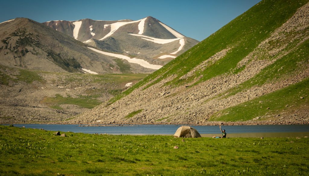
Camp by Javakheti’s high alpine lakes
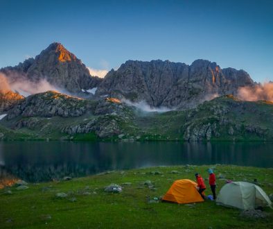
The terrain is challenging, but the sense of isolation and raw beauty is invigorating. As the sun dips below the ridgeline, you eventually reach the Patara Levani (Little Levani) Lake and set up camp.
Up here at 2,850m, the temperature drops quickly when the sun goes down, and you settle in for a chilly, clear night, the stars so bright it feels like they are beaming straight into your tent.


Evening and morning on the shore of Lake Patara Levani.
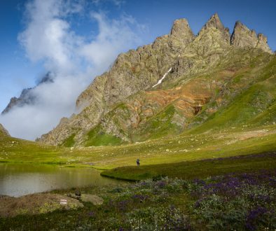
The next morning, you continue along grassy tracks to your next stop on what we like to call our Javakheti Alpine Lake Tour: Lake Levani, shimmering in the sunlight.

Lake Levani.
Meet the local trail experts
As you come towards the lake, you spot a small stone cabin– a typical structure anywhere else, but almost surreal up here so far from any settlements.

Small cabin at Lake Levani.
And if you’re extra lucky– or if you’ve really planned ahead– perhaps you mean Rafael Darbinyan, a local tourism expert and one of the cabin’s builders.
Rafael played a big role in our mapping efforts when we were exploring potential TCT routes through the Abul-Samsari range in 2022 as part of a USAID cross-border tourism project with People In Need Georgia, showing us some of his favorite lakes and routes.

Rafael exploring the lakes of the Abul-Samsari Range.
He’s also a local legend in the ecotourism space, having built a gorgeous new guesthouse in Akhalkalaki, spearheaded winter tourism efforts around Lake Levani (including a portable sauna, hikers take note!), and contributed to mapping and marking hiking routes. In short, the best kind of guy to know.
And although the Abul-Samsari Range is still off most hikers’ radar, the trails here have been in development for several years, thanks to the ongoing efforts of local guides like Rafael and the impressively active Samtskhe-Javakheti DMO. All of them are passionate about showing people the high volcanic mountains of southern Georgia… and we have to say, we agree wholeheartedly.


Fishing in Lake Levani…and with buddies Vova and Artur (and Meagan). If you’re lucky, maybe they’ll even invite you for khorovats at the cabin!
Climb to Samsari Pass
If it weren’t still early in the morning, the north shore of Lake Levani would make a perfect campsite.
And you know what? Maybe you decide that the alpine lakeshore is too simply compelling, the breeze is too pleasant to be reasonable, and so you decide to pitch your tent early, take an extra day, and wander some of the side paths and explore the nearby lakes you can see on your map– or simply break out your book and enjoy your view. You wouldn’t be the first.

Camping at Lake Levani.
Whenever you do decide to start walking again, it’s a steep climb to Samsari Pass, with shimmering Lake Levani far below and Didi Abuli looming across the valley.
As you near the top, you’re stepping gingerly across boulder fields and crossing an occasional lingering snow patch– balance and sunscreen are both top of mind.


Boulder fields and snow as you near Samsari Pass.
At the pass, you’re faced with the most unusual trail marking you’ve ever seen: A massive red exclamation point painted onto a large boulder, seemingly leading straight into the abyss over the very steep pass. (No, we did not paint this, and no, it’s not our style– but to be fair, it does capture the sentiment pretty well.)

Samsari Pass.
As you look over the pass and the clouds clear, the expanse of the Samsari Caldera stretches before you, lined with rocks and glacial debris and dotted with small lakes.
There’s no real trail over the pass, so you scan your surroundings, looking for the safest way down.
(If you’re feeling less daring, or if weather conditions are bad, there’s also a lovely, much gentler route that takes you down to Lake Paravani and around the pass. But you’re feeling daring today, the north-facing snow has finally melted, and the weather is good. You’re going for it.)

The Samsari Caldera. Analog photo by hiker Tom Runge.
Camp in the Samsari Caldera
The descent is relatively short but quite steep, and with some scree loose underfoot, every step is an exercise in careful balance.
Adrenaline carries you down to the base of the caldera, where the walls of Samsari loom overhead as you make your way across the caldera to one of the small lakes to camp for the night.
And here’s where we leave you for the day: Setting up your small little tent in the middle of all this ancient volcanic activity, not a soul in sight as the last rays of the sun cast long shadows across the caldera.
You say a little toast with your camp mug to the wind and the rocks, and crawl in your sleeping bag for a cold, contented night.

Sunset in the Samsari Caldera.
And that’s 900km down on the TCT!
Stay tuned… and we’ll see you on the TCT tomorrow as we leave behind the highlands and descend into the lush forests of central Georgia!
We hope you’re enjoying coming with us on the trail and meeting some of the people and places behind it. Over our 15 days of hiking the TCT, we’re aiming to raise $30,000 to blaze new sections of the trail and to continue our work to make these spectacular areas accessible.
We mapped this section between 2021-2023, launched it as a “beta route” for thru-hikers starting in 2022, and have continued to refine the route and trail information based on hiker feedback. We aim to launch it as an official section within the next year. Several parts of this trail section have been blazed by other trail projects in Georgia, but there’s a lot more that can be done to make the routes safer and more accessible.
If you’ve enjoyed the trail in the past or are dreaming of hiking it someday, please join us to make these efforts possible. Donate $15 or more and share with 15 friends today to blaze the TCT.
Thanks for all your support, and happy trails – we’ll see you back on the TCT tomorrow!
Meagan & the TCT team


