Join Us Saturday, May 16 to Help Map the Caucasus!
Are you curious about the data that feeds your navigation apps? Want to contribute to an open-source mapping project improving the data on remote regions for the public good? Have way too much time to fill on your couch right now? Come join the TCT team on Saturday, May 16 for an introduction to virtual mapping!
Believe it or not, there are still plenty of places in the world left unmapped. And the Caucasus has a lot of them. Back in 2010, for example, Georgia was so full of blank spots on the map that it was nearly a blank spot itself. That year, members of our team (before it was the TCT) spearheaded an initial effort to map the Caucasus that resulted in big improvements. Over the years, we’ve continued to host mapping events to improve the data in regions around the trail.
Now, there’s a lot of detail available– but there’s still much more to be done. And with so many of us stuck at home, we figured there was no better time to make progress. Want to join us?

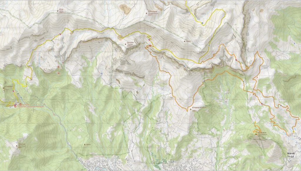
In this Zoom session, we’ll introduce you to OpenStreetMap. We’ll discuss some of the many applications that pull from its data as well as how that applies to the trail, such as the work done by our longtime partner Cartisan to produce the first detailed topographic maps of Armenia’s mountains. Then we’ll do a walk-through together and teach you the basic principles so you can get started mapping yourselves. We’ll talk through some of the key gaps and needs for maps in the Caucasus. And we’ll share our list of priority projects– so that after the session you can continue to help us map the Caucasus, for as much or as little time as you like.
If you want to get more involved in the TCT remotely and contribute to some of our projects, this is a great opportunity. We hope we’ll see you there!
Event information:
Registration required. Please register here.
Date: Saturday, May 16
Time: 9:00am – 10:00am PDT / 12:00pm-1:00pm EDT / 4:00pm – 5:00pm GMT / 8:00pm – 9:00pm Caucasus time
Before joining, please download Zoom and create an account on OpenStreetMap.
Registration will be capped at 100. Register here.
*This event will be in English and is aimed at our international community. We’re also planning a more locally-focused event in Georgian, so stay tuned if you’re interested!


