#BlazetheTCT Day 3: Sisian to Martiros
Welcome to Day 3 of #BlazeTheTCT!
Today, we’re continuing our journey along the Transcaucasian Trail, following the 1500-kilometer North-South route that connects Armenia and Georgia. Each day, we’re highlighting a new 100-kilometer section of the trail and some of our favorite people and places along the way.
Bit by bit, we’re inching towards the Black Seat coast in Georgia – and towards our fundraising goal of $30,000 to Blaze the Transcaucasian Trail.
Today, we’re moving from Sisian into the cliffs and canyons of Vayots Dzor. Along the way, we’ll meet some incredible hosts and trail builders who are making the TCT a reality.

Fuel up on lavash and let’s get started!
Happy trails,
Meagan
Day 3: Sisian to Martiros
You’re already sun-baked as you roll out of Sisian early in the morning, grateful when you can turn off the hot pavement and climb out of the city following a nicely blazed trail. (Yes– it does exist in some places, and we’re excited to create more!)
You’re on another trip through time today– starting all the way back at prehistoric monoliths, poking into a 13th-century cave church, passing the remnants of Soviet relocation projects, and ending with modern conservation efforts. Don’t forget to eat lots of snacks along the way.

Contemplate the mysteries of ancient existence at Karahunj
(What? You thought we were starting light today?)
Sisian itself has a rich history that you wouldn’t guess at first glance. Archaeological findings link it to the Bronze Age Trialeti-Vanadzor culture, and in the 8th century BCE as an Urartian center of paganism. It was a spiritual and political center until the 10th century AD, when Kapan became the capital of the Kingdom of Syunik and power shifted to Tatev.
As Sisian fades behind you, you follow the waymarked side trail to the prehistoric monolithic site of Karahunj– known as Zorats Karer (“Stone Soldiers”).
The site is sometimes referred to as Armenia’s Stonehenge, with its distinctive arrangement of large stones, many of which have holes bored into them.
Why? Well, that’s still debated among archaeologists, but luckily you have many miles ahead of you to spin your wildest theories.

Take a dip in Shaki Waterfall
Hiking in southern Armenia is hot work, so you’re pleased when shortly after you stumble on the 18m-high cascades of Shaki Waterfall.
This is one of the only waterfalls we’ve ever encountered that has on & off hours – because it shares its flow with the hydro-electric station, so the sluice is on a timer!
It’s not huge by global standards, but it’s still impressive, and it’s a popular spot for locals and visitors alike.
You decide to take a dip. Depending how long you’ve been on the trail, it’s also a great spot for a hiker “shower”– a fact we can personally endorse.

You hang your towel on your backpack to dry and continue north.
Learn about Soviet history at Spandaryan Reservoir
You’re following the river Vorotan now, tracing its path to the Spandaryan Reservoir– Armenia’s largest reservoir.
Spandaryan is the uppermost of five reservoirs and three hydroelectric power plants built by the Soviets between 1961–1989 on the River Vorotan.
Building the 83 metre-high dam wasn’t without controversy: it submerged two towns, Bazarchay and Borisovka, both of which were historically Russian Old Believer communities.
The populations were resettled in nearby Gorayk and Tsghuk. Now, only their hilltop cemeteries remain above water.


It’s a troubled history, but as a hiker, you have to admit, it’s a pretty beautiful place to camp and watch the sunset.
(Just don’t eat the gas station kebab nearby. We shouldn’t have to tell you this, but… just in case you’re hungry optimists like us… don’t do it.)


Camping at Spandaryan Reservoir.
Cross into Vayots Dzor
It’s been 240 km on the trail so far… and you’ve finally completed your first regional section!
You exit Syunik and enter Vayots Dzor at the windy and Vorortan Pass (2,344m). You’re greeted by the eye-catching “Gates of Zangezur” twin monuments of 1987, as well as seasonal produce for sale on the roadside.

And now you’re officially entering Vayots Dzor– the “canyon of woe,” according to the name.
Or as we like to call it: “The canyon of WOAH.”

Check out the globe in Mirror Lake
Armenia isn’t short of Instagram-gold locations, but this one’s pretty high up there.
You’re walking through the grassy hills when suddenly you come to a crest and see below you a small lake that looks… well, quite a bit like a map of the world. (With a few notable places missing, of course. Still, the resemblance is pretty striking.)
This spring-fed lake is listed as a protected natural monument, and you’ll hear it referred to as Artavan Lake, Red Lake, and World Map Lake. The name used in official government documents is Hayeli Lich (“Mirror Lake”), so we guess that settles it.
We’ve had a lot of fun cheesing for Instagram here. And we highly recommend that you do too.

Stay in Artavan with local trail builder Garnik
If there’s one person you absolutely need to meet on your thru-hike through Armenia, it’s Garnik Gevorgyan in Artavan.
Garnik was one of the first trail builders on the TCT in Armenia– and one of its first entrepreneurs too.
When the TCT was still quite new, Garnik already had a vision. He established Artavan Campsite, one of the first official campgrounds on the TCT.
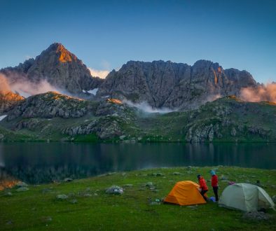
Now, hikers can pitch their tent with the incredible view of the nearby cliffs and enjoy sunset while eating home-cooked food by his family.
His campsite and commitment to ecotourism spurred a wave of low-impact tourism development in the village, which now is now home to several delightful guesthouses. It’s become one of the most beloved stops along the TCT.


Camping and khorovats (Armenian barbecue) at Artavan campsite. Photos by hiker Jeff Ballard.
Garnik spread the love of trails within his hometown, getting lots of young people involved in trail work and outdoor activities. Two of our current Caucasus Conservation Corps crew members– Tigran and Hrach– are from Artavan, and love telling people about their hometown!
As if that wasn’t enough, Garnik is also somewhat of a local conservation hero. He’s a ranger with the World Wildlife Foundation Armenia, leading the local fight against poaching and monitoring populations of species like the brown bear, wild boar, lynx, bezoar goar, and the endangered Persian leopard. He even recently started another organization, the Artavan Environmental-Social NGO, that’s leading community conservation efforts in the region.
If you can catch him when he’s not out checking photo traps for wildlife movement or working on the trails, there’s no better person to learn from about the wildlife around Artavan, or to talk to about the impact that trails can have on surrounding communities.


Hike through the cliffs to Kapuyt’s basalt arch
After a lot of dirt roads from Sisian, you’re relieved when you branch off into a proper trail– even if the long grass is a bit overgrown at times.
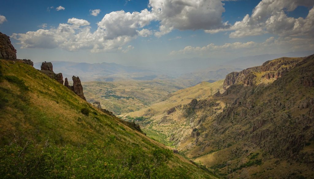
The next section leads you back into the wilderness, following an old trail that’s been reopened through dramatic basalt cliffs to Kapuyt.
It’s a big day of climbing, but at the top, the trail opens into a dramatic side cut into the cliff face– and how can you mind a climb when you’re greeted with views like this?


As the trail appears to vanish into impassable terrain, you suddenly find yourself descending an historic, rock-built, zig-zag staircase directly up and down the extremely steep hillside. Bless those ancient trail builders!
You descend along the footpath, weaving between bushes and bare rock, until you reach a small offshoot of a trail. You follow it a kilometer further to a spectacular natural rock arch spanning a stream in a side gorge.

But it’s not just the geology in this section that catches your eye– is that something high up on the cliffs?
You look closer and spy a group of rare 12–15th-century khachkars carved into a cliff face. What can we say? Never a dull moment while hiking in Armenia.

Camp next to the cave church in old Martiros
In the wavering afternoon heat, you follow the trail blazes through the gentle fields between Gomk and Martiros.
We originally blazed and opened this section in 2018, and it’s been amazing to see the number of hikers grow on the trail in the years since.
You almost certainly still have it all to yourself, though. Local hospitality is strong, but the hiking experience on the TCT is still a lot of solitude!

As you approach Martiros, you branch off the TCT on a short side trail near Martiros. It’s worth it for two reasons: the cave church and the excellent camp site.
You duck your head in the cave church before pitching your tent. It’s the 1286 monastery of Martirosats, also known as Surb Astvatsatsin (Holy Mother of God) or Vimapor Church, and Armenia’s second largest rock-hewn church. Casual.

And you get to camp right next to it, with a beautiful bisetka– the community picnic shelters you’ll find dotted across the landscape– and all.
You settle in for the night, wondering if you have ever seen such a lovely spot to make your instant ramen.


That’s 300 kilometers down on the TCT!
Tomorrow, we hike through the desert of Vayots Dzor. But first, we might get sidetracked by some Armenian hospitality…. Stay tuned!
We hope you’re enjoying coming with us on the trail and meeting some of the people and places behind it. Over our 15 days of hiking the TCT, we’re aiming to raise $30,000 to blaze new sections of the trail and to continue our work to make these spectacular areas accessible.
This section is in pretty good shape thanks to the work of Garnik, other trail crew members, and our partners at Trails For Change in Armenia. But bringing other sections up to the same standard is a lot of work, and we’ve got a long way to go!
If you’ve enjoyed the trail in the past or are dreaming of hiking it someday, please join us to make these efforts possible. Donate $15 or more and share with 15 friends today to blaze the TCT.
Thanks for all your support, and happy trails – we’ll see you back on the TCT tomorrow!
Meagan & the TCT team

The cool kids on the TCT think YOU should help blaze the trail.


