#BlazetheTCT Day 12: Oni to Tsana
Welcome to Day 12 of #BlazeTheTCT!
Today, we’re heading deep into the remote valleys connecting the regions of Racha and Lower Svaneti, tackling one of the most challenging—and rewarding—sections of the Transcaucasian Trail.

This is where the TCT truly tests your mettle– and your tolerance for nettle– as the trail gradually disappears, leaving you to navigate wild, untamed landscapes.
It’s also the site of our biggest trail building project, where hundreds of volunteers have worked over the past 5 years to build a beautiful new trail to re-open this historical connection between the two regions. You’ll eventually make your way to that lovely new trail– but first, there’s a lot of wilderness to get through.
I’ll be honest: because so much of this trail is still in progress, we don’t recommend this section to most hikers. You really have to be up for a tough bushwhack. But if you are, it’s worth every scratch, every stumble, and every soaked boot.
So, take a deep breath, lace up those boots tight, and let’s dive into the wild heart of Georgia!
Happy trails,
Meagan

2023 Trail Crew at the pass above Zeskho. Drone photo by Gio Asanidze.
Backstory time: The Zeskho Alpine Camp
But first, before you get deep into the rhododendron bushes, we want to tell you a little bit about why you’re bothering with this bushwhack at all. And that starts with the story of the Zeskho Alpine Camp.
The small village of Zeskho and its nearby border guard station and abandoned buildings in the mountains don’t look like much. It’s beautiful, yes– but so very quiet.
But just a few decades ago, the Zeskho alpine camp was a hive of summer activity. The wide field in front of the border guards’ outpost was packed with tents every summer. Alpinists came from all over the Soviet Union to train and climb the nearby peaks. Trails connected the camp in several directions, including to the bases of the surrounding peaks and to the neighboring region of Racha.

The old alpinists’ camp in Zeskho. Photo by Ia Iakobashvili.
But we all know how the end of that story went. After the Soviet Union collapsed, the mountaineering and sporting camps around the region fell into disrepair. There was no funding for such endeavors, and in the economically harsh years that followed, nature was often a resource for survival rather than a resource for enjoyment.
And so the Zeskho alpine camp was more or less abandoned. The historical trail connecting Svaneti and Racha– despite a few signposts– became ridiculously overgrown, unmanageable to anyone except for the hardiest of bushwhackers. And to make matters worse for the trail, the route over the first pass featured an extremely steep scree slope– where a fall might be not just dangerous, but even deadly.
But the old buildings of the alpine camp are still there, and you can see why it was such a hotspot for climbers. Ringed by towering rock faces, it’s spectacular.

Peaks towering above the old alpine camp.
And this is one of the things that we think makes Zeskho such an interesting place to build a trail. It’s not that this is an untouched landscape where there’s been no tourism– there’s actually a long, rich history of tourism and of people enjoying these mountains. It’s just become inaccessible.
So we set out to change that. We wanted to re-open access to this wilderness so that people can enjoy it– a conservation goal that becomes even more important with the new neighboring Racha national park.

Trail building in Zeskho. Photo by Ia Iakobashvili.
The TCT’s early days in Zeskho
Back in 2015, when Paul Stephens and the other TCT co-founders in Georgia first set about their project of trying to map a route across the Greater Caucasus, the connection between Svaneti and Racha was one of the big open questions.
In 2016, Paul, trail crew leader Leah, and our board member Laura Santos-Bishop (a former trail crew member herself) undertook an early-season scouting project on this route, initially thinking that it would be the TCT’s first volunteer project. But they quickly realized that it was far too demanding and remote of a project to undertake in the first year.


Leah, Laura, and Paul battling tough trail conditions between Ghebi & Zeskho in 2016. Photos by Laura Santos-Bishop.
In 2018, the Georgia team came back, this time with volunteers. But even then, we naïvely thought that it might be a one-summer project.
We learned a lot in the early days of the TCT– how to plan trail projects, how to estimate how much time it will take to build a set of steps or clear a 100m trail corridor, how to work in different types of terrain.
But the terrain around Zeskho proved to be so demanding– so overgrown with rhododendron bushes, so thickly forested, so steep– that it also drove home a different lesson: if you want a trail to last, you have to really build it well.
There was no point here in simply trimming back the vegetation. If we did, it would simply grow right back over the trail the next year.
No, this demanded a different approach: painstakingly designing and flagging the trail, digging out a huge amount of earth, and meticulously benching a flat, compacted surface to walk on.

Sculpting the flagged trail corridor. Photo by Ia Iakobashvili.
And since 2018, we’ve sent crews out there each summer to do exactly that. For many of our volunteers and crew leaders, Zeskho has been our training ground for designing and building sustainable trails– a process we’re now slowly starting to replicate all across the Caucasus.
And while the Zeskho trail is not yet done– and it still has a long way to go– it nevertheless serves as an example of what can be possible with a dedicated group of people and a strong vision. When the trail is finally complete, I think we can say with confidence that it will be the nicest trail in Georgia.

TCT staff, volunteers, and visiting U.S. Forest Service partners in Zeskho, 2022.
So that’s what you’re walking towards today.
And that’s why we’re going to bushwhack for several kilometers through some of the toughest valleys you’ve ever seen.
(Not convinced it’s tough? You don’t have to take our word for it– 2024 hiker Salomé Stähli, who traversed 3000km off-trail across Alaska, said to us after she hiked this section: “Caucasus bushwhacking just hits different.”)
Sound fun yet? Yeah, we thought so. So let’s go.

Hike the Rioni River Valley
After a quick visit to the border guard station in Oni to secure your permit for the next few days in the border zone, you leave the charming town behind.
Your day starts out walking along the road that connects Oni with the small village of Ghebi. It’s a relatively busy car road, bustling with 4x4s and the occasional rumbling Soviet truck, but once you make it out of the narrow gorge and turn to the west, it’s easy enough to veer off the road and walk through the open terrain next to the Rioni riverbank.
The fierce Rioni is the main river of western Georgia, and you’ll be following it for a while as you gradually get closer to its headwaters in the Greater Caucasus. It makes a pleasant soundtrack for your walk, drowning out the traffic on the nearby road. Here you find groves of aspen trees, and the roar of the river, and several nice spaces for camping.
As you walk, you look up at the towering peaks all around– the jagged lower peaks to the south and the occasional view of the glaciated peaks that form the border with Russia. For now, you’re happy to walk in the gentleness of the flats, even if it means some road walking, but you look up at the mountains with a shiver of anticipation, knowing you’ll be in the thick of them soon enough.

Camping near the bank of the Rioni river.
After a long walk along the river, you finally make it to Ghebi– your last little bit of civilization for a while. Ghebi is a lovely spot for a stop, with several guesthouses and a growing hiking scene. It’s also, frankly, one of the most scenic villages in Georgia.

The village of Ghebi.
After a good rest in Ghebi, it’s time to head into the wild.
The trail starts out innocently enough, following a gentle jeep track deeper and deeper into the forest.
But then things start to get spicy. There’s several small rivers that you have to cross– which can be particularly challenging earlier in the summer when all the snowmelt is rushing down. There are frequent small landslides along the riverbanks, making the terrain trickier.

Paul crossing a river on a makeshift bridge.
But as the jeep track slowly narrows into a trail, you find yourself climbing towards the treeline and entering the new Racha National Park– on a nicely cleared historical path, thanks to our trail crews who have worked here in previous years.
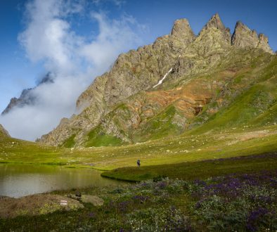
And eventually, you crest the treeline, and it’s just a little further until you reach the sparkling Sasvano Lakes– a small cluster of alpine lakes with an incredible panorama of the Greater Caucasus stretching all around before you.

One of the Sasvano Lakes. Analog photo by hiker Tom Runge.
From here, you walk on open terrain until you reach Vatsistsveri Pass– and here’s where the challenge really begins.

Climbing towards Vatsistsveri Pass.
Bushwhack through the Tskhenistskali Valley
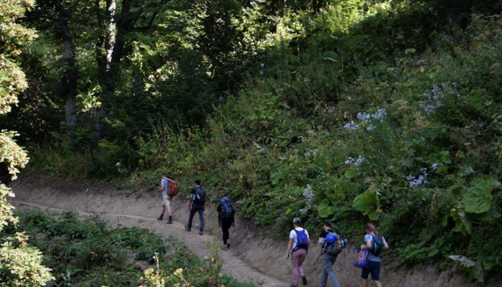
It’s an intense bushwhack down to the Tskhenistskali (“horse’s water”) River, featuring vegetation over your head, giant hogweed– the plant whose sap strips your skin of its ability to protect itself from sunlight, which can lead to severe burns when combined with sun exposure– and thick rhododendrons that you’re better off downclimbing backwards rather than trying to walk through.

Thick vegetation in the valley. Photo by Salomé Stähli.
Eventually you reach the riverbed, and from here it’s a pretty easy choice to walk directly in the river rather than trying to traverse the tangled landscape around you.
It’s several kilometers of wet feet, but hey, you’ve already done the mental work of embracing the challenge– so you can’t help but give it a good laugh, grateful simply not to be swimming in the sea of bushes, and enjoying the shock of cold water as you slowly inch your way downriver.

Hiker Lea traversing this section. Photo by Salomé Stähli.
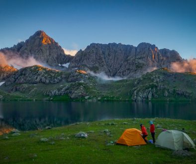
After a long day, you reach the ruins of a tiny settlement on the banks of the Tskhenistskali River. It’s overgrown with stinging nettle, but it still works well as a lovely place to set up camp next to the roaring river. You settle in, exhausted and proud.
The next day you set off uphill once more, climbing through a steep grassy valley towards the ridge. This is our next big trail building project– to connect this valley with the other side of the pass. But in the meantime, you follow the contours of the landscape as you slowly make your way towards a notch in the ridge. It’s steep at the top, so you watch your footing carefully as you climb.

Finally you reach the pass– and here you balk, looking ahead at the steep chute and slippery scree below you. No way do you want to go down that. One missed step, and you’re sliding all the way down to the valley below.

The pass. Photo by Ia Iakobashvili.
But then you look to the north and you spot it: a pink trail flag leading you just a little higher along the ridge. These were placed this year by TCT technical manager Giorgi, to help hikers find their way to the new trail this year. You follow the pink flags, until they lead you off the ridge down the hill and into a sea of rhododendrons.
You’re sliding down the rhododendrons now, staining your hands with blueberry juice along the way – it’s one small perk of the rhododendrons that they’re often found alongside blueberry bushes, so at least you get tasty snacks while you’re suffering through the bushwhacks.
And finally, finally, you see it at last: a beautiful, gently sloped new trail.

Enjoy the TCT’s new trail and vibrant camp in Zeskho
After so many kilometers of tough terrain, you feel like you could skip. Actually, you do skip– the weight of your backpack be damned. You could run down this trail. You could sing down this trail.
And as the late afternoon sun rays slot through the gaps in the pine trees, you make your way down to a small gathering of tents. There’s a tarp strung up, a kitchen area, a fire pit– and even before you get there, you can hear the laughter echoing out from the camp. You’ve arrived at the TCT’s hub of summer operations, our lovely backcountry home in Zeskho.


Our trail crew camp in Zeskho.
Say hello to the friendly border guards
The next morning, you wave farewell to the trail builders and continue down the valley.
You make a stop at the old alpine camp to admire the former hub of Soviet mountaineering and to show your permit to the border guards who live there in the summer.
The border guards greet you enthusiastically. They’re always happy to see trail builders and hikers these days – in fact, they’ve become some of the TCT‘s biggest fans.

The border guard station in Zeskho.
But it wasn’t always that way. When we first arrived to start the Zeskho trail building project in 2018, they were skeptical. What were a bunch of foreigners doing showing up, claiming to build a trail? Surely there was some other motivation – looking for gold perhaps, or were they spies? Or maybe they were simply idiots. Building a trail? Who would use that? The horses would destroy it. The winters would destroy it. It’s fair: they had no reason to believe us.
But year, after year, we kept on coming back. Year after year, more and more Georgian volunteers and crew leaders joined us. Year after year, we extended the trail. And slowly, hikers started coming in greater numbers too.
And to everyone’s surprise, the border guards actually became some of the biggest fans and users of the trail. They have to reach those upper valleys for their patrols anyway– turns out that’s a lot easier and nicer on a smooth trail.
And over time, we learned that they’re telling their family and friends about the TCT when they go home– slowly building trust in the regions near the trail, straight from the community members who see it firsthand.
We’re so grateful to have their friendship and support. And we think it’s a powerful example of how building the type of community relationships that will make a trail like this last can take a lot of time, but it’s well worth the effort.

2024 Trail Crew at the border guard station.
Hike village roads to Tsana
Now you’re following the road out of Zeskho, down the valley, making your slow way towards the next region of Svaneti.
We won’t sugarcoat this – it’s a long road walk, but it’s a quiet and peaceful one. And at last you reach the small settlement of Tsana, a quiet transit stop on the recently renovated road between Lentekhi and Ushguli.
There’s one guesthouse in Tsana and what it might lack in luxury, it makes up for the charm and hospitality of its hosts. After several tough days of bushwhacking, you couldn’t be more grateful for the warm welcome, and you settle into their sweet balcony overlooking the valley, stretching your sore legs and giving yourself a well-earned pat on the back.
The TCT is full of rites of passage – and you’ve just completed one of the toughest.

Guesthouse in Tsana. Drone photo by hiker Tanel Tilk.
And that’s 1,200 km down on the TCT.
Tomorrow, we’re in for a big change of scenery as we climb into the high mountains of Upper Svaneti, visit the remarkable defensive towers of Ushguli, and enjoy a whole lot more hiking infrastructure along the way.
Huge thanks to everyone who has made this Zeskho trail building project possible over the past few years– our partners, our supporters, and our dozens and dozens of volunteers from around Georgia and around the world.
It may still be a long way to go, but it’s hard to stress just how far it’s come. It would not have been possible without you– and we can’t wait until the day that the whole route is finally open, and we can invite all of you to come back on a big celebratory hike.
Rest up and we’ll see you back on the trail tomorrow.
We hope you’re enjoying coming with us on the trail and meeting some of the people and places behind it. Over our 15 days of hiking the TCT, we’re aiming to raise $30,000 to blaze new sections of the trail and to continue our work to make these spectacular areas accessible. And the countdown is on now– we’ve got 3 more days!
If you’ve enjoyed the trail in the past or are dreaming of hiking it someday, please join us to make these efforts possible. Donate $15 or more and share with 15 friends today to blaze the TCT.
Thanks for all your support, and happy trails – we’ll see you back on the TCT tomorrow!
Meagan & the TCT team


