Full Dates Announced For Our 2020 Supporters’ Treks in Armenia!
We’re happy to announce the full calendar of annual supporters’ treks in Armenia next year – including a brand new itinerary in southern Syunik, for which we (already!) have only one spot remaining!
With Ryanair announcing new routes to Yerevan via Berlin, Rome and Milan, it’ll never have been easier or more affordable to sample one of the very first stages of the world’s newest long-distance hiking trail – and to support its future development in the process.
Read on for dates, regions and routes, for links to find out more about the unique characters and hiking statistics of each itinerary, and to apply for a place on one of next year’s teams.
June 7–14th: South Syunik, Armenia

Our newest 8-day itinerary connects the legendary historic sites of Syunik, medieval Armenia’s most fiercely independent kingdom, following forgotten footpaths rediscovered and restored by our local team in the summer of 2019.
The UNESCO-listed clifftop monastery of Tatev and the cave city of Old Goris are just two of the iconic sites we’ll explore along the way. We’ll spend most of our nights in charming local homestays, and at specially prepared campsites where indoor accommodation is unavailable.
In June in Syunik, we’re expecting long days of warm, early-summer weather as we pass through rocky gorges and lush forests among meadows bursting with greenery and wildflowers.
Vital statistics
- Total distance: 103km (64 miles)
- Average daily hiking distance: 17km (10.6 miles)
- Total elevation gain/loss: +3,820m/-4,170m (+12,533ft/-13,681ft)
- Average daily elevation gain/loss: +637m/-695m (+2,090ft/-2,280ft)
Click for full details of the Syunik 2020 supporters’ trek and to apply for a place on the team →
July 5–12th: Dilijan National Park, Armenia (extended route)

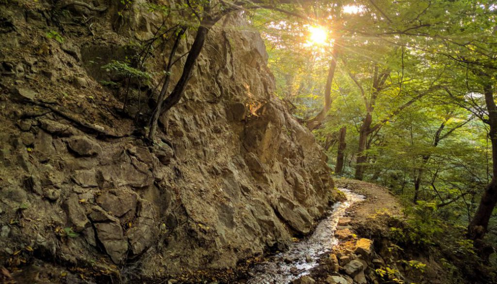
The second supporters’ trek of 2020 takes us through the broadleaf forests, wildflower meadows, limestone escarpments and hidden monasteries of Dilijan National Park in the Tavush province of northeast Armenia.
This was the very first stage of the Transcaucasian Trail to be built in the Lesser Caucasus mountain range that bisects Armenia and Georgia, and parts of the route now represent some of the most established and popular trails in the country.
Thanks to the funds raised by last year’s group, we’re extending this year’s itinerary by an additional day, taking us up and over the dramatic limestone cliffs in the north of the Park, wild-camping in the mountains, and following a newly opened section of the trail to the provincial capital of Ijevan.
In July we’ll be enjoying the sights and smells of high summer in Armenia’s most temperate region, meeting haymakers and herders as we pass through deep forests and dramatic mountains.
Vital statistics
- Total distance: 105km (65 miles)
- Average daily distance: 17.5km (11 miles)
- Total elevation gain/loss: +4,316m/-4,130m (+14,160ft/-13,550ft)
- Average daily elevation gain/loss: +703m/-688m (+2,306ft/-2,257ft)
October 11th–18th: Vayots Dzor, Armenia

Our challenging but very popular Vayots Dzor trek will also be reprised for the fall of 2020. We’ll be following the same overall route among the dramatic gorges of the region, but this time enjoying several newly improved sections of trail built using funds raised by last year’s hikers.
Instead of camping, we’ll be staying in several newly-opened rural guesthouses that have sprung up to take advantage of the opportunities created by a growing number of visitors – a fantastic demonstration of how trail tourism can help rural people lift themselves out of poverty.
In October, in this part of Armenia, we expect dry, clear and crisp conditions on the trail, with warm, sunny days, chilly evenings, and beautiful fall colours along the forested sections. It’ll be winemaking season, too, so expect the grape harvest to be in full swing – and perhaps a surprise wine-tasting session or two!
Vital statistics
- Total distance: 114km (71 miles)
- Average daily distance: 19km (12 miles)
- Total elevation gain/loss: +4,844m/-5,118m (+15,892ft/-16,791ft)
- Average daily elevation gain/loss: +807m/-853m (+2,648ft/-2,799ft)
Prefer to hike independently? Several stages of the Transcaucasian Trail are fully mapped and documented over at the Trail Guides section of the website. Whichever way you prefer to explore the Caucasus, we hope to see you on the trails next year!


